Urban exploration can be dangerous. Urban exploration can be scary. Urban exploration can be illegal. I guess that’s why I get more and more messages asking for tourist locations with a bit of an urbex feel to them – from people travelling with their families, from people who want to avoid trouble at any cost, from people who don’t want to take the risk of dying alone after falling through a roof when exploring solo… So here it is, my little guide about touristy abandoned places – irregularly updated whenever I get to find places that suit this special.
Shime Coal Mine
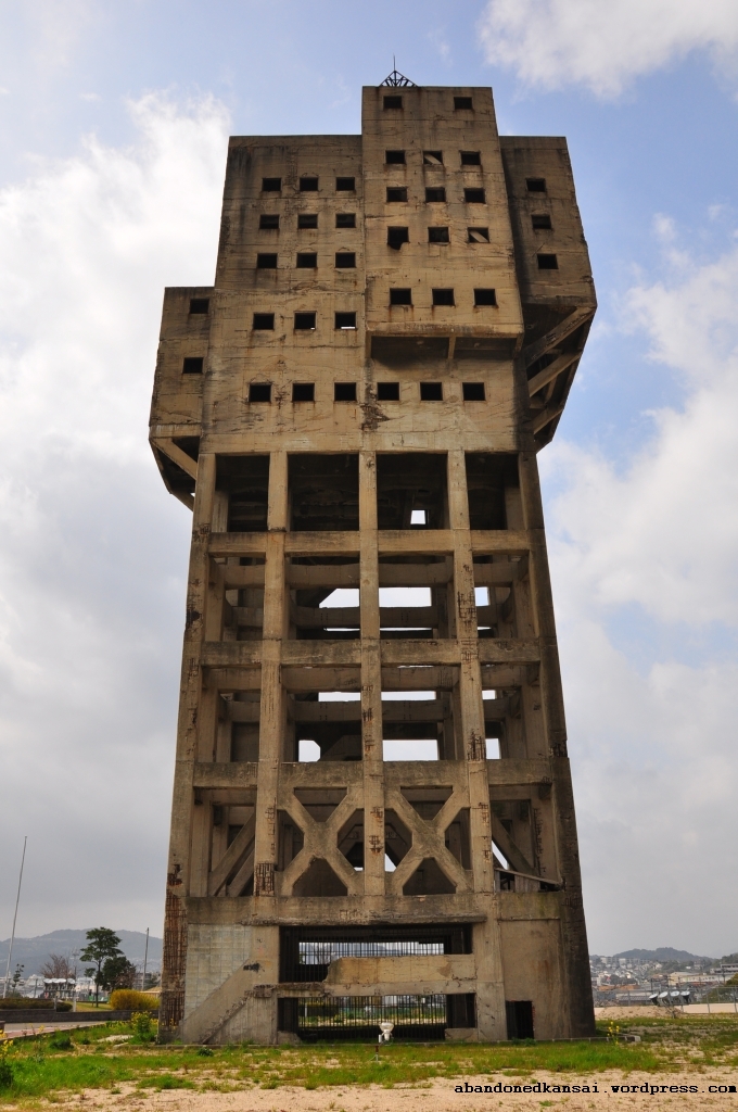
The Winding Tower of the Shime Coal Mine a.k.a. The Anti-Zombie Fortress is the remaining headframe of an otherwise mostly demolished coal mine. Now fenced off and surrounded by various sports facilities as well as a welfare center and a senior citizen center, it attracts both locals and tourist visitors.
Where it is: In the suburbs of Fukuoka, Fukuoka prefecture, Japan.
Coordinates: 33.590334, 130.486291
How to get there: Take a train to Sue Station and then either walk (15 minutes) or take a bus (8 minutes).
What it looks like: *Shime Coal Mine @ Abandoned Kansai*
Gunkanjima
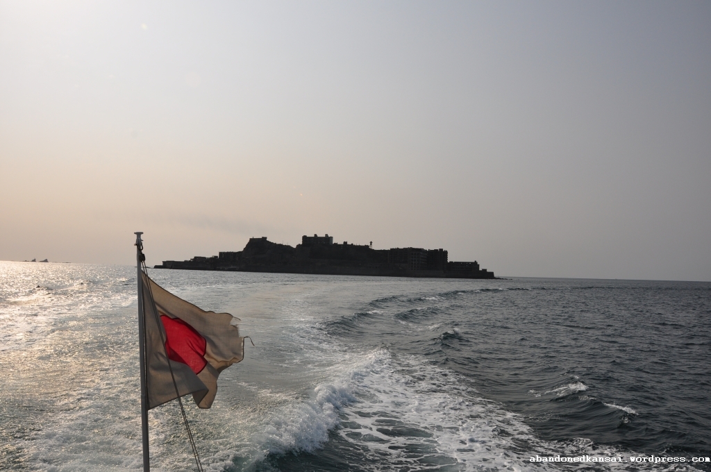
Hashima once was an island allowing access to a large coal mine underneath. As the mine grew bigger the island was expanded, giving it the silhouette of a battleship, hence the nickname Gunkanjima (Battleship Island). Closed and abandoned within weeks in 1974, the island once densely populated island with Japan’s first concrete building became a burden for its original owner Mitsubishi. In 2002 the ownership of Hashima was transferred to Takashima city, which was absorbed by Nagasaki in 2005. In 2009 the island was opened for tourists and in 2015 approved as a UNESCO World Heritage site.
Where it is: Off the coast of Nagasaki, Nagasaki prefecture, Japan.
Coordinates: 32.627326, 129.738107
How to get there: Take a train to Nagasaki, make your way to the harbor and take a cruise landing on Gunkanjima. (Various operators, tours take about 2.5 hours and cost around 4200 Yen.)
What it looks like: *Gunkanjima @ Abandoned Kansai*
Ikeshima
Similar to Gunkanjima, Ikeshima once was an island offering access to large coal deposits, but in comparison to its more famous counterpart, Ikeshima was much bigger and more of a regular island – it also was never abandoned, though the population dropped significantly from about 20000 to 300 people. For that reason visitors can roam the streets freely and have access to a couple of remaining facilities, like a post office, a shop, a visitor center (in the former town hall) and one or two small restaurants. Guided tours in Japanese are also offered.
Where it is: Off the coast of Saikai, Nagasaki prefecture, Japan.
Coordinates: 32.883996, 129.598591
How to get there: Either take a train to Sasebo and then a boat to Hashima (only one connection per day!) or drive to Saikai or Konoura and take a boat from there.
What it looks like: *Ikeshima @ Abandoned Kansai*
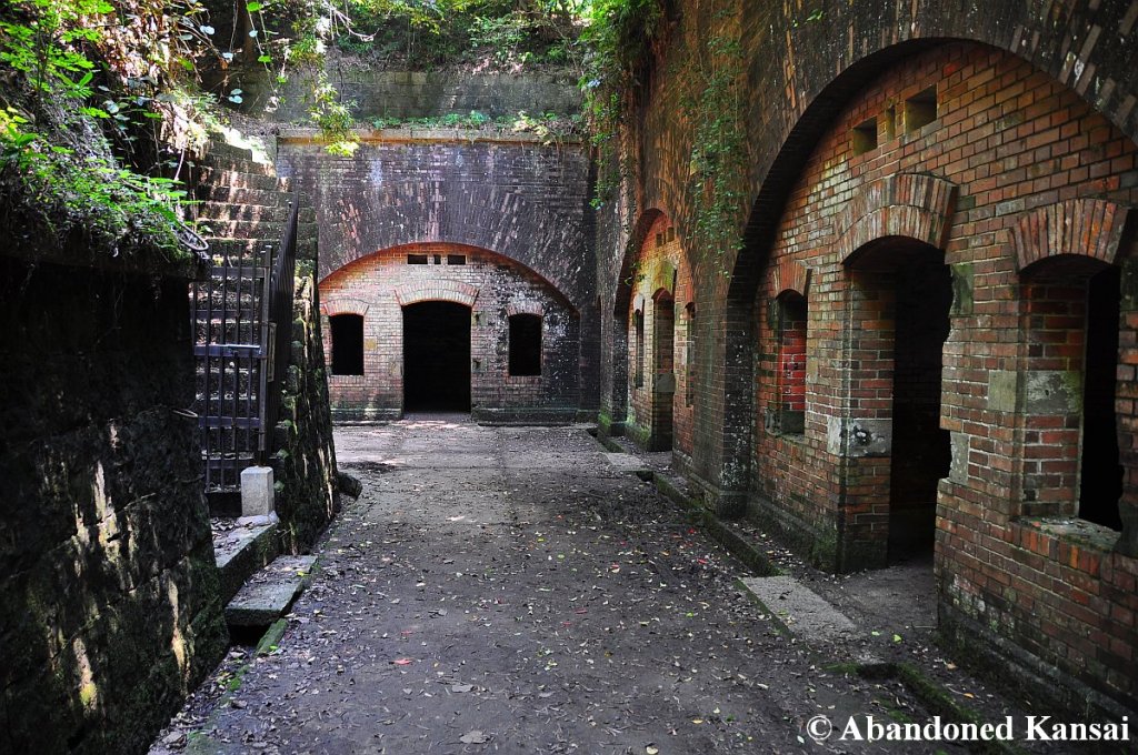
Tomogashima
Centuries ago a retreat for Buddhist monks, the four islands Jinoshima (地ノ島), Kamishima (神島), Okinoshima (沖ノ島), and Torajima (虎島) are collectively known as Tomogashima and were home to a military fortification during the Meiji Era (1868-1912) due to their strategic location between Awaji Island and Honshu. Since WW2 the main island Okinoshima is accessible by boat – the fort ruins, a guest house (with a restaurant and bar), a camping place, signposted hiking trails and several beaches make the island a nice destination for a day trip or a weekend trip.
Where it is: Off the coast of Kada, Wakayama prefecture, Japan.
Coordinates: 34.283188, 135.008765
How to get there: Take a train to Kada, walk to the harbor and take a boat to Okinoshima (4 times a day in summer, 2 times a day in winter) – please *click here for a schedule in Japanese*.
What it looks like: *Tomogashima @ Abandoned Kansai*
Okunoshima
Internationally and locally also known as “The Rabbit Island”, Okunoshima should be famous as “The Poison Gas Island”, because Japan was the only country who produced and used poison gas during World War 2 – all of it produced in a secret factory on Okunoshima. After the war some rabbits were released on the island… and they did what rabbits do. Now hundreds of them freely roam the island and historians took care of the destroyed factory remains; even built a small poison gas museum. A hotel on Okunoshima is fully booked months ahead of time as the island is a wonderful destination for the whole family off the beaten tracks – and the nice sand beaches are a great bonus!
Where it is: Off the coast of Mihara, Hiroshima prefecture, Japan.
Coordinates: 34.306104, 132.991843
How to get there: Take a train to Tadano-Umi, walk to the harbor, *take a boat to Okunoshima with Sanyo Shosen* (7 connections per day).
What it looks like: *Okunoshima @ Abandoned Kansai*
Sankei Hospital
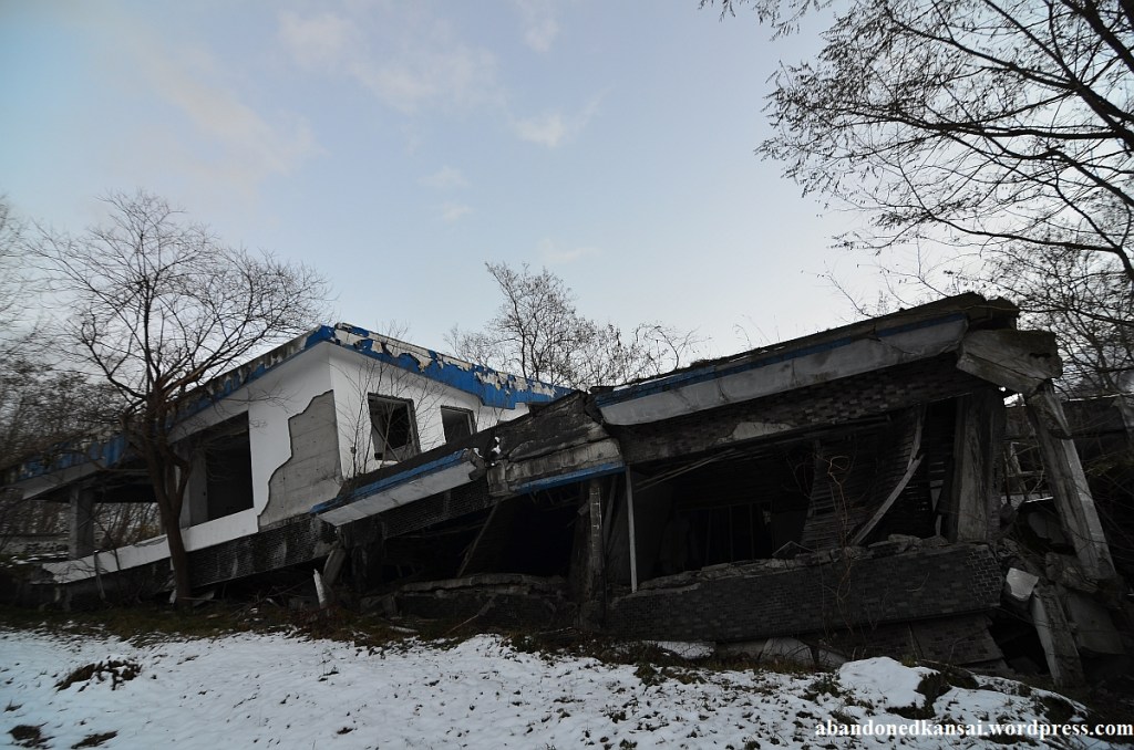
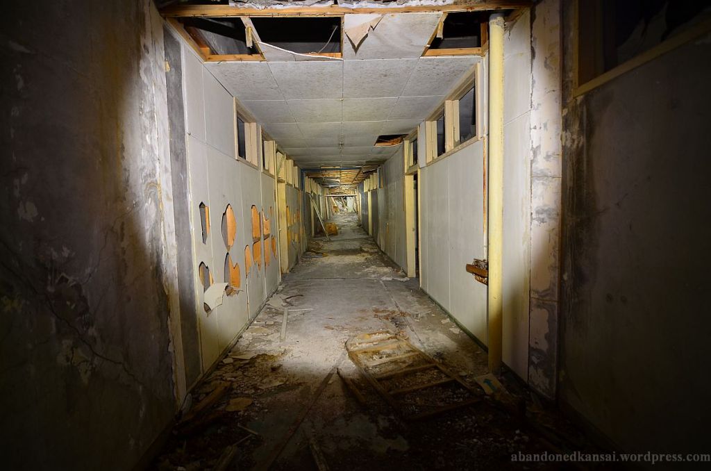
This former mental hospital got pretty much destroyed in the aftermath of the eruption of the volcano Mount Usu in 1977. Instead of getting demolished, it was fenced off and provided with some bilingual information signs…
Where it is: Sobetsu, Hokkaido prefecture, Japan.
Coordinates: 42.555715, 140.851221
How to get there: Drive to Lake Toya, the hospital is about 300 meters away from the southern shore.
What it looks like: *Sankei Hospital @ Abandoned Kansai*
People’s Park
In the northern part of the People’s Park in Yanji you can find what I would call the creepiest fairground in the world – at the time of my visit in 2013 about half of the attractions were abandoned and another estimated quarter was closed. Yet music was playing and in the distance you sometimes saw some people. The fact that a chamber of horrors with some pretty graphic exteriors was one of the abandoned attractions didn’t exactly help to lighten the atmosphere.
Where it is: Yanji, Jilin province, China.
Coordinates: 42.909117, 129.493715
How to get there: Take a plane to Yanji Airport and a taxi from there.
What it looks like: *People’s Park @ Abandoned Kansai*
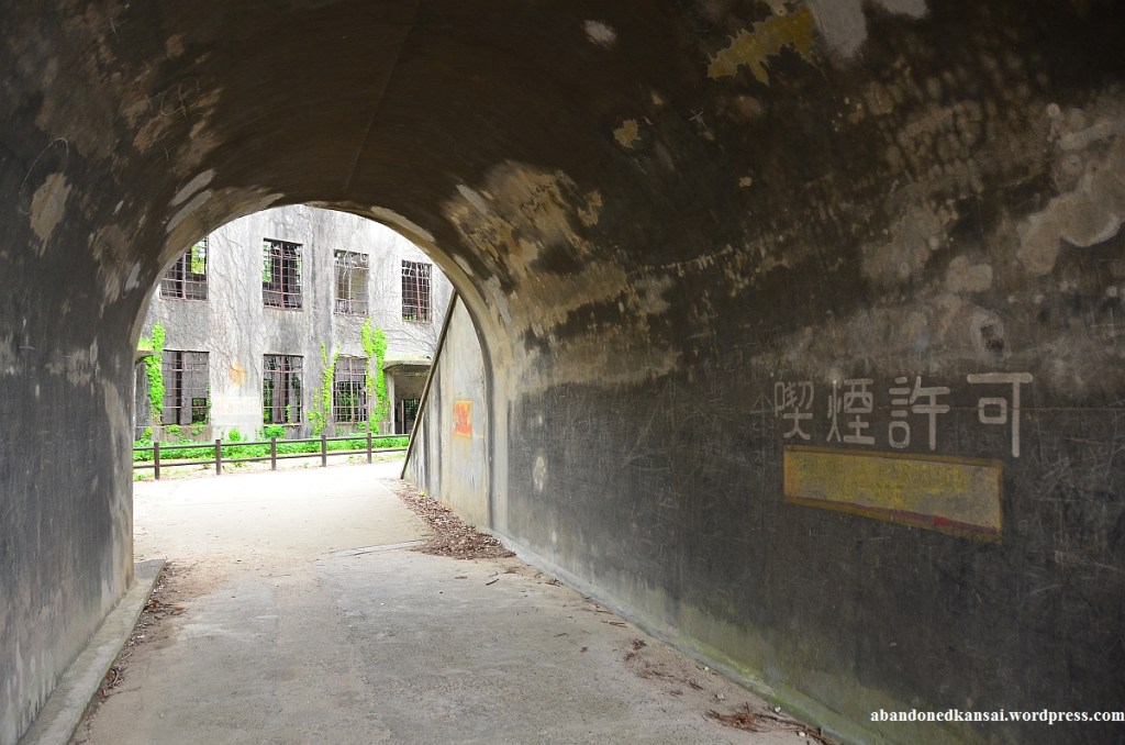
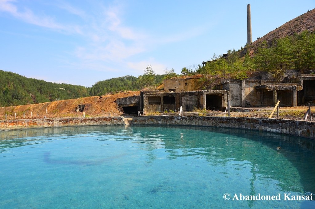
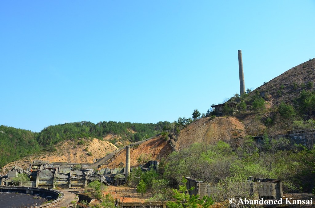
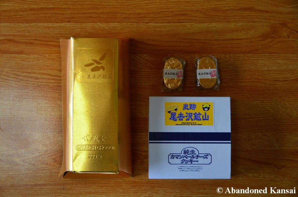
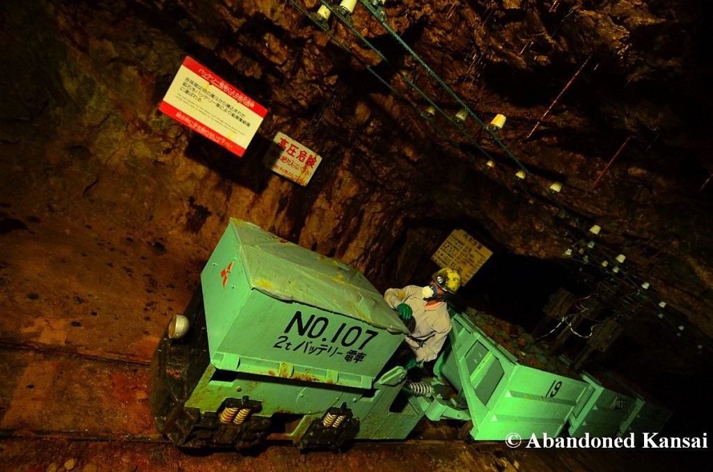
Osarizawa Mine
The Osarizawa Mine has the reputation of being one of the great abandoned mines in Tohoku, which is only partly true – the former gold mine and hideout for persecuted Christians is now a tourist mine with some abandoned areas. Guided tours in Japanese are available, but you can also explore on your own. They tend to be low on English pamphlets, but if you ask politely, you’ll receive one with a smile – touristy facilities like a gift shop and several small restaurants are right next to the entrance / exit…
Where it is: Near Kazuno, Akita prefecture, Japan.
Coordinates: 40.185947, 140.748016
How to get there: Take a train to *Kazuno-Hanawa Station and then take a bus to the Osarizawa Mine*.
What it looks like: *Osarizawa Mine @ Abandoned Kansai*
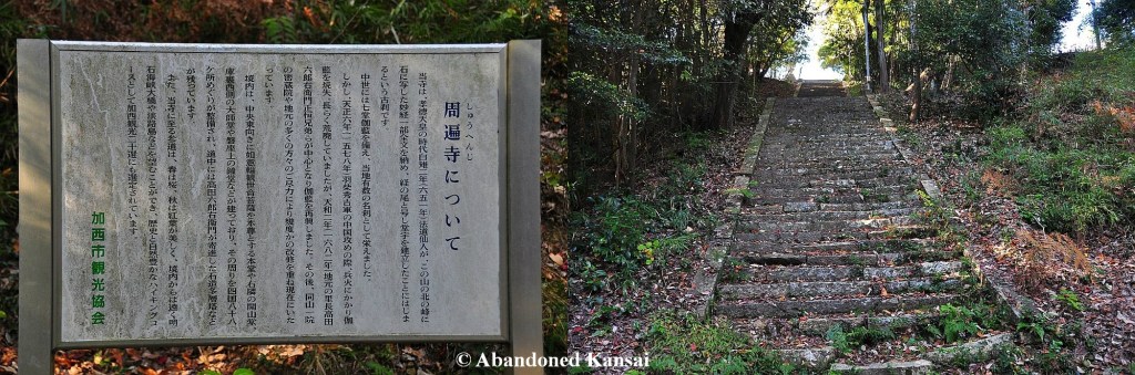
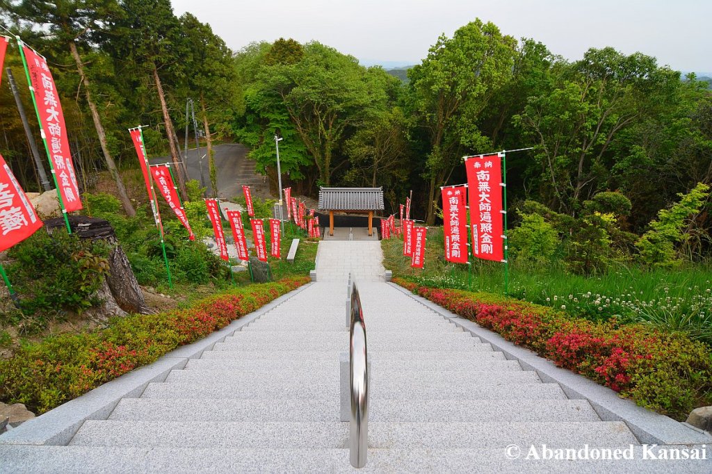
Shuuhen Temple
The *Shuuhen Temple* in Kansai’s Hyogo prefecture was a rather little known place of worship with an abandoned house a monk used to live in and a mid-size temple nobody seemed to take care of. Located on a countryside hill and barely accessible since a landslide damaged the road leading up to the temple, it was one of the most peaceful places I’ve ever visited. Years later I found out that place got renovated and cleaned up – now it’s just another temple with some brand-new steps and buildings; oh, and of course the road was repaired…
Where it is: Near Kazuno, Akita prefecture, Japan.
Coordinates: 34.847039, 134.868614
How to get there: Take a train to Abiki Station and walk south – it takes about 45 minutes to get to the temple.
What it looks like: *Shuuhen Temple Revisited @ Abandoned Kansai*
Rainbow Pool
An abandoned water park within Showa Memorial Park, Tachikawa, Tokyo. The rainbow pool area has always been fenced off, but you can look at the area from pretty much all angles and take decent photos over / through the fence at several spots, like the two now closed entrances.
Where it is: Showa Memorial Park, Tachikawa, Tokyo prefecture, Japan.
Coordinates: 35.707051, 139.390035
How to get there: Take a train to Nishi-Tachikawa, walk to the park and pay 450 Yen (as of 2024) and enjoy.
What it looks like: *Rainbow Pool @ Abandoned Kansai*
Kinugawa Onsen
Kinugawa Onsen is actually a super popular onsen town, despite often being called abandoned or a ghost town. Sure there are plenty of deserted places around Kinugawakoen Station, but the area around Kinugawa Onsen Station is as lively as it can be. If you want to take some pictures though with a post-apocalyptic vibe, head to Takimi Bridge and give it your all!
Where it is: Takimi Bridge, Kinugawa Onsen, Tochigi prefecture, Japan.
Coordinates: 36.83834, 139.72169
How to get there: Take a train to Kinugawakoen Station and walk to the Takimi Bridge.
What it looks like: *Kinugawa Onsen @ Abandoned Kansai*