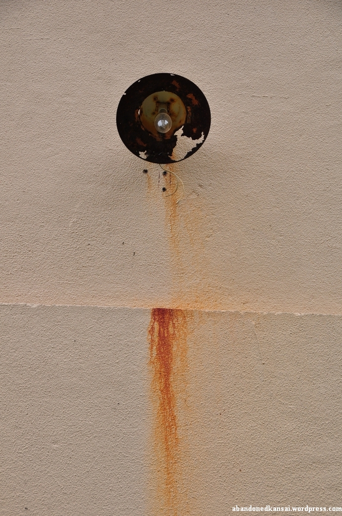
Nippon No Haikyo, probably the most famous Japanese book about urban exploration / haikyo since it was recommended plenty of times by both Japanese and foreign blogs because of its huge amount of maps, recommended Yashima as one of the top abandoned places in West Japan. In my opinion Nippon No Haikyo is vastly overrated – while some maps are quite detailed others are completely useless. Even more so since an estimated 50% of the places (at least on the West Japan list) are either demolished or completely trashed by now. At the same time some of the best haikyo locations, like *Nara Dreamland*, are missing completely. But I guess you’ll get what you pay for: a 4 year old book about a topic that can change within a week or two. Especially in Japan, where old buildings are replaced by parking lots while you are on vacation. (It actually happened in my neighborhood…)
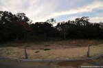
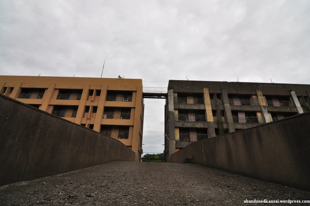
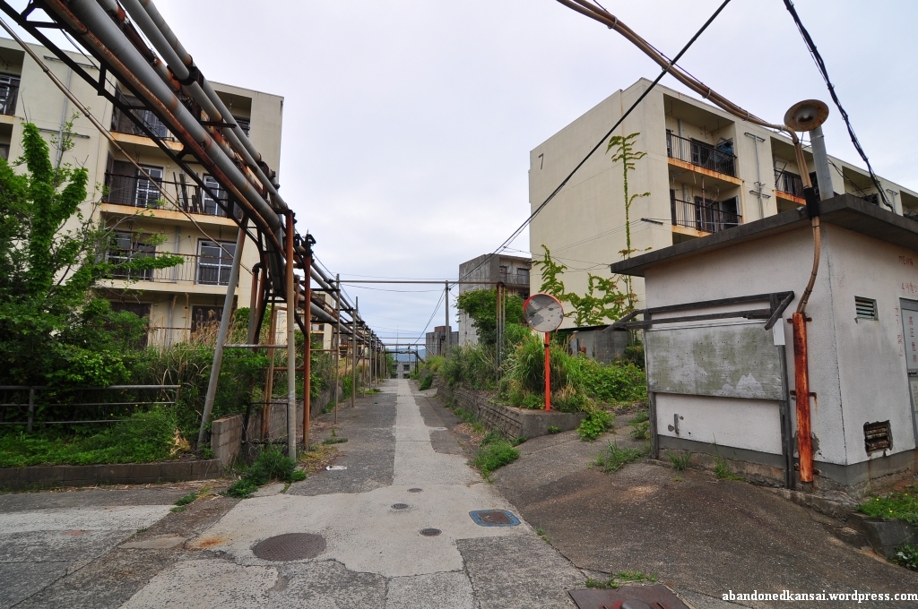
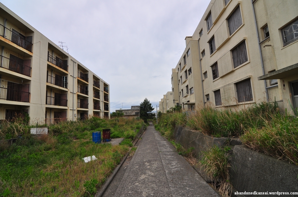
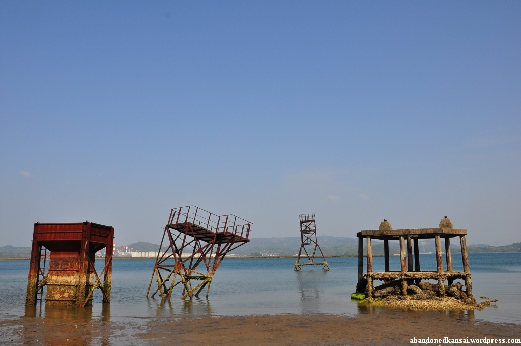
So whenever I visit a location described in Nippon No Haikyo I’m prepared for the worst, just in case. Which was a good thing in the case of Yashima – more than half of the buildings that were responsible for the praisal are gone now; four, to be specific. All that was left of them: 3 leveled building grounds, ready for new construction to begin. Construction that most likely won’t happen.
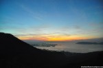
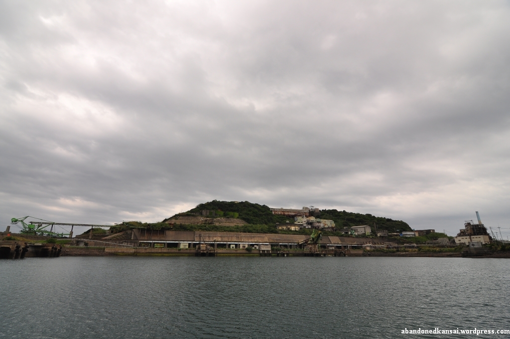
Yashima (屋島, roof island) has attracted people for centuries. The famous temple Yashima-ji on top of the mountain, founded as a Ritsu school temple in 754 by Ganjin (a.k.a. Jianzhen, 688–763), is the 84th stop of the Shikoku 88 temple pilgrimage. On March 22nd 1185 the Battle of Yashima took place in the waters around Yashima, resulting in one more defeat for the Taira, who owned a castle on top of the mountain. (Which is being reconstructed as I write these lines…) The whole story was later made popular in an epic poem called “The Tale of the Heike” (平家物語, Heike Monogatari).
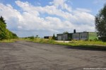
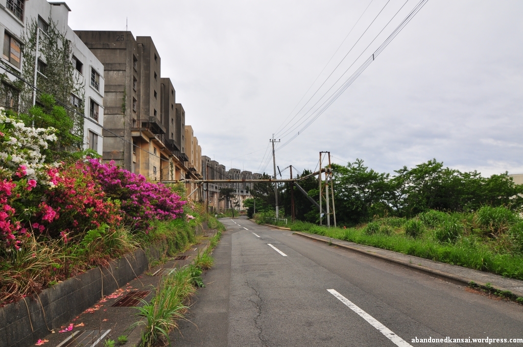
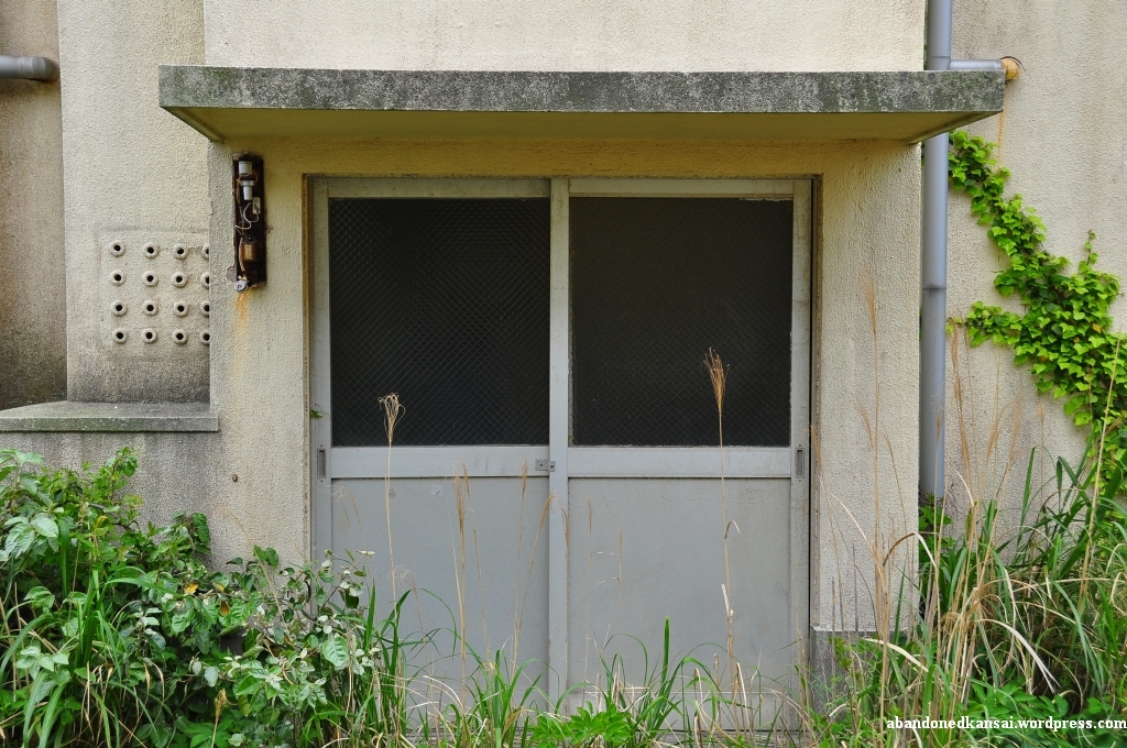
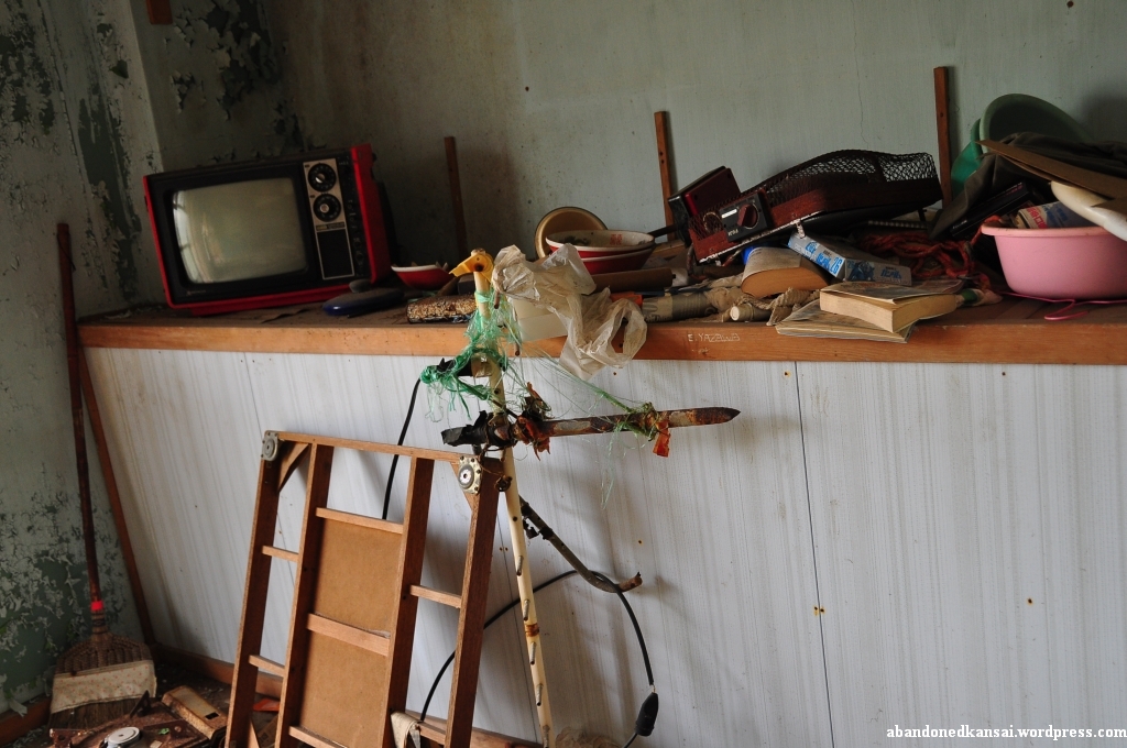
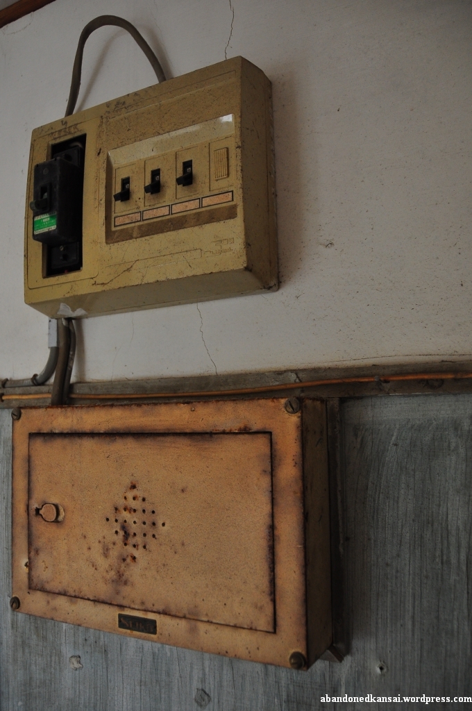
A famous temple, stunning views of the Seto Inland Sea, a historical battle. What else do you need to attract tourists? Right, an aquarium! The Yashima Mountaintop Aquarium (屋島山上水族館, Yashima Sanjo Suizokukan) was opened in 1969 and reopened as the New Yashima Aquarium (新屋島水族館, Shin Yashima Suizokukan) in 2006. In-between some (not so) smart businessmen took advantage of the Japanese asset price bubble (1986 to 1991) to build some rather big hotels on Yashima, creating way more beds on the 300 meter high mountain than necessary. Because let’s be honest: Yashima is a daytrip location, not a place to stay overnight. (Heck, I made it a daytrip although I live in Osaka!) Around the turn of the millennium most of those new hotels were already forced to close, only a few smaller ryokan north of Yashima Temple survived. It seems like the closed hotels were still standing there when Nippon No Haikyo was written in 2007, maybe for two or three more years – when I visited in late 2011 most of them were gone… The Lost Ruins of Mount Yashima.
(I used this posting for a big update of my *Map of Demolished Places in Japan* – it’s really worth a look!)
Archive for the ‘House’ Category
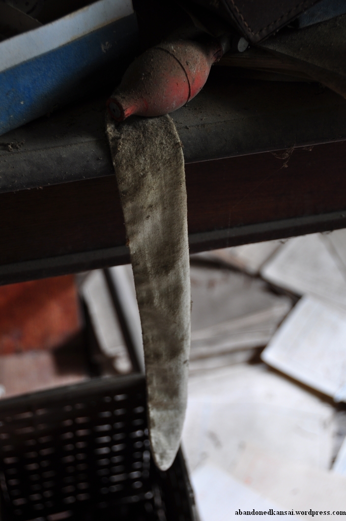
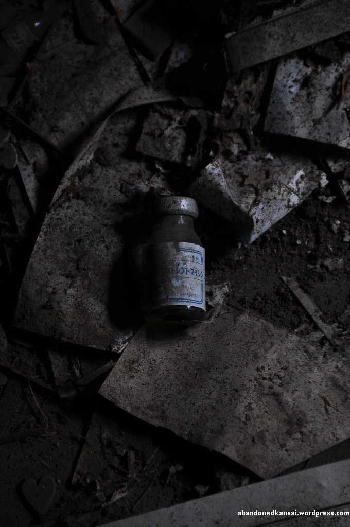
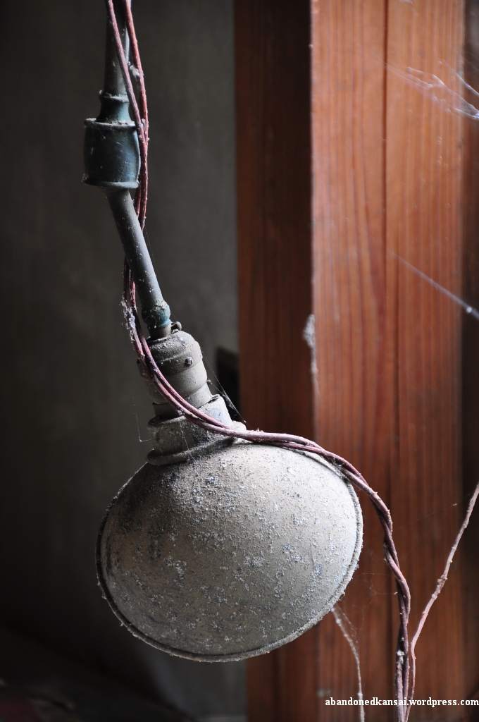
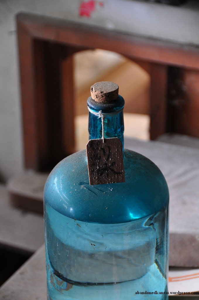
The Lost Ruins Of Mount Yashima
Posted in Demolished, Haikyo, Hiking, Hotel / Ryokan, House, Japan, Kagawa, Map, Restaurant, Sacred Site, Shikoku, Urbex, Visited in 2011 on 2011/11/28| 2 Comments »


Sembach Air Base
Posted in Abandoned, Airport, Demolished, Depot, Europe, Fire Station, Germany, House, Military, Rhineland-Palatinate, Transportation, Urbex, Video, Visited in 2011 on 2011/11/17| 58 Comments »
The now abandoned Sembach Air Base has quite a long history. The location was first used as an airfield after World War I by the French occupation troops in 1919 with 10 sheet-iron barracks and 26 wooden hangars. When France retreated from Germany in 1930 the air base was abandoned on June 15th and the land was returned to farmers who used it as a hay field. (The area around Sembach is very rural and agriculture is an important economic factor till this very day.)
In preparation of World War II the Nazi-German Luftwaffe deemed the area proper to build a fighter base and claimed the land in early 1940, but gave it back to the owners in June of 1940 after France was conquered in a blitzkrieg now known as the “Battle of France”.
After the defeat of Nazi-Germany in May of 1945 Sembach was part of the French occupational zone. In April of 1951 German surveyors along with French officers were looking for suitable locations for air bases. The Cold War had begun a few years prior and both the NATO and the Warsaw Pact armed themselves at a remarkable speed. The NATO’s lack of air fields suitable for modern jets made it necessary to build new military airports – so the French authorities began with the construction of a hard surface airfield in June of 1951, much to the protest of local farmers, who demonstrated in Mainz, the capital of Rhineland-Palatinate, without much success. On September 1st the United States took over the construction site, naming it Sembach Air Auxiliary Field, and pushed hard to finish the base – completing the 8500 foot concrete runway by the end of the month working round the clock using nighttime illumination. The rest of the airfield (tower, hangars, repair shops, storages and other buildings) were built during the winter. Local protests rose again when plans for the construction of barracks and office buildings surfaced in April of 1952 – this time with a little bit more success: Instead of using valuable farm land the new buildings were constructed on a sandy area with little agricultural value about 1.5 kilometers away from the airfield (Heuberg). Everybody was happy and after another year of construction the American flag was finally raised at the base now known as Sembach Air Base on July 8th 1953, when a RB-26 Invader arrived from Shaw Air Force Base in South Carolina. It was part of the 66th Tactical Reconnaissance Wing, the first of many units to be stationed in Sembach.
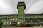
40 years after Sembach Air Base was opened protests rose again – this time because the Americans announced plans that the base will only be used as a substation of Ramstein Air Base; a huge economical setback for the town and nearby cities, directly (German civilian employees at the base) and indirectly (soldiers spending money in the area). The airfield was returned to German control two years later on March 30th 1995, the installations in Heuberg were renamed Sembach Annex. In summer of 1998 the demolition of the base began, the runway being the first “victim” of this process. Since then most of the buildings on the former air base have been demolished – but not all of them, at least not by the time Gil and I arrived at the location.
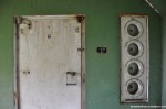
After the *Deportation Prison Birkhausen* and the *USAREUR Communication Facility Lohnsfeld* turned out to be quick stops we decided to tackle another big one and drove to Sembach to have a look at what was left of the air base. First we went to the western part and found some half-underground bunkers, inaccessible of course. Next was a small office building (?) that looked like it was made of corrugated cardboard. Quite interesting was the former Fire Station, part of the Fire and Emergency Service. I was rather surprised by the coloring of the toilets – white and pink. Seriously? The restrooms of the fire department on a US Air Force base were pink?
In the afternoon, when we left the fire station, the weather started to turn drastically. The sunshine was gone and dark grey clouds approached quickly. While we were making our way to the abandoned tower the wind sped up massively – to my favor as I should find out minutes later. I just finished shooting the tower building when a wall of rain came closer quickly and before I had the chance to take shelter it poured liked I was standing in the shower; a first class cloudburst. At that time I was close to the eastern wall of the tower, so I pressed myself against the high wall while the wind was blowing so hard that it actually blew the rain over my head. About 15 minutes I was standing there, hoping for the wind to continue and the rain to stop. When the heavy rain turned into light drizzling I started to look for Gil, who found shelter in a nearby building I assumed was inaccessible. That building was boarded up (almost) completely and its massive walls made me wonder right away what it was used for. Sadly it was pretty much empty, nevertheless we found some interesting items – a sleeping bag and other signs of a homeless person being there for a while, a perforated cardboard character and some documents with rather sensitive information; like special travel orders, granting individuals the permission to hand-carry a M16 rifle. I have no clue how those documents escaped the shredder, but I guess I better refrain from posting photos since each sheet of paper contained several names including ranks and addresses…
Going on an exploration trip with Gil was absolutely fantastic (thanks, man!). While the first two locations were quite disappointing from an urbex point of view Sembach Air Base made up for it big time. It was the first US military base I was able to explore (yes, I went to a second one, so stayed tuned!) and I had a blast – no pun intended. The locations in Germany differ quite a bit from the places I usually get to see in Japan, so I really enjoyed this refreshing experience!
Addendum 2013-08-27: If you liked this article, check out the one about the nearby *Hochspeyer Munitions Storage*!
(If you don’t want to miss the latest article you can *like Abandoned Kansai on Facebook* and *follow this blog on Twitter* – and of course there is the *video channel on Youtube*…)


New (Old) Videos!
Posted in Abandoned, Amusement Park, Asia, Haikyo, Hotel / Ryokan, House, Hyogo, Japan, Kansai, Museum, Nara, Restaurant, Shiga, Urbex, Video, Visited in 2009, Visited in 2010 on 2011/09/03| 2 Comments »
Today I had a look at some rather old videos shot at locations I already wrote articles about. None of them were intended to be published, so the camera work might be a bit rushed occasionally, but I decided to upload them anyways as I think there might be some interest in them out there in the world wide web. While some of my videos only get a couple of dozen views quite a few of them were watched by thousands of people – *this one* will actually reach 30.000 views soon. Please enjoy!
*Nara Dreamland – Aska Rollercoaster*
Ikeshima – In The Afternoon
Posted in Abandoned, Animals, Asia, Haikyo, House, Japan, Kyushu, Map, Mine, Nagasaki, School, Transportation, Urbex, Video, Visited in 2011 on 2011/08/01| 2 Comments »
The best way of getting in contact with the locals on Ikeshima seems to be leaving camera equipment on the side of a street. It worked in front of the apartment complex and it worked again about an hour later just down the road next to the school. I left my belongings behind to take a video of the apartment buildings next to the abandoned baseball field. When I came back I saw a guy in his mid-30s and of course I said “Hi!”. His English was actually pretty good, so we started talking about the school and he told me that it still has 9 students – and as many teachers (although this number might include other staff like secretaries). I asked him if he was born on Ikeshima, but he wasn’t. A Kyushu native he studied in Nagasaki and then was sent to Ikeshima by his company – and he didn’t seem to be very happy about it.
For all of you not familiar with big Japanese corporations: In Japan you usually don’t apply for a specific position within a company after graduation (from senior high school or college), you apply at a company in general and then the company decides what to do with you. Commonly this includes intense training from several months to several years, depending on the company you got into. Of course your classes at university kind of give that education a direction, but it’s not unusual that somebody with a degree in mathematics or French literature ends up in marketing or HR – getting into a university in Japan tends to be a lot tougher than actually graduating, so companies tend to start from scratch after 3 years of drinking, sports and art clubs. And just because you are fluent in a second (or third!) language doesn’t mean the company makes proper use of that. (But if you are female and good looking chances are great you won’t have to clean ashtrays for two years – instead you most likely will become some supremo’s secretary.) The same applies for your place of work. Just because your company has its HQ in Tokyo doesn’t mean you won’t end up in a subsidiary somewhere remote. Like on an island off the coast of Nagasaki prefecture…
After the guy told me that he worked for a recycling company on Ikeshima we split since he had to get back to work – and I was eager to continue my exploration.
I was actually starting to run out of time, so I went back to the apartment building area I shot in the morning, this time more to the east. Some of the buildings had new plumbing outside and people were actually living there. At this point everybody I saw gave me a short nod, which I interpreted as a sign of “Yeah, you are welcome here.” – it felt really good. At an abandoned house the window next to the entrance door was broken, so I took a few pictures of the bike, cleaning tools and mailboxes that were still there. When I got back to the main street, route 216, I actually found a house that was open for visitors (I guess… it was unlocked, clean and had a sign in Japanese outside saying something about a room on the 4th floor). All the doors were locked and the staircase kinda smelled funny, but on the 4th floor I was indeed able to look inside an apartment that was arranged like a museum room.
Outside again I followed route 216 to finish my circumnavigation of Ikeshima. I passed by the noisy Ikeshima Urban Mine Co., Ltd. and several apartment buildings before reaching the old loading plant. On the southern side of the harbor entrance was a scrapyard where a single worker was moving rusty stuff around. In continued following route 216, taking some pictures here and there, before I reached the apartments at the harbor again, where my explorations started about seven and a half hours earlier, making my visit to Ikeshima one of the longest photo shoots I ever did. But it wasn’t over yet…
Figuring out the ferry / boat schedule when planning the trip wasn’t exactly easy since all the information was in Japanese and not really clear. I got some help from friends who are Japanese natives and confirmed the schedule with the hotel staff in Sasebo – everybody told me the boat (it actually was a boat, not a ferry, also in the morning – sorry for that!) would leave at 4.09 p.m., so when my ride entered the harbor at around 3.55 p.m. I continued to take some photos and videos. But something felt wrong watching the activities on the boat, so I decided to hurry to the terminal – and of course the boat left right when I arrived, shortly after 4 p.m.; thank you very much, guys! The people arriving on Ikeshima of course saw what happened and told me that there was another boat leaving for Sasebo today, but they couldn’t tell me when. So I waited and thought about the day – my rocky start and how I didn’t even enter any of the huge industrial ruins at the harbor. 10 minutes passed, 20 minutes… Then some senior citizens arrived at the terminal and I felt a bit of relief – I wasn’t the only one wanting to leave Ikeshima. At around 4.35 p.m. the boat to Sasebo arrived. As I took a seat while the ship left the harbor I had a last look at the huge characters in the sand of the breakwater and I couldn’t have agreed more: „絆 池しま 大スキ“ – „Kizuna Ikeshima daisuki“ – „I / We like Ikeshima a lot“
(Since the inhabitants of Ikeshima consider their island a tourist attraction I added it to the *Map Of Demolished Places And Tourist Spots* and created *a new map just for Ikeshima*. If you don’t want to miss the latest postings you can *follow Abandoned Kansai on Twitter* and *like this blog on Facebook* – and of course there is the *video channel on Youtube*…)


Ikeshima – At Noon
Posted in Abandoned, Asia, Demolished, Factory, Haikyo, House, Japan, Kyushu, Map, Mine, Nagasaki, Urbex, Video, Visited in 2011 on 2011/07/21| 2 Comments »
After I left the apartment building and shot the first video I was looking for a new approach to Ikeshima. So I left the area with three-storey buildings and headed towards a bunch of row bungalows with little garden. Some of them were still inhabited and it seemed like the people living there took care of their former neighbors’ gardens. I continued to walk uphill and reached a small park with an observation platform – the highest point of the island. Although the stairs leading up were really rusty and maybe should have been off-limits I went up and had a look around. What a nice view!
A building with a headframe caught my eye, so I carefully went down again and walked toward the coop – which is sometimes mistaken for a hospital due to some “Safety first” signs. On my way I came across what turned out to be one of the most fascinating building complex I’ve ever seen, totally reminding me of my trip to *Chernobyl and Pripyat*. Its foundation was on the lower end of a slope, with bridges connecting the upper floors with the street I was walking along. A really fascinating construction, even more beautiful from its base as I found out later. But for now the headframe was more important, so I walked down some concrete steps with a severely damaged handrail to the backside of the coop. The rear entrance was actually open, but I refrained from entering. A sign displayed some kind of opening hours of the Mitsui Matsushima Resources Company (三井松島リソーシス株式会社), the subsidiary of Mitsui Matsushima responsible for taking care of the trainee program that ended in 2007. The front entrance had the same or a similar sign. So I took some photos from the outside of the building and walked up the street towards the apartment complex.
To get a better grasp of the whole complex I put down my tripod (including the camera) and my backpack on the side of the road and headed for the bus stop right in front of it. There was some kind of roundabout and the moment I wasn’t visible from the street a small pickup truck (actually a kei truck or Japanese mini truck) passed by and stopped next to my belongings. “Great… trouble!”, I thought and made myself visible. Two guys in their 50s or 60s got out of the truck and when I came closer they addressed me in a mix of Japanese and English – and I answered the same way.
What I was doing here?
Just taking some photos…
Interested in history?
Yep, a lot!
From America?
No, Germany.
At this point their faces lit up a bit and we switched from 75% Japanese to 75% English. Then they asked me if I wanted to see their offices. Wait, what? Yeah, they were working at the coop building with the headframe, they told me. So I picked up my belongings and jumped on the truck bed. Knowing that there wouldn’t be any oncoming traffic the driver sped up quite a bit and hurried down the mountain, but somehow I managed to take some slightly blurry photos without falling off the truck.
The front door of the building was also unlocked and the guys guided me to the second floor. There were several offices and the entrance to the mine shaft. Lighting was horrible and the guided tour was so quick that most pictures turned out to be blurry. I snatched some shots of the room where the mobile radios as well as other equipment were stored (and charged), then we went through some more offices and by the time I realized what I was doing I was outside again and said goodbye to my guide – I barely spent ten minutes inside the coop, but I was able to take some rare photos. What a great opportunity!
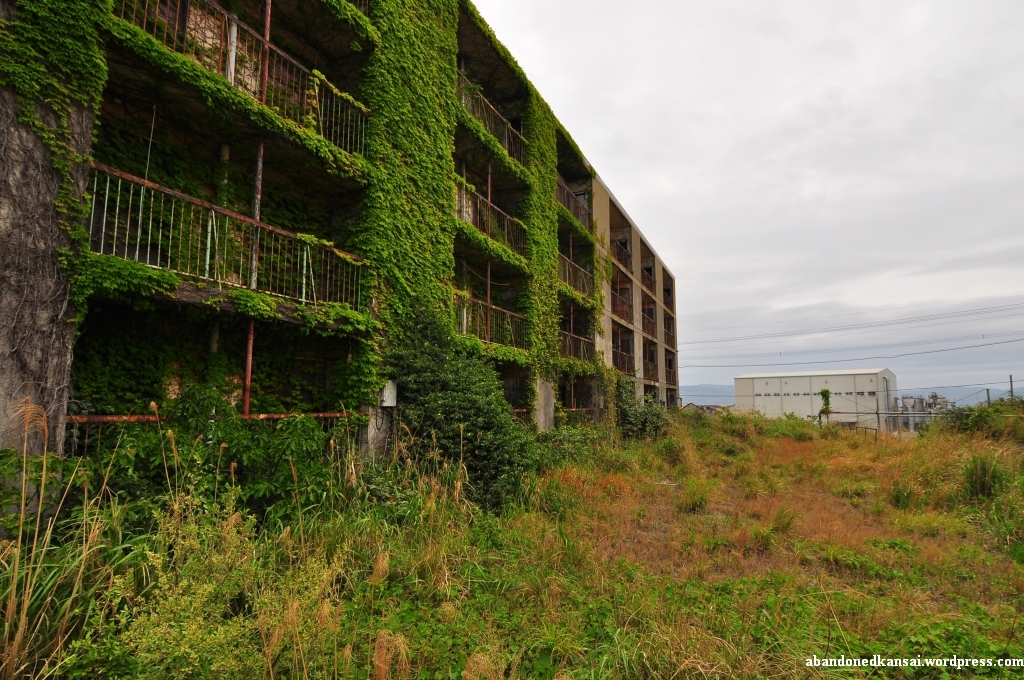
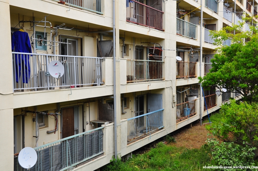
Since the guys gave me a one way ride I walked up the street again and back to the apartment complex. This time I put down my belongings where they weren’t visible from the street and started to take pictures and videos. The weather seemed to brighten up a bit and just looking at the amazing apartment complex put a smile on my face. Such a great building, such a nice atmosphere… I felt at ease and my worries about living up to the uniqueness of Ikeshima were gone. Now that I’m writing these lines I’m again not sure if the pictures and videos can really put you there, but looking at the material for the first time in a couple weeks makes me daydream a bit. As far as I could see all entrances were boarded up or even bricked up, there was quite a bit of barbed wire and the previously mentioned bridges looked very dilapidated from below – but I didn’t even have the urge to enter the complex. It was just nice being there. With the apartment complex, more apartment buildings further down the slope, and an overgrown children’s playground on an additional level between the two housing sections. A couple of minutes before I continued my exploration of Ikeshima the van parked in front of the bus stop continued its tour after quite a long break (the driver must have taken a rest in the little hut next to it) and I felt good. Really good.
Half of my time on Ikeshima was over and I was curious *what the afternoon would bring* – it didn’t disappoint…
(Since the inhabitants of Ikeshima consider their island a tourist attraction I added it to the *Map Of Demolished Places And Tourist Spots* and created *a new map just for Ikeshima*. If you don’t want to miss the latest postings you can *follow Abandoned Kansai on Twitter* and *like this blog on Facebook* – and of course there is the *video channel on Youtube*…)


Ikeshima – In The Morning
Posted in Abandoned, Asia, Demolished, Factory, Haikyo, House, Japan, Kyushu, Map, Mine, Nagasaki, Power Station, Transportation, Urbex, Video, Visited in 2011 on 2011/07/13| 5 Comments »
„絆 池しま 大スキ“ – „Kizuna Ikeshima daisuki“ – „I / We like Ikeshima a lot“
That’s what’s written with huge, colorful characters in the sand of the breakwater at the Ikeshima harbor. A last pledge of allegiance from about 300 remaining inhabitants of an island once the home to several thousand people – miners and their families, shop owners, restaurateurs, …
When I arrived on Ikeshima I can’t say I agreed with the bold statement at the harbor. The weather changed from sunny to overcast with a serious risk of rain and the humidity rose to levels you usually experience during the long, excruciating Japanese summers. Though the previous day was pretty long, exploring the *Imari Kawaminami Shipyard* and the *Mukaiyama Mine*, I had to get up again before 6 a.m. to make it to the ferry on time and my landlubber slugabed stomach wasn’t a big fan of the early morning breakfast, although the ferry ride itself was really enjoyable.
In addition to that I felt a pressure right from the beginning I hadn’t felt in years. Back in my days as a journalist in Germany (10+ years ago) I was writing about all kinds of topics. Most of the stuff was trivial and routine, but once in a while I dealt with a project close to my heart – and in those cases of course I wanted to rise to the occasion and write an article that did justice to the topic.
So while I tried to calm down my slightly upset stomach I was worried if I would be able to take pictures that represent Ikeshima properly, if I could come up with interesting stories to write about – if I was able to experience this island that is on its way to become an urbex legend; some people already call it Gunkanjima’s little brother (although Ikeshima is way bigger…). And since Ikeshima is in way better shape and way easier to access than *Gunkanjima* it is actually on its way to become more popular amongst urban explorers – a trend that seems to be appreciated and supported by the remaining inhabitants of the island, at least to some degree.
The first thing I saw getting off the ferry were two maps of the Ikeshima right at the pier – one being an aerial shot of the island from 1982, highlighting 9 points of interest; the other being a typically Japanese manga tourist map with a hiking guide, pointing out restrooms, bus stops, areas off-limit and buildings you shouldn’t miss. Sadly (for for the locals) Ikeshima wasn’t a tourist attraction (yet), at least not during Golden Week 2011: I was not only the sole foreigner on board, I was also the only person carrying photography equipment. The other half a dozen passengers were elderly Japanese guys looking for a relaxing day of fishing.
I took a few quick photos at the harbor to calm my stomach, get used to the humidity and make sure that the settings of my camera were how they should be – and somehow I got the feeling that the few locals I met weren’t really happy about it. As a rather big, tall non-Asian foreigner in Japan I’m used to being stared at, but maybe I was overly sensitive because of the uncomfortable situation I felt I was in, so I didn’t like Ikeshima a lot at that point…
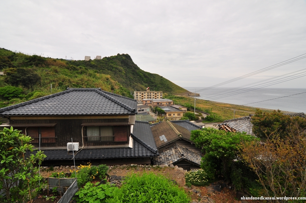
I passed by four of five people trying to get one of the omnipresent cats from an electricity pole and left the harbor area to follow the street uphill. Down to the right was a little settlement, several dozen houses, once the homes of the non-mining population on Ikeshima. I saw some big apartment buildings on the top of the hill, so I decided to follow the street and maybe have a look down there later.
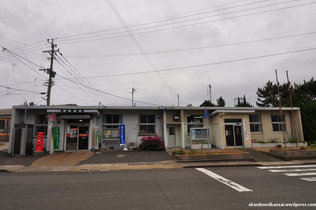
Reaching the top I passed by the post office which, to my surprise, actually had one or two customers while I was looking around that area. Although nowadays most people seemed to live down by the harbor the uphill apartment section was surprisingly busy. Within the first hour I spent there I saw maybe two dozen pedestrians and at least half a dozen cars, including the local shuttle bus which seemed to pass by me every 5 minutes – and in the background a recycling company caused quite some noise.
At that point I felt like a kid in a candy store – extremely excited, looking at dozens of opportunities, each one of them usually worth a day-trip on its own, and no idea where to start. But this was Ikeshima, Little Gunkanjima, so I had to take some spectacular shots! Just how? Especially since all buildings seemed to be boarded up, the doors bolted or welded. And the industrial areas were all off-limits, “No Trespassing!” signs everywhere in Japanese (kanji) and Bahasa Indonesia (Latin alphabet and katakana). Still under irrational pressure I felt like I had to make a move – and when I saw an open balcony door I jumped the railing and got inside. Finally what I was looking for? Not at all! I felt more uncomfortable than ever. I’m into urban exploration for the unique esthetics, for the quiet time in the middle of nowhere, for interesting angles and the amazing atmosphere really spectacular places provide. I’m not doing it for the thrill of being in buildings I’m not supposed to be. Quite the opposite in fact, I really dislike that aspect. So I took a few quick shots while hearing cars and voices everywhere outside – I could have gotten to the staircase and maybe to other apartments from there, but instead I decided to leave the building. Seconds later another car passed by, followed by two senior citizens, greeting me with a smile. Maybe it was about time to change my approach. So I put down my tripod and my backpack at one of the crossroads, grabbed my video camera and started to tape a walking tour of the housing area, wondering what the people I met were still doing on Ikeshima.
It was not until World War II that coal was discovered under Ikeshima. At that time about 300 people lived on the island while the huge corporate conglomerate (keiretsu, 系列) Mitsui Matsushima (三井松島) started to buy large parts. The development of the coal deposits started in 1952 and in 1959 mining finally began – the last colliery to open in Japan. In 1970 about 8,000 people lived on the island (although one source throws out a number as high as 20,000…), but like in all Western industrialized countries coal became less and less important; oil was the new coal. In summer of 1999, long after most Japanese coal mines were closed for good, a technology transfer program was proposed and as if it was a sign that the days of the Ikeshima Coal Mine (池島炭鉱) were numbered a fire broke out in the mine in February of 2000. On November 28th of 2001 the last shift left the Ikeshima Coal Mine, about 3000 people living on the island at that time – making Ikeshima the second to last Japanese coal mine to be closed. On April 18th of 2002 the technology transfer program started, training students from Indonesia about mining – hence the multi-language warning signs all over the island. The trainee program ran out by the end of March 2007, a year after 77 miners won a lawsuit against Mitsui Matsushima; suing them for negligence, related to coal worker’s pneumoconiosis. Around that time the number of people living on Ikeshima dropped to about 300 – as it was before coal was discovered. (The name Ikeshima means “pond island”, because until the 1950s a large pond was the main feature of the island – it was turned into the harbor by Mitsui Matsushima… Please *click here* to be taken to a Japanese homepage with before and after shots next to each other.)
Did the two old ladies know any of those 77 miners? Were they maybe even sons or husbands? And why were they still living on Ikeshima? I never found out. But I talked to several other people on the island later that day – so don’t miss *part 2* and *part 3* of my Ikeshima exploration…
(Since the inhabitants of Ikeshima consider their island a tourist attraction I added it to the *Map Of Demolished Places And Tourist Spots* and created *a new map just for Ikeshima*. If you don’t want to miss the latest postings you can *follow Abandoned Kansai on Twitter* and *like this blog on Facebook* – and of course there is the *video channel on Youtube*…)


Back From The Island(s) – Again…
Posted in Abandoned, Amusement Park, Demolished, Factory, Haikyo, House, Japan, Kyushu, Mine, Nagasaki, Shipyard, Transportation, Urbex, Visited in 2011 on 2011/06/02| 4 Comments »
About 15 months ago I went on my first multi-day urban exploration trip: 3 days to Kyushu with my buddy Enric. A trip with lots of up and downs, visiting some amazing locations – Gunkanjima, the Katashima Suicide Training School and the winding tower of the Shime Coal Mine, now known to some people as the Anti-Zombie Fortress. But March was kinda cold, last year as well as this year. So when Golden Week came up (late April / early May) and my company forced me to take two of my paid vacation days to install a new AC I took the lemon and made lemonade – it was time to go back to Kyushu!
Since Enric left Japan and returned to Spain a couple of months ago, I went on my own this time. Remembering the best burger I’ve ever had I set up my base in Sasebo after a long day of exploring an abandoned shipyard and the abandoned leftovers of the dock of a mine close to it. The next day I explored one of the most amazing places I’ve ever been to: an almost abandoned island, once the home of several thousand people – and as exciting as that day was as disappointing was the next one when I walked through drizzle for hours without an umbrella to look for remains of a mine and its workers’ housing-estate; but they were gone forever – as research after my return confirmed… Luckily the weather turned around on my last day, so I was able to visit an abandoned amusement park on my way back home. Thank heavens for sunscreen, because without it the harsh Kyushu sun would have burned me crisp within half an hour…
Exploring all day I spent my three evenings in Sasebo at Base Street to enjoy some burgers. While the regular sized ones are good I’ll definitely recommend the so-called “Special Size” – this 15 centimeters in diameter monster is a classic Sasebo style burger that will fill you up with pure deliciousness; if you ever wanna spend 1100 Yen (yep, that’s 9.50 Euros or 13.60 Dollars!) on a single burger without even considering regretting it then this is the place to go! I just hope I’ll find more abandoned places close to Sasebo so I can have a good reason to go back there once more…
(Oh, and greetings to the tourist office in the Sasebo! It sells a variety of souvenirs, but not the awesome huge plush hamburgers that fill half of their display window. To get one of those you have to ride a bus for about half an hour to get to a small store at a shopping mall in the middle of nowhere. And since I had to wait 45 minutes for the next bus they lost a customer who would have happily paid 200 Yen more to avoid the hassle of a 2.5 hour long round trip to get a cute present for his even cuter niece. A no-win situation… and pretty much the worst sales strategy ever!)


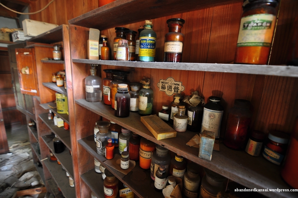
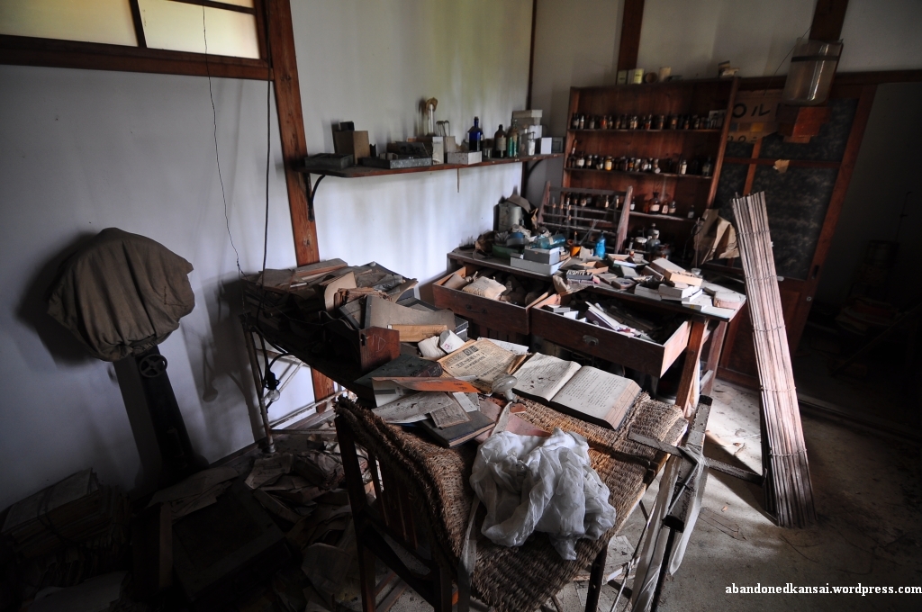
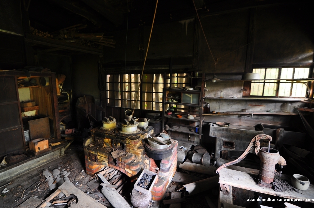
The Tokushima Countryside Clinic (徳島田舎診療所) – In Color
Posted in Abandoned, Asia, Haikyo, Hospital, House, Japan, Shikoku, Tokushima, Urbex, Visited in 2010 on 2011/03/30| Leave a Comment »
Okay, after quite a few articles about the Zone Of Alienation it’s about time to go back to Japan. I’ll return by posting the previously announced color set of a location I already described before the “Chernobyl & Pripyat” special: The Tokushima Countryside Clinic. I went there in November of 2010 and wrote a long article about it in December. Please *click here to read what I had to say* and enjoy the same pictures as below – just in black and white. (Next week I’ll continue with another location from my Haikyo Road Trip To Shikoku – an abandoned indoor waterpark, which is quite a rarity in Japan!)


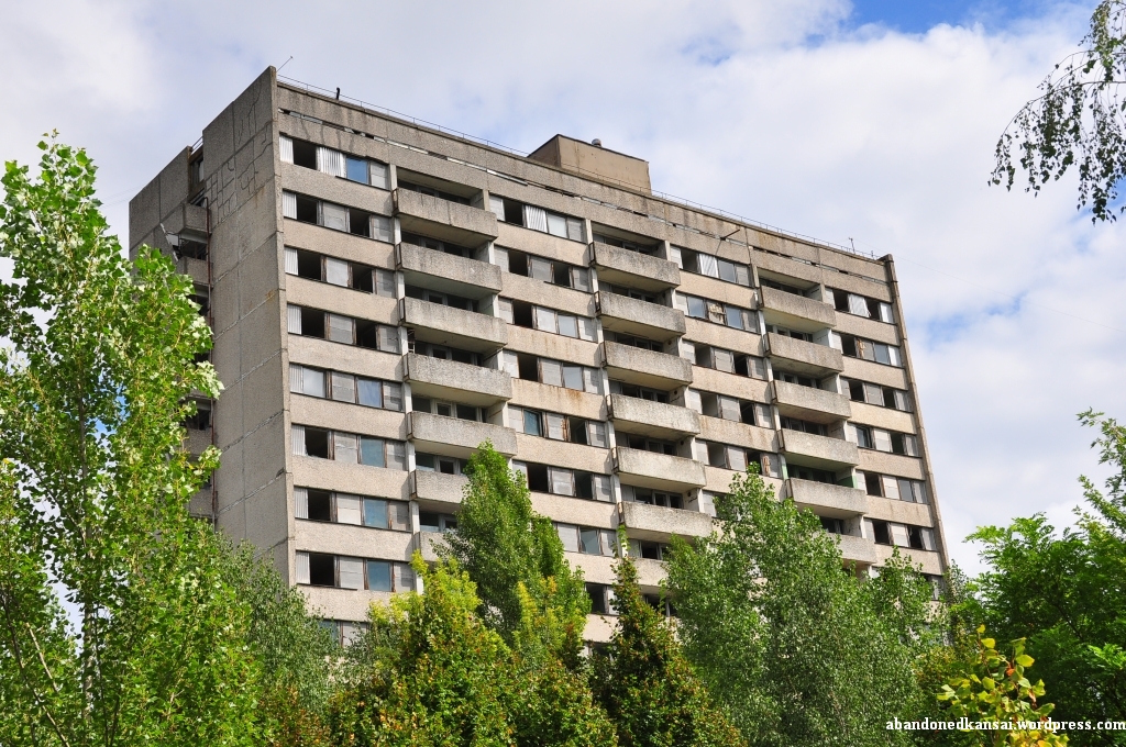
Zone Of Alienation – Pripyat: Apartment Building at Lazarev Street 1/14
Posted in Abandoned, Europe, House, Kindergarten / Nursery, Map, Pripyat, Ukraine, Urbex, Visited in 2010, Zone Of Alienation on 2011/03/17| 7 Comments »
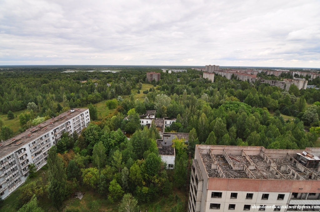
After sunny visits to the Jupiter Factory and the Kindergarten “Golden Key” we had some time left before we had to leave the Zone Of Alienation, so Maxim suggested to go to another rooftop. Of course he had to guard the car again, so Sebi, Michi and I went up on our own.
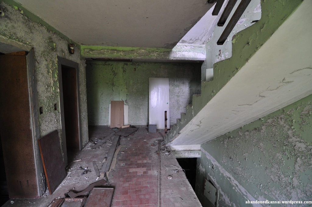
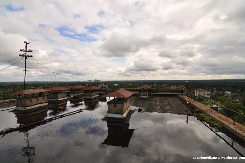
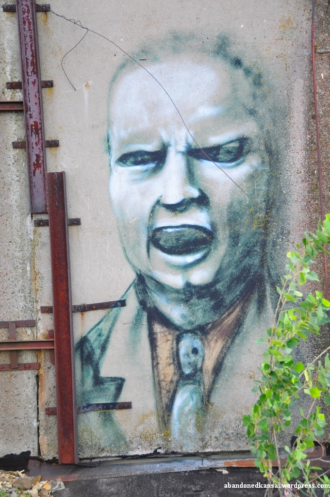
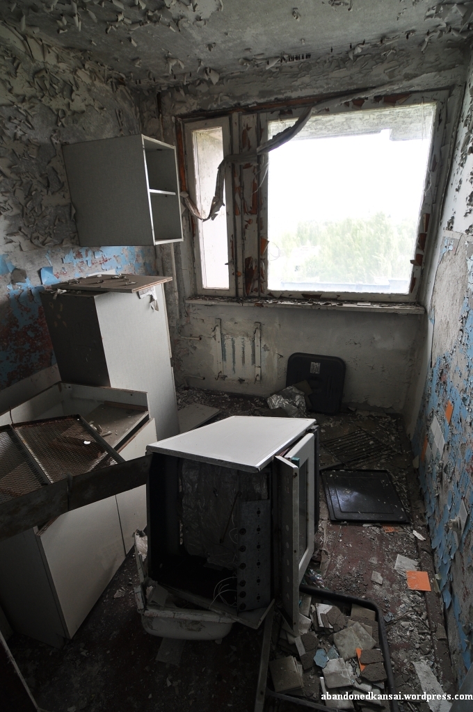
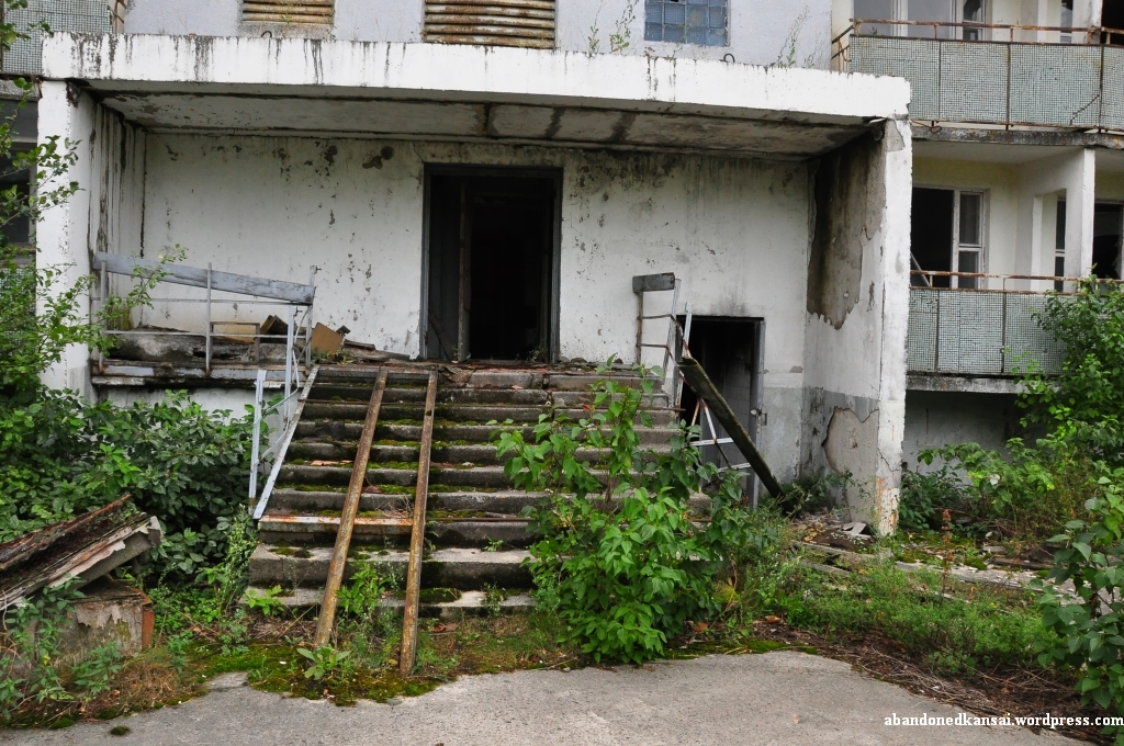
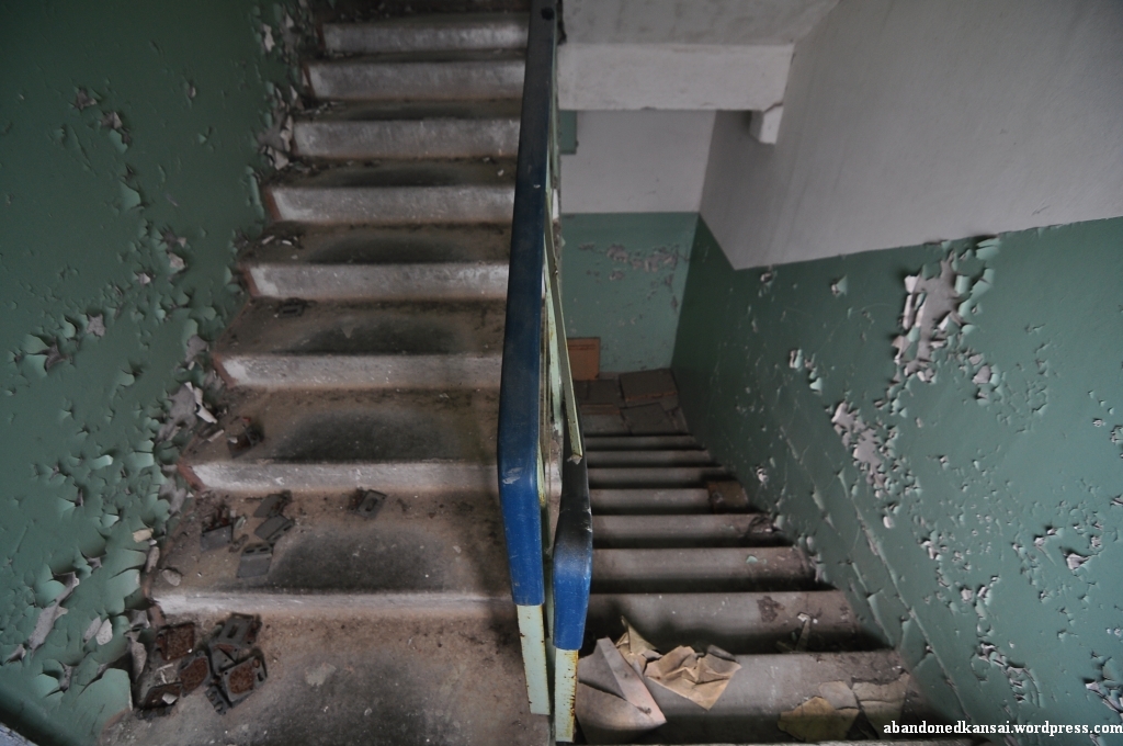
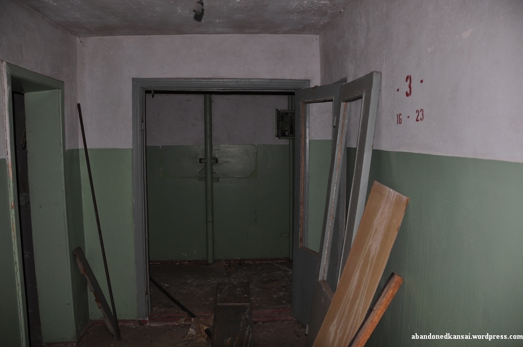
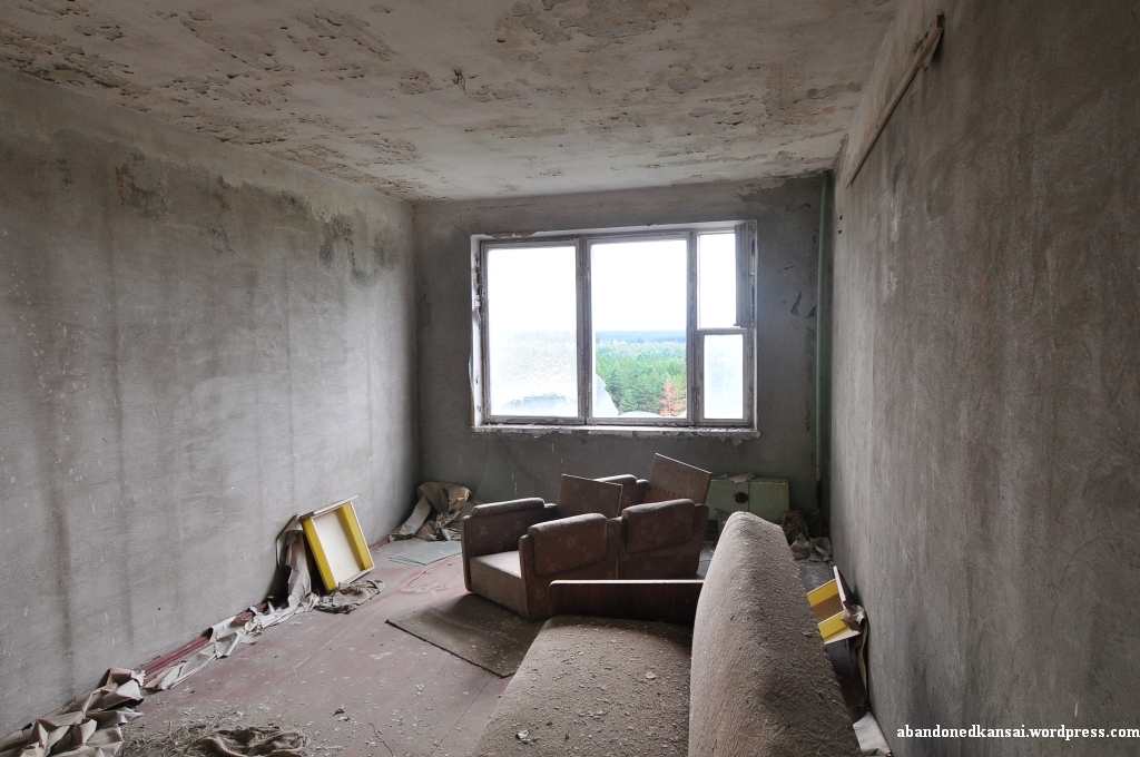
The construction of this building in the city center close to Lenin Square was interesting in that regard that for the first couple of floors the staircase was inside the building, but for the top half we had to go outside on a balcony and then get in again to climb more stairs. Quite weird… and nasty when it was raining, as we experienced on the way down. Furthermore I’m sure sooner or later one of those balconies will crumble (hopefully at a moment when nobody is standing on it) and then the floors above won’t be accessible anymore. Considering the state of the building in hindsight I’m actually not sure if I would go up there again – especially since the roof had huge puddles of water, which I’m sure contribute to the demise of the whole construction. The view was stunning though, no matter in which direction we looked. Seeing how the kindergarten was indeed swallowed by nature was as impressive as seeing the Amusement Park, the Palace Of Culture “Energetik” and Lenin Square at the same time. On the way down I took a quick minute to have another look at some apartments and actually found one with some interior left – in bad shape, but nevertheless interesting. When I left the apartment house at Lazarev Street 1/14 I saw a graffito on a wall at the building next to it – the black show of a girl… and the last photo I took in Pripyat.
Although now as I am writing these lines most nuclear experts agree that what happened in Chernobyl and what’s going on in Fukushima these minutes have barely anything in common, it’s still a weird feeling being only 550 km away from the events that shake the world these days. And I’m actually kind of glad that this is the last entry of my “Chernobyl & Priypat” special. I seriously hope Fukushima will turn to the better and that you, dear reader, will continue to follow this blog when I’m going back to my main topic: abandoned places in Kansai and the rest of Japan.
(If you would like to know more about my trip to the Zone Of Alienation please *click here* to get to the “Chernobyl & Pripyat” special. For a map of the area please *click here*.)


Zone Of Alienation – Pripyat: Apartment Building at Lesya Ukrainka Street 56
Posted in Abandoned, Europe, House, Map, Pripyat, Ukraine, Urbex, Video, Visited in 2010, Zone Of Alienation on 2011/01/27| 5 Comments »
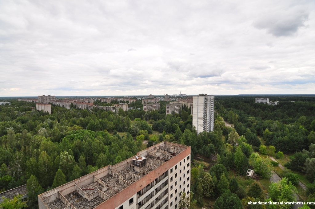
Before going to Pripyat there were two things I badly wanted to do: I wanted to take a really good picture of the ferris wheel at the Amusement Park – and I wanted to have a good view over the city from the top of one of the buildings.
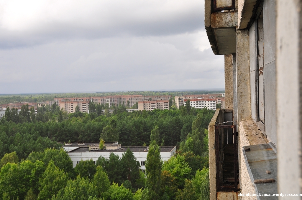
Of course officially it’s way too dangerous to allow people to go on top of any of those buildings, in countries like Germany and Japan they probably wouldn’t even let you inside most of them, but of course nobody really cares about those rules as seen many, many times in magazines, on TV and the internet. So after we left the supermarket we drove through the city for quite a while to get to the northwestern part of Pripyat. There was a 16-story building rather far away from the main attractions and in close proximity of some unfinished buildings. Maxim, who still looked a little bit… well… hungover… told us that he would “guard the car” and asked us to be careful and to stay away from the edges so we won’t be seen by the units policing the area occasionally – and he gave us 30 minutes to get back. (Strangely enough Maxim wasn’t worried that much about 35 minutes later when we running late a bit. We were on our way down and at around the 9th or 10th story we heard a car horn making quite some noise. Being used to unofficial explorations I panicked for about a second or two until I realized that I had no reason to really worry about anything. And neither had Maxim… obviously.)
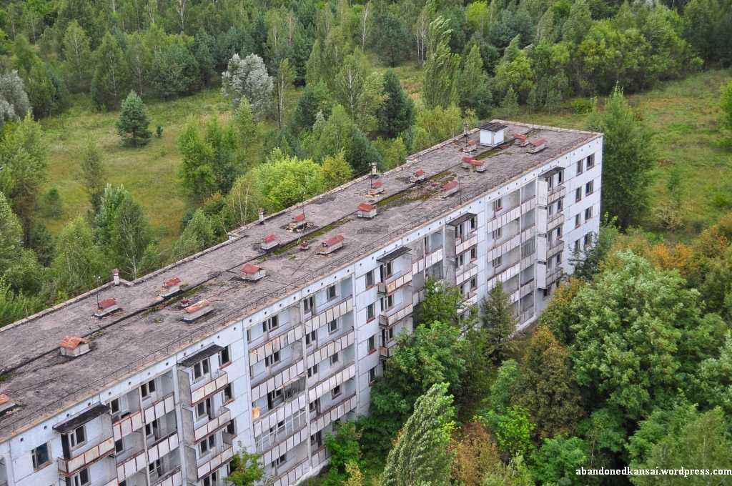
The entrance of the building at Lesya Ukrainka Street 56 didn’t exactly look like a building you really want to enter, let alone stand on top of, but that didn’t cross the mind of either of us – we were eager to experience a view to remember. On the way to the roof I made a quick stop at one of the floors to see with my own eyes how much damage the liquidators and looters did to the apartments. Most of the rooms were indeed empty, electronics were nowhere to be seen and of course both wallpapers and paint were falling off the walls. At the top floor was a machinery room where we had to climb a wooden chair to get to the opening to actually get onto the flat roof. Climbing that chair and looking outside was another magic moment, almost as intense as when I saw the ferris wheel for the first time at the gymnasium of the Palace of Culture – not even two hours earlier, but it seemed like it had been weeks ago.
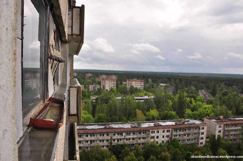
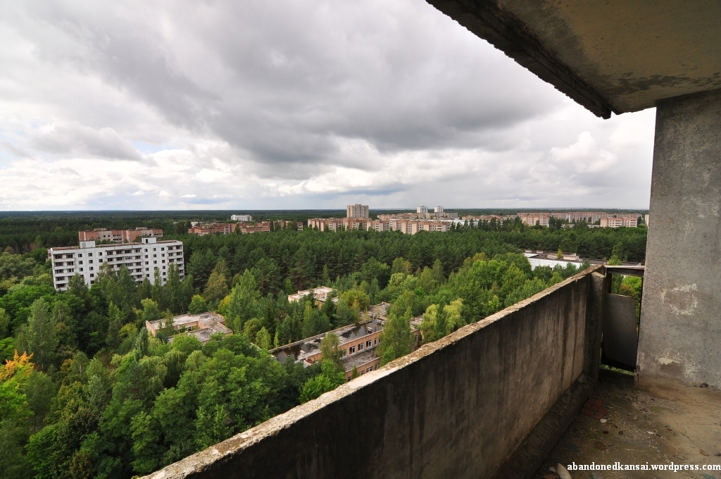
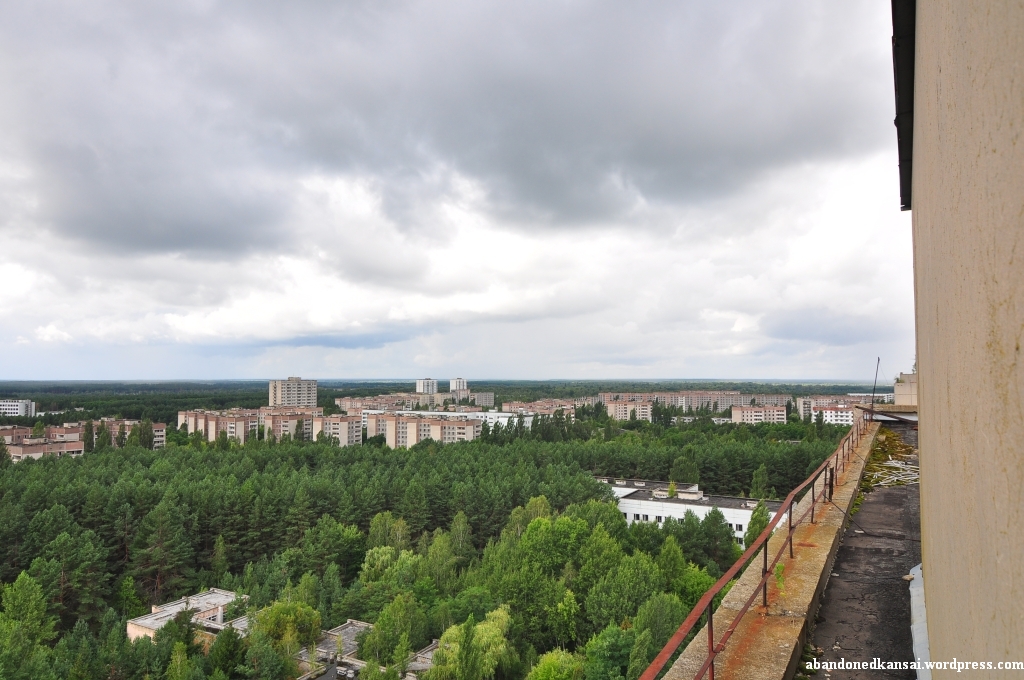
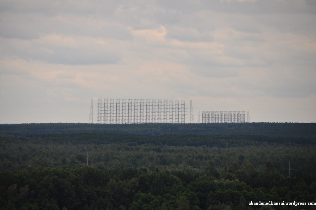
Stepping onto the roof I actually saw just green and grey-ish blue at first – the almost endless forest west of Pripyat and the impressive dramatic sky of that late summer day. The view was breathtaking and seeing Pripyat for the first time from that perspective I realized how big the city really was and how much of it was re-claimed by nature. Lots of the smaller buildings were completely swallowed by the sea of trees and even some of the bigger ones looked like they were drowning. In the south the Jupiter Factory was rising from the forest and at the horizon the remains of the Russian Woodpecker, part of the Soviet Union’s anti-ballistic missile program, were still defying nature. And in the distance in the southeast the Chernobyl Nuclear Power Plant was reminding everybody why the city to our feet was abandoned…
(If you would like to know more about my trip to the Zone Of Alienation please *click here* to get to the “Chernobyl & Pripyat” special. For a map of the area please *click here*.)


Abandoned Kansai on Facebook
-
Join 5,098 other subscribers
Pages
Archives
Categories
Recent Comments
Gred Cz on Sakura Car Shop Sue on Sakura Car Shop Gred Cz on Mie Minshuku Matauia vainetutai M… on Nara Dreamland – Frequen… Emily on Mie Minshuku Gred Cz on Kitakitsune Farm (Non-Urbex) Seyeon Park on North Korea Revisited: Ep… Florian / Abandoned… on Green Plaza Akakura Florian / Abandoned… on Green Plaza Akakura Gred Cz on Green Plaza Akakura
