All abandoned: Chernobyl / Pripyat, Nara Dreamland, Anti-Zombie Fortress, Japanese Sex Museum – and many, many more! Plus: North Korea Special – 2 trips, 16 days / 14 nights! As seen on CNN…
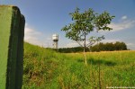
Being a mountainous country Japan has lots of cable cars and ropeways. And it seems like every single one of them was built in the late 1920s / early 1930s. A lot of them were demolished after just a couple of years in the 1940s to support the war efforts of Imperial Japan (every piece of metal counted…) – amongst others the *Mount Atago Cable Car* and the *Rokko Ropeway*. The Yashima Cable Car (YCC) had a bit more luck. Opened on April 21st 1929 it too was suspended as a nonessential line on February 11th 1944. But although some material was taken away (I’m not sure what exactly though…) it didn’t mean the end of the YCC: On April 16th 1950 the Yashima Cable Car opened again for business. And business was good thanks to the famous Yashima Shrine on top of Mount Yashima, about a kilometer away from the YCC terminal. I guess it got even better when some businessmen decided to make Mount Yashima a full-blown tourist attraction (*you can read all about it here*), but when the plan fell through the Yashima Cable Car was in trouble, too. On October 16th 2004 operations were suspended again, but it took almost a year (August 31st 2005) until the line was officially closed and abandoned.
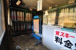
According to a tourist guide book first published in the 1980s the cable car ran from 7 a.m. to 7 p.m., charging 1160 Yen for the roundtrip. It seems like prices went up and service hours were cut down, so in 1999 the cable car ran every 20 minutes from 8 a.m. to 5.40 p.m., charging 700 Yen one way and 1300 Yen for a roundtrip.
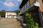
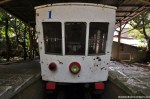
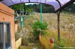
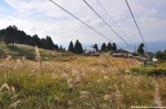
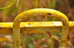
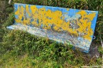
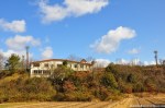
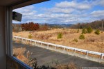
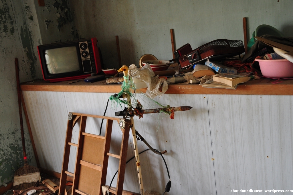
At the time of my visit the lower terminus of the Yashima Cable Car (屋島登山口駅, yashima tozanguchi eki – Yashima Trailhead Station) stood locked-up and abandoned on the foot of Mount Yashima near the trailhead up the mountain. The road leading there was almost as abandoned – I could vividly imagine how good business must have been 20, 30 years ago for the now closed restaurants and souvenir shops. Right next to the station were a taxi stand and a metalworking company, making some noise and keeping an eye on the inaccessible station building. The 858 meter long cable car track was accessible though, with car #1 parked right at the platform. And it was beautiful! On the one hand it was hard to believe that the place had been abandoned just six years ago, on the other hand there were no signs of vandalism and everything had just the right amount of decay – and the beautiful weather on the day of my visit didn’t hurt the atmosphere either…
After a couple of explorations with family and friends during my summer vacation 2011 it was about time to fly solo for the first time in Germany. The place to go: an abandoned shipyard along the river Rhine in a really nice little town called Germersheim, the city of syringa and the nightingale, just south of the way more famous Speyer. Germersheim was first mentioned in written form in 1090, but it was most likely founded more than a 1000 years prior to that. One of many beautiful small towns in the Rhine-Neckar Metropolitan Region.
It was kind of by chance that I stumbled across the place since I never saw it on the usual German urbex blogs and homepages – but the more excited I was about it. So enjoy, dear German urban explorers. While you can…
At first I was actually thinking about calling this location Shipyard G# – but that would have prohibited me from writing about the long and and turbulent history of the Shipyard Germersheim. Founded as “Oberrheinische Schiffswerft Spatz & Co GmbH” (Upper-Rhenish Shipyard Spatz & Co., Ltd.) in 1927 the company was renamed to “Germersheimer Schiffswerft” (Shipyard Germersheim) in 1953 after the “Reederei Reichel & Co” (Shipping Company Reichel & Co.) bought into the dockyard – but for whatever reasons the sign on top of the buildings says “Schiffswerft Germersheim”. In 1989 the company had to file for bankrupcy, but a rescue company with the creative name “Neue Germersheimer Schiffswerft” (New Shipyard Germersheim) was founded. Interesting fact: When Germany granted a guarantee to build two ships it was ordered by Brussels in December of 1990 to withdraw it since the whole procedure was repugnant to the Treaty of Rome (the whole thing was rather complicated, but it had something to do with a development aid project for the benefit of Senegal – we’ll kinda get to that topic later on again…). The new company was nevertheless successful for a couple of years, but finally failed in 2002. In 2009 a few scenes of an episode of the most popular German crime TV show “Tatort” (there is an English Wikipedia entry about the series if you wanna look it up… more than 800 episodes since 1970 – eat that, CSI!) called “Tod auf dem Rhein” (Death on the Rhine) was shot at the abandoned (New) Shipyard Germersheim and broadcasted in early 2010. A guy passing by on his bike told me that there are plans to tear everything down to build some mansions (with marinas, I guess), but nothing has happened yet to my knowledge…
The shipyard started by building inland cargo ships and pusher crafts, but later added tugboats, tankers and passenger ships to their portfolio. In the Spatz years the dockyard was also famous for (and a European leader in) repairing and conversions. More international fame was gained with the towboat Zongwe and the coastal motor vessel Lukuga, both built in pieces at the shipyard in Germersheim and assembled on location at Lake Tanganyika. In 1990, after the reboot, the ferry Le Joola (80 meters long, 12.5 meters wide, designed for 536 passengers and and a crew of 44) was built to cruise the coast of Senegal – one of the biggest ships ever to be built on the Upper-Rhine. 2002 turned out to be a horrible year for both the shipyard and the Le Joola. The ferry capsized and sank off the coast of Senegal, more than 1800 people died while 65 were rescued, making it the second largest naval desaster since World War 2.
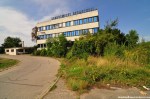
I actually didn’t know any of that background when exploring the shipyard on a hot and humid late summer day. The gate to the area with access to the Rhine was wide open, so I had a look at the backside first. Later I spotted some anglers and probably some geocachers at the waterfront, too (there is a cache on the premises or at least very close by… lost places geocaches are becoming more and more popular and people go there with their whole families). Back at the main street I saw that the sliding gate at the entrance and the porter’s office were closed – the door to the management office building was secured by an additional chain with a heavy lock. I decided to have a look at the rest of the area from the outside to think about how to enter, so that’s what I did. After visiting the *Kawaminami Shipyard* just a couple of months prior it was interesting to see a dockyard that survived way longer although it was founded earlier. Some of the construction buildings were very old, probably from the founding days – too bad they were pretty much empty. So was the office building – way more modern, but empty. And moldy! I’m sure the hot and humid day didn’t help, but I could actually feel how it became more difficult to breathe inside of the building – that’s why I kinda hurried to get out of there again.
It’s hard to imagine that once 140 people were planning, constructing and welding ships at this quiet, almost tranquil place. All the machines were gone and about half of the former dockyard area was already taken over by another business – one that continues the metal work and painting: a car tuning and repair shop. (At least that’s what it looked like from the distance, I didn’t get really close to avoid drawing any kind of attention.)
Visiting the Shipyard Germersheim was a great experience overall. Sunny weather, a pretty much unknown and rather unique location with a long history und barely any hazards – it’s good to know that there are still places to uncover back home in Germany…
The Mt. Hiei Artificial Ski Slope is an abandoned ski resort near the top of Mount Hiei on the border between Kyoto prefecture and Shiga prefecture. Famous for its Enryaku Tempel and the Kokuhoden Museum this holy mountain was once thought to be the home of gods and demons in the Shinto belief system. Interestingly enough the predominantly religion on Mt. Hiei has always been Buddhism. The monk Saicho founded the Enryaku-ji in 788 as the first outpost of the Tiantai / Tendai sect and it remained the Tendai headquarters till this very day, although it was famously destroyed by Oda Nobunaga in 1571 to vanish the rising power of the local warrior monks, killing about 20,000 people (including civilians) in the area. The temple was rebuilt soon after and is one of the main tourist attractions in Shiga prefecture today, accessible via two cable car lines, several beautiful hiking trails and a toll road for cars, motorcycles and busses.
Along the “Kitayama East Course” lies the Mt. Hiei Artificial Ski Slope, probably the most visited haikyo in all of Japan. On an average day during the hiking seasons in spring and autumn you’ll never be alone in the area as people are constantly passing by – about half a dozen hiking trails meet here and a close-by cable car station, serving the longest funicular line in Japan, attracts hundreds of people a day. Most hikers barely notice the abandoned ski lift and ski slope, hardly anybody peeks through the broken windows of the gear rental store or has a look at the undamaged closed restaurant. Why wasting a thought on that ugly stain when the surrounding nature is of such beauty? Because beauty lies in the eye of the beholder and though the ski resort on Mount Hiei was rather small it nevertheless offers a few neat angles now that it is abandoned.
Wanna know some facts about the resort? Okay, this is what I was able to find out: The Mt. Hiei Artificial Ski Slope was opened in 1964 and on November 1st of 2002 the newspaper Kyoto Shimbun reported that the ski resort was closed for good after a hot summer in 2000 and a way too warm winter in 2001 – followed by a year of temporary closing; which explains why both the restaurant and the rental store are still stocked with all kinds of items. In the almost 40 years of operation the already mentioned facilities welcomed customers for both a summer and a winter season. In winter a combination of natural and artificial snow (provided by a snow gun) offered fun for the whole family, in summer grass skiing was the business of choice. A lift transported guest for a distance of 170 meters so they could enjoy the pretty short slope of up to 200 meters with a vertical drop of 38 meters.
Oh, before I forget: The nearby “Garden Musem Hiei”, a flower park, once was an amusement park with a haunted house, a small Ferris wheel and a viewing platform, but I guess it was converted quickly enough to never been considered abandoned.
And that’s it for now from Mount Hiei. For now, because the ski resort was actually my second urbex trip there and my fourth or fifth overall – I really like Mount Hiei! Next time I’ll take you there I’ll either show you an abandoned rest house on a steep slope or a mysterious construction I’ve never seen anywhere else on the internet…
Japan is one of only 25 countries in the world without military – at least by some people’s definition. Others see it a little bit different thanks to Japan’s Self-Defense Force (自衛隊, Jieitai) with active personnel of about 240,000 people – plus about 60,000 in reserve. Abandoned military institutions are nevertheless rare in Japan, usually places (partly) given up by the Americans, like the Tachikawa Air Base, the Fuchu Air Base or Camp Drake – all located in the Tokyo / Yokohama area.
So when I was back in my home country of Germany for vacation I was eager to explore a military basis of the Federal Armed Forces / Federal Defense Force / German armed forces – or just Bundeswehr (that’s what they are called in German). While the Jieitai are still going strong the Bundeswehr had to deal with several structural reforms over the past two decades, main reasons for that being the fall of the Iron Curtain and the German reunification in 1990. Back in the 1980s the Bundeswehr had about half a million employees (career soldiers and conscripts), in 2010 the number was down to 250,000 – with plans to reduce further to a little as 175,000 soldiers; about a quarter of what both German armies (Bundeswehr and NVA (Nationale Volksarmee – National People’s Army)) had combined in the late 1980s… Reducing personnel that seriously you can’t (and won’t…) maintain all the military bases. A lot of them were demolished, some got reconverted to housing projects and business parks – but a few slipped through the cracks and became abandoned; because nobody took proper care or because there were problems reusing the property.
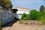
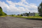
The Federal Armed Forces Depot Pfeddersheim (Bundeswehr-Depot Pfeddersheim – officially “Wehrbereichsgerätelager IV”) is one of these cases where the infamous German bureaucracy took its toll; on a personal note: German bureaucracy actually isn’t that bad, especially when compared to other countries. Built to house Car Pool Company 621 (Fahrzeugpark-Kompanie 621 – and by company I mean the military unit, not the business…) in the early 1950s on the site of the the cannery Braun AG (Konservenfabrik Braun AG), a factory of international fame in business from 1871 till 1951, the depot was one of the main Bundeswehr storages in Germany for many decades. It was closed with effect from 2004-12-31 with the last employees leaving by 2005-03-31 – at that point only 14 people were working at the depot.
Of course early on local politicians were aware what was going to happen and they tried to make use of the location as smoothly as possible, even visiting the still active depot in late 2004. Since Pfeddersheim lost its indepence in 1969 and now is part of the venerable city of Worms a lot of people have a say in what’s going to happen – the Institute for Federal Real Estate (Bundesanstalt für Immobilienaufgaben / BIMA), a city planning officer from Worms, a municipal administrator from Pfeddersheim and of course the citizens of Pfeddersheim; just to name a few. And while everybody was debating whether the depot should be turned into a housing project with a supermarket or being used by established and new businesses the usual hordes of bored youth vandals trashed the place – seven years later the property is still for sale, one of the latest suggestions was to build a showcase project for climate protection housing.
Well at least the buildings were still standing when I paid them a visit in July of 2011 with my high school friend Ira. The main gate was wide open when we arrived and as we were about to enter a building we saw a guy on a bike coming towards us. Judging by his shirt he must have worked for the local public utility company and brought back one of the municipal vehicles. So I told him what I was doing (urbex, Japan, photos…) and if we could take some pictures – he didn’t seem to like the idea, but after some more explanation he said that the main gate actually isn’t locked sometimes; so I told him that we didn’t see him if he didn’t see us – and off he went, with a word of warning that his colleague will lock the gate in the near future. So while I was exploring the first building Ira got familiar with the area and had a look for the colleague to come. When we were about to enter the second building the other guy actually showed up in a car – he stopped next to us, so I told him what I was doing (urbex, Japan, photos…) and if it was okay to take some pictures. He said it was and drove away only to be back a couple of seconds later. “Why?” Well, to keep the memories about those places alive – it’s always nice to hear from people who have been to / worked at places that I visited in their abandoned state. He put up a “those young, crazy people – I’m going to have a beer now and do better things with my time” smile and drove away, this time for good. So Ira and I explored the second building, the open repair shop and strolled along the sealed warehouses and garages. When we were about to leave we found the main gate closed – and locked. The second guy forgot to mention that he would actually do that! Luckily we found an alternative way in and out of the depot while exploring the location – and now was the time to make use of that knowledge…
(If you don’t want to miss the latest article you can *follow Abandoned Kansai on Twitter* and *like this blog on Facebook* – and of course there is the*video channel on Youtube*…)
And now to something completely different – an abandoned driving school in Japan. Well, since it’s abandoned and in Japan I guess it’s not that different, but how many abandoned driving schools have you seen? Especially since it’s so much more than just a driving school, at least by what I’m used to.
In Germany a driving school more often than not is a two room “office”. One small real office room and a bigger seminar room where the driving instructor is having his lessons several times a week. Not much more space needed, because German driving schools tend to be small, at least when I got my driver’s license more than 15 years ago. The one to three driving instructors usually are out on the road, because that’s where the real money is for them. Pretty much all driving school cars in Germany are manual / stick-shift cars – probably because there is only one license (no separate automatic-only license!). Most cars in Germany, except for taxis, have manual transmission anyways. A lot of Japanese people are surprised when I tell them about it, even more so when they find out that you don’t have to renew your driver’s license in Germany. It’s lifelong unless you mess up by violating traffic rules too often.
In Japan (and probably your country) the situation is a bit different. First of all: Most cars in Japan have automatic transmission, which kind of makes sense since traffic here can be nerve- and ankle-wrecking. So when you enter a driving school you have the choice between a “general” manual license and a “limited” automatic-only license. And a surprisingly high number of Japanese people actually have a automatic-only license – which feels totally wrong from my German point of view since I would never give up that kind of control over my car; to me shifting gears manually is part of the fun and it (usually…) reduces fuel consumption. Even worse: In Japan you have to renew you license every 3 years, which costs time and money – if you managed to not violate any traffic laws for 5 years you get gold status and have to renew your license only every 5 years. But it gets worse! New drivers have to put a yellow and green sticker to their car denouncing them as beginners. If you are a senior citizen age 75 or above you need a orange-yellow sticker – guess why. (None of that bullshit in the land of the Autobahn!)
The biggest difference between a driving school in Germany and a driving school in Japan is what we would call a “Verkehrsübungsplatz” in German. It seems like there is neither an English nor a Japanese term, but the literal translation would be something like “traffic training location” – a place that has roads and traffic lights and crosswalks, but is on private property, separated from normal traffic; and therefore you are allowed to practice driving there without having a license (if you at least 16 years old, have an experienced co-driver with a regular driver’s license and are able to pay an hourly fee). In Germany those place are separate from driving schools and usually run by automobile clubs. In Japan those traffic training locations are part of the driving school, which is kind of ironic given the fact that Japan has oh so little space… But it gives the students the great opportunity to practice safely in a driving school car. Worst case scenario in Germany: After a couple of theory lessons and a general instruction by the driving instructor you are pushed right into traffic…
About 2 years ago I spent quite a lot of time researching new places. Nowadays you can find at least 50% of the locations popping up on blogs on one map or the other, but 2 years ago that was a dream! (Now it’s actually a nightmare since urban exploration is going to become a victim of its own popularity soon. Maybe not this year or next, but soon…) Japanese blogs have the funny tendency to obscure names by leaving out kanji in the text decriptions, just to show the full name on the photos coming along with blog entry. Happens all the time. In late 2009 I found the blog of a guy showcasing an abandoned driving school, but of course he wasn’t willing to give up the name or even the location. He just said it was a driving school in Hyogo and that the company is bankrupt now, but has a succession company with a similar name. So I did some research with Google and found out about the Daikyo Driving School and its successor. Sadly the original Daikyo school went bust before the internet got popular, so there was no way to find out about the exact locations of the old schools, just the cities they were in. Luckily the same guy was bragging about his GoogleMaps skills – showing different zoom levels of the same place, which turned out to be the driving school. The guy was pretty smart not showing any train stations and other landmarks, but since I narrowed the location of the school to a couple of towns it took me about 20 minutes to compare his screenshots with the current GoogleMaps satellite images and then I knew where it was…
Abandoned driving schools are pretty rare, especially in Japan. Usually they are rather close to train stations since their customers are depending on public transportation. But land close to railroad stations is rather expensive – and driving schools take up a lot of space since they have that huge training area, so I’m sure realtors can’t wait for them to go bust.
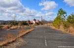
The Daikyo Driving School I went to was located in the same distance of 3 train stations, all about 30 to 40 minutes away by foot; forest on one side, surrounded by fields on the other three. Only a few farm houses in sight. And of course the owners of the closest one had to have a big party exactly on the day that I wanted to explore the Daikyo Driving School. Cars were coming almost constantly, parking up to the only entrance of the driving school. So I took my time circling the place, looking for other ways in, but there weren’t any. So after about half an hour I thought “Screw it!” and just went in, not sure if anybody saw me and how they would react if they did. Luckily nobody was able to see or hear me once I was inside since the driving school was slightly elevated with a beautiful view at the surrounding area.
Abandoned places in Japan have a reputation of being mostly undamaged due to the lack of vandalism – which isn’t true. My experience with urbex outside of Japan is limited to Germany and Luxembourg (*Pripyat / Chernobyl* in Ukraine is kind of a special case), but I can’t say modern ruins in Japan are in better condition overall than back home. Some are, some aren’t. The Daikyo Driving School was not. A couple of the inner walls were smashed in, the more solid outer walls were smeared with graffiti. Furniture not bolted to the ground was dragged outside and / or severely damaged, electrical installations were ripped out. Overall the building was in pretty bad shape and I was kind of surprised that the really rusty chairs and tables of the one “modern” lecture room weren’t smashed to pieces. For a rather remote and virtually unknown place abandoned for only about 15 years the school was in pretty bad shape, especially in comparison to other similar locations like the *Jumbo Club Hotel Awaji Island*. It was actually way more beautiful from the outside than the inside. Since it’s getting dark rather early in Japan the training area was equipped with floodlights, now as overgrown as the school building and most other installations on the premises.
Overall the abandoned Daikyo Driving School was a nice and unspectacular exploration, which I appreciate now, two years later, way more than back then – once you’ve realized that a lot of deserted places in Japan are either hotels or mines a unique deserted place like an abandoned driving school is a welcome change.
The now abandoned Sembach Air Base has quite a long history. The location was first used as an airfield after World War I by the French occupation troops in 1919 with 10 sheet-iron barracks and 26 wooden hangars. When France retreated from Germany in 1930 the air base was abandoned on June 15th and the land was returned to farmers who used it as a hay field. (The area around Sembach is very rural and agriculture is an important economic factor till this very day.)
In preparation of World War II the Nazi-German Luftwaffe deemed the area proper to build a fighter base and claimed the land in early 1940, but gave it back to the owners in June of 1940 after France was conquered in a blitzkrieg now known as the “Battle of France”.
After the defeat of Nazi-Germany in May of 1945 Sembach was part of the French occupational zone. In April of 1951 German surveyors along with French officers were looking for suitable locations for air bases. The Cold War had begun a few years prior and both the NATO and the Warsaw Pact armed themselves at a remarkable speed. The NATO’s lack of air fields suitable for modern jets made it necessary to build new military airports – so the French authorities began with the construction of a hard surface airfield in June of 1951, much to the protest of local farmers, who demonstrated in Mainz, the capital of Rhineland-Palatinate, without much success. On September 1st the United States took over the construction site, naming it Sembach Air Auxiliary Field, and pushed hard to finish the base – completing the 8500 foot concrete runway by the end of the month working round the clock using nighttime illumination. The rest of the airfield (tower, hangars, repair shops, storages and other buildings) were built during the winter. Local protests rose again when plans for the construction of barracks and office buildings surfaced in April of 1952 – this time with a little bit more success: Instead of using valuable farm land the new buildings were constructed on a sandy area with little agricultural value about 1.5 kilometers away from the airfield (Heuberg). Everybody was happy and after another year of construction the American flag was finally raised at the base now known as Sembach Air Base on July 8th 1953, when a RB-26 Invader arrived from Shaw Air Force Base in South Carolina. It was part of the 66th Tactical Reconnaissance Wing, the first of many units to be stationed in Sembach.
40 years after Sembach Air Base was opened protests rose again – this time because the Americans announced plans that the base will only be used as a substation of Ramstein Air Base; a huge economical setback for the town and nearby cities, directly (German civilian employees at the base) and indirectly (soldiers spending money in the area). The airfield was returned to German control two years later on March 30th 1995, the installations in Heuberg were renamed Sembach Annex. In summer of 1998 the demolition of the base began, the runway being the first “victim” of this process. Since then most of the buildings on the former air base have been demolished – but not all of them, at least not by the time Gil and I arrived at the location.
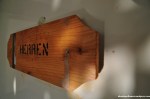
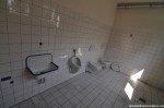
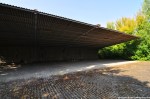
After the *Deportation Prison Birkhausen* and the *USAREUR Communication Facility Lohnsfeld* turned out to be quick stops we decided to tackle another big one and drove to Sembach to have a look at what was left of the air base. First we went to the western part and found some half-underground bunkers, inaccessible of course. Next was a small office building (?) that looked like it was made of corrugated cardboard. Quite interesting was the former Fire Station, part of the Fire and Emergency Service. I was rather surprised by the coloring of the toilets – white and pink. Seriously? The restrooms of the fire department on a US Air Force base were pink?
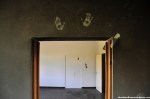
In the afternoon, when we left the fire station, the weather started to turn drastically. The sunshine was gone and dark grey clouds approached quickly. While we were making our way to the abandoned tower the wind sped up massively – to my favor as I should find out minutes later. I just finished shooting the tower building when a wall of rain came closer quickly and before I had the chance to take shelter it poured liked I was standing in the shower; a first class cloudburst. At that time I was close to the eastern wall of the tower, so I pressed myself against the high wall while the wind was blowing so hard that it actually blew the rain over my head. About 15 minutes I was standing there, hoping for the wind to continue and the rain to stop. When the heavy rain turned into light drizzling I started to look for Gil, who found shelter in a nearby building I assumed was inaccessible. That building was boarded up (almost) completely and its massive walls made me wonder right away what it was used for. Sadly it was pretty much empty, nevertheless we found some interesting items – a sleeping bag and other signs of a homeless person being there for a while, a perforated cardboard character and some documents with rather sensitive information; like special travel orders, granting individuals the permission to hand-carry a M16 rifle. I have no clue how those documents escaped the shredder, but I guess I better refrain from posting photos since each sheet of paper contained several names including ranks and addresses…
Going on an exploration trip with Gil was absolutely fantastic (thanks, man!). While the first two locations were quite disappointing from an urbex point of view Sembach Air Base made up for it big time. It was the first US military base I was able to explore (yes, I went to a second one, so stayed tuned!) and I had a blast – no pun intended. The locations in Germany differ quite a bit from the places I usually get to see in Japan, so I really enjoyed this refreshing experience!
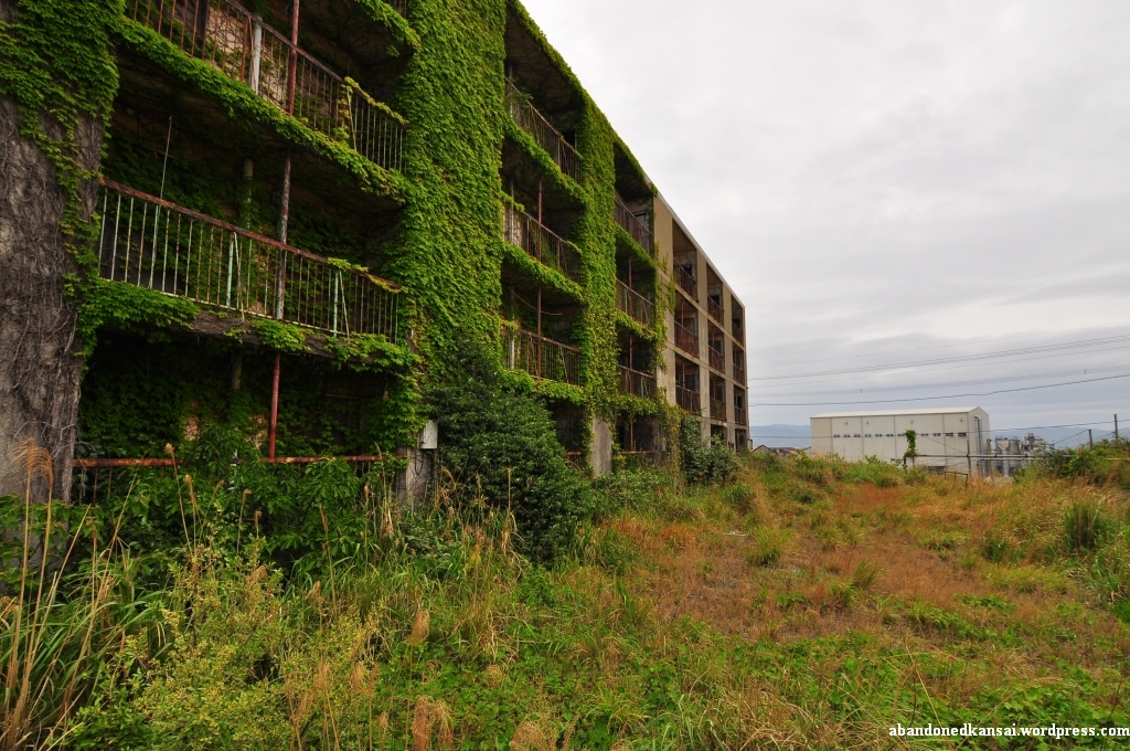
The best way of getting in contact with the locals on Ikeshima seems to be leaving camera equipment on the side of a street. It worked in front of the apartment complex and it worked again about an hour later just down the road next to the school. I left my belongings behind to take a video of the apartment buildings next to the abandoned baseball field. When I came back I saw a guy in his mid-30s and of course I said “Hi!”. His English was actually pretty good, so we started talking about the school and he told me that it still has 9 students – and as many teachers (although this number might include other staff like secretaries). I asked him if he was born on Ikeshima, but he wasn’t. A Kyushu native he studied in Nagasaki and then was sent to Ikeshima by his company – and he didn’t seem to be very happy about it.
For all of you not familiar with big Japanese corporations: In Japan you usually don’t apply for a specific position within a company after graduation (from senior high school or college), you apply at a company in general and then the company decides what to do with you. Commonly this includes intense training from several months to several years, depending on the company you got into. Of course your classes at university kind of give that education a direction, but it’s not unusual that somebody with a degree in mathematics or French literature ends up in marketing or HR – getting into a university in Japan tends to be a lot tougher than actually graduating, so companies tend to start from scratch after 3 years of drinking, sports and art clubs. And just because you are fluent in a second (or third!) language doesn’t mean the company makes proper use of that. (But if you are female and good looking chances are great you won’t have to clean ashtrays for two years – instead you most likely will become some supremo’s secretary.) The same applies for your place of work. Just because your company has its HQ in Tokyo doesn’t mean you won’t end up in a subsidiary somewhere remote. Like on an island off the coast of Nagasaki prefecture…
After the guy told me that he worked for a recycling company on Ikeshima we split since he had to get back to work – and I was eager to continue my exploration.
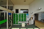
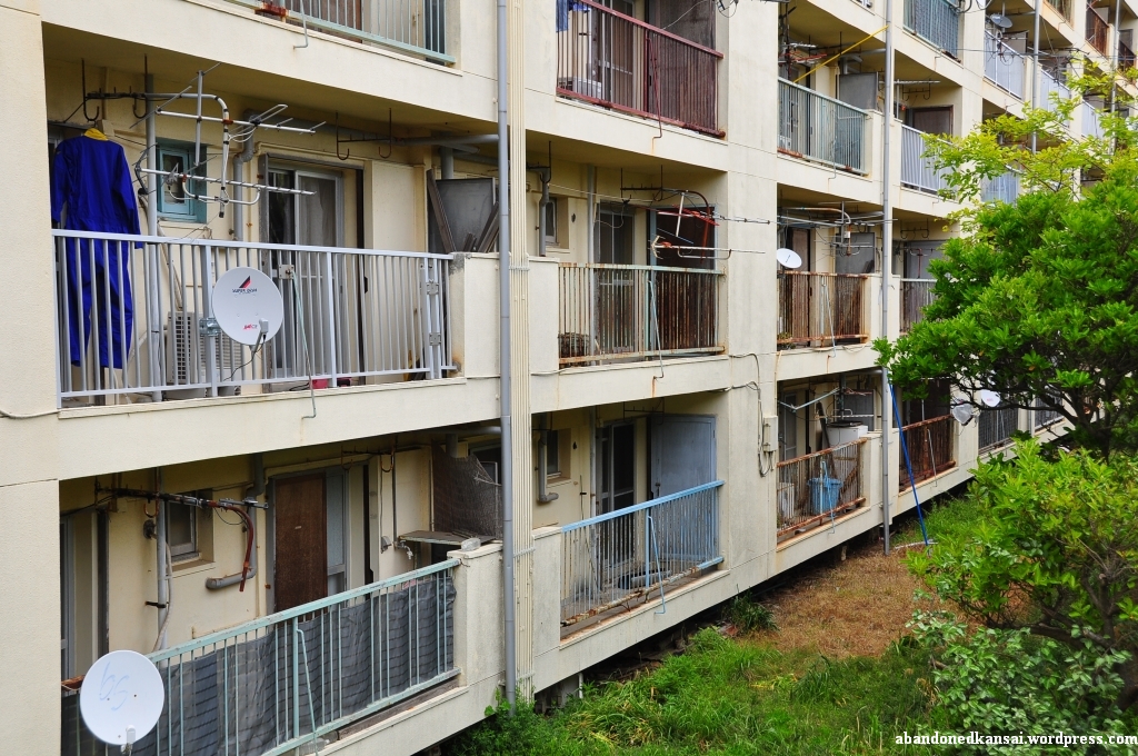
I was actually starting to run out of time, so I went back to the apartment building area I shot in the morning, this time more to the east. Some of the buildings had new plumbing outside and people were actually living there. At this point everybody I saw gave me a short nod, which I interpreted as a sign of “Yeah, you are welcome here.” – it felt really good. At an abandoned house the window next to the entrance door was broken, so I took a few pictures of the bike, cleaning tools and mailboxes that were still there. When I got back to the main street, route 216, I actually found a house that was open for visitors (I guess… it was unlocked, clean and had a sign in Japanese outside saying something about a room on the 4th floor). All the doors were locked and the staircase kinda smelled funny, but on the 4th floor I was indeed able to look inside an apartment that was arranged like a museum room.
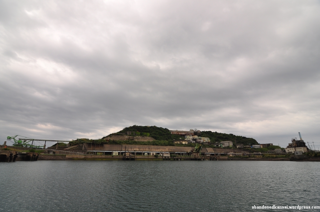
Outside again I followed route 216 to finish my circumnavigation of Ikeshima. I passed by the noisy Ikeshima Urban Mine Co., Ltd. and several apartment buildings before reaching the old loading plant. On the southern side of the harbor entrance was a scrapyard where a single worker was moving rusty stuff around. In continued following route 216, taking some pictures here and there, before I reached the apartments at the harbor again, where my explorations started about seven and a half hours earlier, making my visit to Ikeshima one of the longest photo shoots I ever did. But it wasn’t over yet…
Figuring out the ferry / boat schedule when planning the trip wasn’t exactly easy since all the information was in Japanese and not really clear. I got some help from friends who are Japanese natives and confirmed the schedule with the hotel staff in Sasebo – everybody told me the boat (it actually was a boat, not a ferry, also in the morning – sorry for that!) would leave at 4.09 p.m., so when my ride entered the harbor at around 3.55 p.m. I continued to take some photos and videos. But something felt wrong watching the activities on the boat, so I decided to hurry to the terminal – and of course the boat left right when I arrived, shortly after 4 p.m.; thank you very much, guys! The people arriving on Ikeshima of course saw what happened and told me that there was another boat leaving for Sasebo today, but they couldn’t tell me when. So I waited and thought about the day – my rocky start and how I didn’t even enter any of the huge industrial ruins at the harbor. 10 minutes passed, 20 minutes… Then some senior citizens arrived at the terminal and I felt a bit of relief – I wasn’t the only one wanting to leave Ikeshima. At around 4.35 p.m. the boat to Sasebo arrived. As I took a seat while the ship left the harbor I had a last look at the huge characters in the sand of the breakwater and I couldn’t have agreed more: „絆 池しま 大スキ“ – „Kizuna Ikeshima daisuki“ – „I / We like Ikeshima a lot“
(Since the inhabitants of Ikeshima consider their island a tourist attraction I added it to the *Map Of Demolished Places And Tourist Spots* and created *a new map just for Ikeshima*. If you don’t want to miss the latest postings you can *follow Abandoned Kansai on Twitter* and *like this blog on Facebook* – and of course there is the *video channel on Youtube*…)
„絆 池しま 大スキ“ – „Kizuna Ikeshima daisuki“ – „I / We like Ikeshima a lot“
That’s what’s written with huge, colorful characters in the sand of the breakwater at the Ikeshima harbor. A last pledge of allegiance from about 300 remaining inhabitants of an island once the home to several thousand people – miners and their families, shop owners, restaurateurs, …
When I arrived on Ikeshima I can’t say I agreed with the bold statement at the harbor. The weather changed from sunny to overcast with a serious risk of rain and the humidity rose to levels you usually experience during the long, excruciating Japanese summers. Though the previous day was pretty long, exploring the *Imari Kawaminami Shipyard* and the *Mukaiyama Mine*, I had to get up again before 6 a.m. to make it to the ferry on time and my landlubber slugabed stomach wasn’t a big fan of the early morning breakfast, although the ferry ride itself was really enjoyable.
In addition to that I felt a pressure right from the beginning I hadn’t felt in years. Back in my days as a journalist in Germany (10+ years ago) I was writing about all kinds of topics. Most of the stuff was trivial and routine, but once in a while I dealt with a project close to my heart – and in those cases of course I wanted to rise to the occasion and write an article that did justice to the topic.
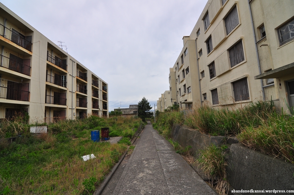
So while I tried to calm down my slightly upset stomach I was worried if I would be able to take pictures that represent Ikeshima properly, if I could come up with interesting stories to write about – if I was able to experience this island that is on its way to become an urbex legend; some people already call it Gunkanjima’s little brother (although Ikeshima is way bigger…). And since Ikeshima is in way better shape and way easier to access than *Gunkanjima* it is actually on its way to become more popular amongst urban explorers – a trend that seems to be appreciated and supported by the remaining inhabitants of the island, at least to some degree.
The first thing I saw getting off the ferry were two maps of the Ikeshima right at the pier – one being an aerial shot of the island from 1982, highlighting 9 points of interest; the other being a typically Japanese manga tourist map with a hiking guide, pointing out restrooms, bus stops, areas off-limit and buildings you shouldn’t miss. Sadly (for for the locals) Ikeshima wasn’t a tourist attraction (yet), at least not during Golden Week 2011: I was not only the sole foreigner on board, I was also the only person carrying photography equipment. The other half a dozen passengers were elderly Japanese guys looking for a relaxing day of fishing.
I took a few quick photos at the harbor to calm my stomach, get used to the humidity and make sure that the settings of my camera were how they should be – and somehow I got the feeling that the few locals I met weren’t really happy about it. As a rather big, tall non-Asian foreigner in Japan I’m used to being stared at, but maybe I was overly sensitive because of the uncomfortable situation I felt I was in, so I didn’t like Ikeshima a lot at that point…
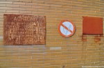
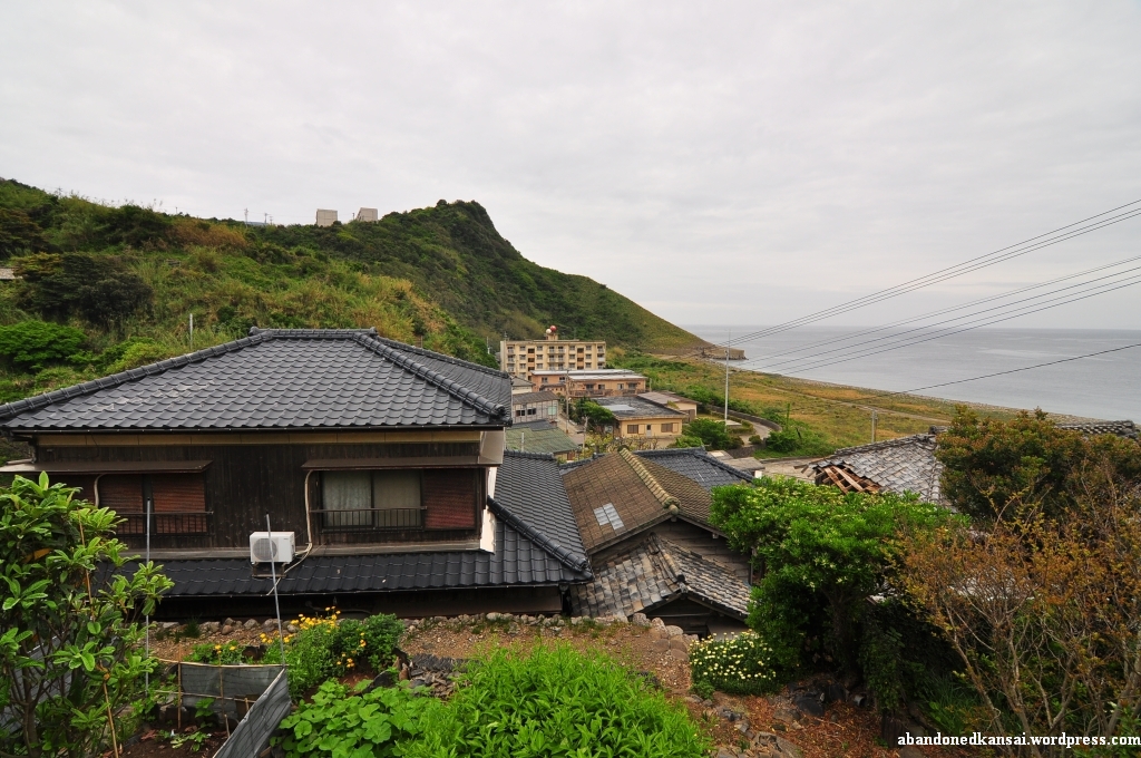
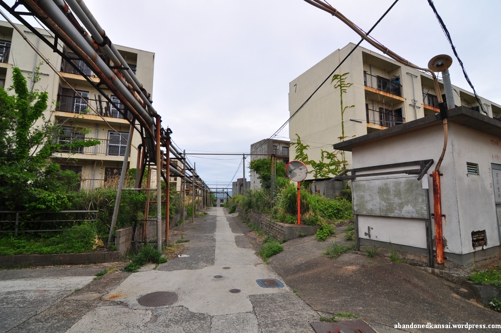
I passed by four of five people trying to get one of the omnipresent cats from an electricity pole and left the harbor area to follow the street uphill. Down to the right was a little settlement, several dozen houses, once the homes of the non-mining population on Ikeshima. I saw some big apartment buildings on the top of the hill, so I decided to follow the street and maybe have a look down there later.
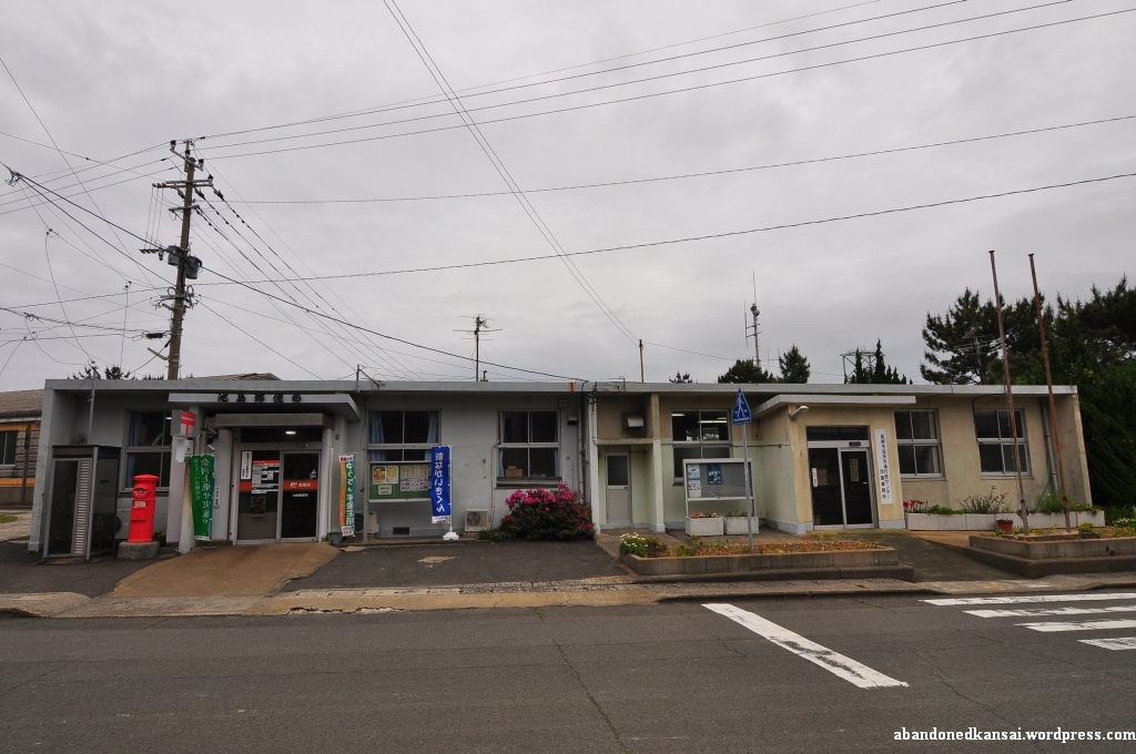
Reaching the top I passed by the post office which, to my surprise, actually had one or two customers while I was looking around that area. Although nowadays most people seemed to live down by the harbor the uphill apartment section was surprisingly busy. Within the first hour I spent there I saw maybe two dozen pedestrians and at least half a dozen cars, including the local shuttle bus which seemed to pass by me every 5 minutes – and in the background a recycling company caused quite some noise.
At that point I felt like a kid in a candy store – extremely excited, looking at dozens of opportunities, each one of them usually worth a day-trip on its own, and no idea where to start. But this was Ikeshima, Little Gunkanjima, so I had to take some spectacular shots! Just how? Especially since all buildings seemed to be boarded up, the doors bolted or welded. And the industrial areas were all off-limits, “No Trespassing!” signs everywhere in Japanese (kanji) and Bahasa Indonesia (Latin alphabet and katakana). Still under irrational pressure I felt like I had to make a move – and when I saw an open balcony door I jumped the railing and got inside. Finally what I was looking for? Not at all! I felt more uncomfortable than ever. I’m into urban exploration for the unique esthetics, for the quiet time in the middle of nowhere, for interesting angles and the amazing atmosphere really spectacular places provide. I’m not doing it for the thrill of being in buildings I’m not supposed to be. Quite the opposite in fact, I really dislike that aspect. So I took a few quick shots while hearing cars and voices everywhere outside – I could have gotten to the staircase and maybe to other apartments from there, but instead I decided to leave the building. Seconds later another car passed by, followed by two senior citizens, greeting me with a smile. Maybe it was about time to change my approach. So I put down my tripod and my backpack at one of the crossroads, grabbed my video camera and started to tape a walking tour of the housing area, wondering what the people I met were still doing on Ikeshima.
It was not until World War II that coal was discovered under Ikeshima. At that time about 300 people lived on the island while the huge corporate conglomerate (keiretsu, 系列) Mitsui Matsushima (三井松島) started to buy large parts. The development of the coal deposits started in 1952 and in 1959 mining finally began – the last colliery to open in Japan. In 1970 about 8,000 people lived on the island (although one source throws out a number as high as 20,000…), but like in all Western industrialized countries coal became less and less important; oil was the new coal. In summer of 1999, long after most Japanese coal mines were closed for good, a technology transfer program was proposed and as if it was a sign that the days of the Ikeshima Coal Mine (池島炭鉱) were numbered a fire broke out in the mine in February of 2000. On November 28th of 2001 the last shift left the Ikeshima Coal Mine, about 3000 people living on the island at that time – making Ikeshima the second to last Japanese coal mine to be closed. On April 18th of 2002 the technology transfer program started, training students from Indonesia about mining – hence the multi-language warning signs all over the island. The trainee program ran out by the end of March 2007, a year after 77 miners won a lawsuit against Mitsui Matsushima; suing them for negligence, related to coal worker’s pneumoconiosis. Around that time the number of people living on Ikeshima dropped to about 300 – as it was before coal was discovered. (The name Ikeshima means “pond island”, because until the 1950s a large pond was the main feature of the island – it was turned into the harbor by Mitsui Matsushima… Please *click here* to be taken to a Japanese homepage with before and after shots next to each other.)
Did the two old ladies know any of those 77 miners? Were they maybe even sons or husbands? And why were they still living on Ikeshima? I never found out. But I talked to several other people on the island later that day – so don’t miss *part 2* and *part 3* of my Ikeshima exploration…
(Since the inhabitants of Ikeshima consider their island a tourist attraction I added it to the *Map Of Demolished Places And Tourist Spots* and created *a new map just for Ikeshima*. If you don’t want to miss the latest postings you can *follow Abandoned Kansai on Twitter* and *like this blog on Facebook* – and of course there is the *video channel on Youtube*…)
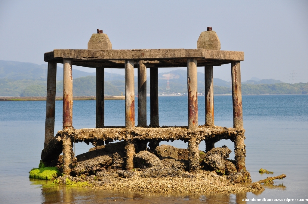
Just a couple of hundred meters down the road from the *Imari Kawaminami Shipyard* is another haikyo – visible from both the street and the train tracks the place is nevertheless often overlooked. After we finished shooting the seaside part of the shipyard Yasu was heading back to the main building while Ben and I headed to the remains I saw a couple of times on Japanese blogs without even exactly knowing what to expect – the pictures I saw were labeled “向山炭鉱“ (Mukaiyama Tankou, tankou being the Japanese word for mine), but a mine so close to the sea? Could that be?
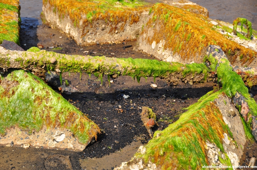
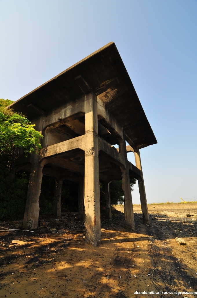
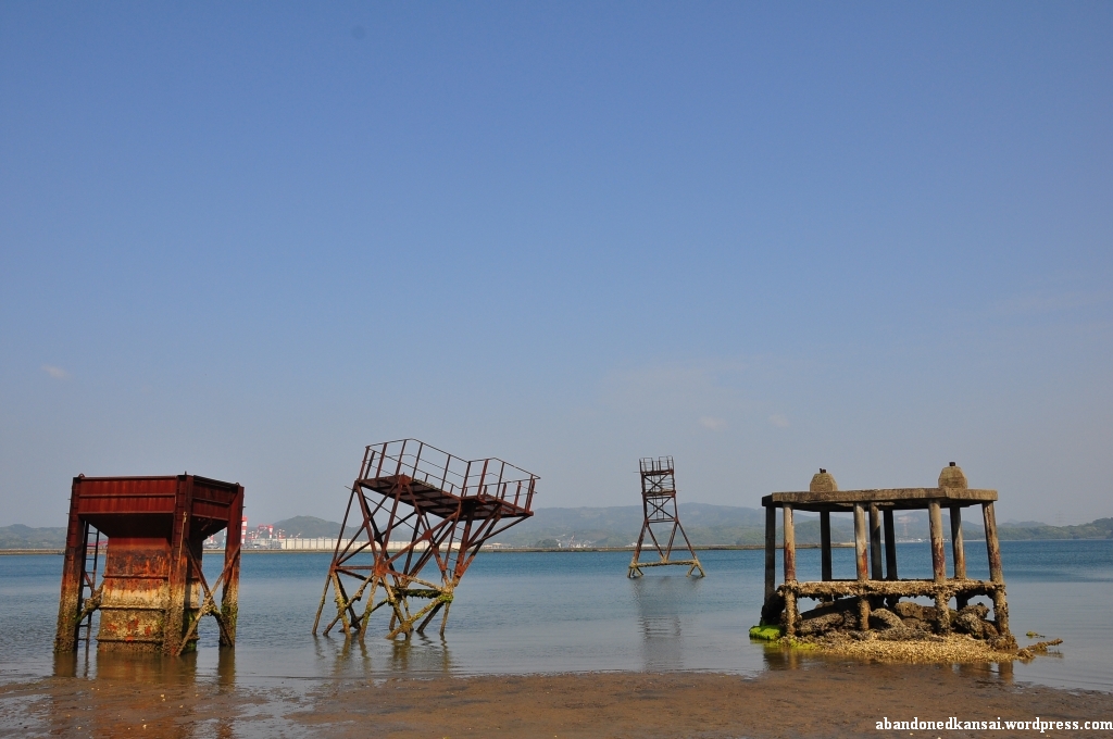
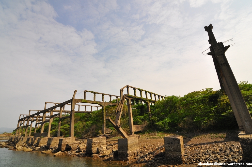
When Ben and I arrived on the other waterfront we saw three elderly Japanese people skimming through the part of the beach that was now accessible thanks to the low tide. Since Ben’s Japanese was way better than mine he talked to them and found out that they were looking for Asari (also known as Manila clam or Venerupis philippinarum), a popular ingredient in miso soup. Like the fisherman from the dam the clam searchers were quite chatty and told us a bit about the abandoned place we were visiting. As I assumed the concrete and rusty steel remains weren’t part of a mine, but part of the sea terminal of the mine – the mine itself was somewhere in the nearby mountains and demolished centuries ago. Speaking of mountains: I didn’t realize it until Ben told me what he heard from our new Japanese friends, but the surrounding hills near the beach weren’t natural. They were also remains of the sea terminal, in this case the parts of the deliveries from the mine that didn’t get onto the ships as there weren’t coal, but worthless rocks not even good enough to be used for construction. Like everywhere else in the world that stuff was piled to create spoil-tips (or botayama, ボタ山, in Japanese).
There is actually not a lot of general information I found about the Mukaiyama Mine. Coal extraction at the place started during the Meiji era under different names and different owners. Until 1909 23 miners mined about 750 tons of coal, in 1910 15 miners brought 298 tons to daylight. 1911 brought a new owner with headquarters in Matsuura and new deposits were found. In 1912 the mine was renamed once more to now known “Mukaiyama Mine” and 100 miners were employed to mine about 800 tons of coal a year. At the same time 15 houses were constructed for the miners – if you want to see pictures from that era please have a *look here*, but please be aware that the site is in Japanese; nevertheless I didn’t want to steal their photos to put them up here… In 1937 the mine was taken over by Kawaminami Industries Ltd. who increased production again in 1939 – probably to support their *soon to be demolished shipyard*. In 1946 the Mukaiyama Colliery Labor Union was formed, raising the daily wage from 35 to 50 Yen and prohibiting underground work of women and minors. (Minors, not miners!)
In 1951, when the *Kawaminami Shipyard* was struggling, a railroad connection to the sea was built. Although new coal deposits were developed in 1957 and 1960 the Mukaiyama Mine was shut down in 1963 – and with it the sea terminal. Okay, so much for the history lesson…
As I mentioned several times before: I was extremely lucky that the tide was low during my visit. On most pictures I saw on the internet the beach was covered with water, the remains of the sea terminal barely sticking out of the sea. Not during my visit. Thanks to that the remnants were almost completely visible, exposing their more decayed parts with vibrant colors.
About 15 months ago I went on my first multi-day urban exploration trip: 3 days to Kyushu with my buddy Enric. A trip with lots of up and downs, visiting some amazing locations – Gunkanjima, the Katashima Suicide Training School and the winding tower of the Shime Coal Mine, now known to some people as the Anti-Zombie Fortress. But March was kinda cold, last year as well as this year. So when Golden Week came up (late April / early May) and my company forced me to take two of my paid vacation days to install a new AC I took the lemon and made lemonade – it was time to go back to Kyushu!
Since Enric left Japan and returned to Spain a couple of months ago, I went on my own this time. Remembering the best burger I’ve ever had I set up my base in Sasebo after a long day of exploring an abandoned shipyard and the abandoned leftovers of the dock of a mine close to it. The next day I explored one of the most amazing places I’ve ever been to: an almost abandoned island, once the home of several thousand people – and as exciting as that day was as disappointing was the next one when I walked through drizzle for hours without an umbrella to look for remains of a mine and its workers’ housing-estate; but they were gone forever – as research after my return confirmed… Luckily the weather turned around on my last day, so I was able to visit an abandoned amusement park on my way back home. Thank heavens for sunscreen, because without it the harsh Kyushu sun would have burned me crisp within half an hour…
Exploring all day I spent my three evenings in Sasebo at Base Street to enjoy some burgers. While the regular sized ones are good I’ll definitely recommend the so-called “Special Size” – this 15 centimeters in diameter monster is a classic Sasebo style burger that will fill you up with pure deliciousness; if you ever wanna spend 1100 Yen (yep, that’s 9.50 Euros or 13.60 Dollars!) on a single burger without even considering regretting it then this is the place to go! I just hope I’ll find more abandoned places close to Sasebo so I can have a good reason to go back there once more…
(Oh, and greetings to the tourist office in the Sasebo! It sells a variety of souvenirs, but not the awesome huge plush hamburgers that fill half of their display window. To get one of those you have to ride a bus for about half an hour to get to a small store at a shopping mall in the middle of nowhere. And since I had to wait 45 minutes for the next bus they lost a customer who would have happily paid 200 Yen more to avoid the hassle of a 2.5 hour long round trip to get a cute present for his even cuter niece. A no-win situation… and pretty much the worst sales strategy ever!)