Feeds:
Posts
Comments

Archive for the ‘Transportation’ Category

It takes almost a whole day to go by train from Pyongyang to Beijing – and it’s quite an experience…

One of the few limitations Americans have when visiting the DPRK is the fact that they are not allowed to ride trains as the railway system is considered a military installation; so if you are American and you want to travel to North Korea you have to enter and exit by plane. All other nationalities usually take the plane in and the train out (or vice versa) – not because it is cheaper (it actually isn’t, at least not for the customer, probably for the travel agency though…), but because it is part of the fun. 23 hours on the train, that’s not a bug, it’s a feature! Well, to some people. Not to me necessarily. So I decided to split the train ride in half and have a 24 hour layover in Dandong, right at the border between China and the DPRK.

My last hours in North Korea began with the usual morning routine, but instead of going sightseeing after entering the bus, we went to Pyongyang Station – and I wish I had taken some photos outside instead of rushing inside with the flock as the square in front of the huge station looked quite modern, including some advertising and huge screens. Instead I spent another 15 to 20 minutes in the waiting room for international travelers, featuring the last gift shop before leaving the DPRK.

Pyongyang Station actually isn’t that busy and it seems to have only one platform – a gigantic platform where you can park buses crosswise. Nevertheless it serves four lines: One to Nampo, one to Rajin in the far North, one to Kaesong (theoretically to Busan via Seoul, but you know the problem there…) and one to Sinuiju; the one our group took.
The standard procedure is the following: The train leaves at around 10.30 in the morning for Sinuiju with several stops at stations along the way. At around 15.30 you arrive in Sinuiju, where you have to go through customs on the Korean side, which takes about two hours – sometimes more, sometimes less. Then the train crosses the river Yalu to Dandong, China. There you have to go through Chinese customs, which takes about 30 minutes. (Don’t forget to adjust you watch as China is in a different time zone!) Then you have about half an hour before the train continues at 18.30 to Beijing, where it arrives at 8.30 in the morning. At no time you have to leave the train – customs on both sides take care of everything on board. People going to Beijing directly are located in nice 4 bed compartments, travelers getting off at Dandong enjoy the 5 hour ride plus 2 hour long customs process in a smelly wagon with open 6 bed compartments. Since I opted for the layover in Dandong I was with the latter group…
We had seen lots of settlements and fields on the way to Kaesong and Nampo, but the northern part seemed to be a bit greener – and the train wasn’t nearly as shaky as that bus, so I was able to take some nicer photos and a really decent video.

The train ride through the North Korea countryside was actually quite relaxed, despite the fact that the 160 km long trip took a whopping 5 hours. The reason for that is the fact that the railway system was in abysmal condition. Like I said, we were not allowed to take photos and although we said goodbye to our Korean guides back in Pyongyang I stuck with it – out of respect and out of fear to get in trouble at customs. Our train was by far the most modern one on the way as all the other ones looked like they were from back in the days when Japan was still in charge of the country. The stations were in decent condition, but the trains… it’s actually hard to describe. First of all I don’t remember seeing many of them being in working condition, we saw only a couple of them with passengers in them. The trains and wagons parked within stations… half of them looked like they were involved in fires or explosions, the other half looked like they were rusting away for decades. I guess shock and surprise was another reason why I didn’t take photos. People thought the East German railway system was in bad condition when the FRG “bought” the GDR – but damn, this was a whole different level! Another sign that there was no to barely any railroad modernization since the 1930s or 1940s were the electricity posts along the track you can see in the video and on one of the photos. I’ve seen similar ones in Japan. Along railway tracks. Abandoned tracks! The DPRK must have spent quite a chunk of money on maintenance, but I am sure the railroad system in the 1960s was in better condition than it is now… except for the rather luxurious overnight wagon to Beijing.
Customs in Sinuiju took indeed a little bit more than two hours, but they weren’t really thorough. We occupied 5 or 6 beds in the smelly wagon, but they didn’t look at any of our photos and even forgot to look inside one of our suitcases…
Customs in Dandong were even faster, basically a passport and visa check, they didn’t even open any of our luggage. After the Chinese custom officers were done we left the train, said goodbye to our fellow travelers continuing to Beijing and left the station, where our 24 hours in Dandong began; three people from my group, four people of the other group. More about that on Friday!

24 hours later we were back at the station – well, me and my other two group members Patrick and Juliette as the group A guys actually stayed for 48 hours in Dandong.
This time we checked into one of those luxurious sleeper cars with four beds and a door, shared with a young Chinese woman travelling from Dandong to… somewhere in China. The train stopped every couple of hours and she left maybe two hours outside of Beijing. When I woke up in the middle of the night we just had stopped at one of those stations and I took a photo over my head aiming outside of the window – it turned out to be a quite nice one, so I added it to the gallery.

Overall the train ride to Beijing wasn’t nearly as bad as I expected it to be, probably because I was able to split it into two halves. Arriving in Beijing though my bad luck in the city continued: While at the *Mansudae Art Studio* I bought a lithography too big to put in my suitcase, so I was having an eye on it for almost a week. At Beijing Railway Station I left in a hurry and after about three minutes I realized that I didn’t have the lithography in my hand anymore. Despite the masses, the heat and the humidity I immediately ran back to the train compartment where the cleaning personnel already started their work, less than five minutes after I left in this huge, loud, summer smelly crowd – of course nobody understood me or had seen anything. I don’t think I’ve ever lost anything since I was five years old! But that was just the beginning of another horrible, horrible stay in China’s capital…

(Please *click here to get to Abandoned Kansai’s North Korea Special* and *here for a map about the tour at GoogleMaps*. If you don’t want to miss the latest article you can *follow Abandoned Kansai on Twitter* and *like this blog on Facebook* – and of course there is the *video channel on Youtube*…)

Read Full Post »

Korea’s former capital Kaesong was the next major destination on my itinerary, but before reaching the DPRK’s last city with lots of historical buildings surviving the Korean War we had a busy yet unspectacular day; most of the locations visited during that time I will talk about in the other locations article at the end of the series. (I already mentioned the lamb BBQ in the *Food For Tourists* entry the other day.) Since there is no direct highway between Nampo and Kaesong we had to go back to Pyongyang via the Youth Hero Motorway and then take the Reunification Highway (a.k.a. Pyongyang-Kaesong Motorway) south, making a stop at the “tea shop” mentioned in the Vice documentary. Just in case you saw it – the (unspectacular) building is a very basic highway rest, not a tea shop. And the “tea shop girl” has company now as there were two sales stands outside of the building both times we stopped there, although I can’t say for sure if Pun-Yun-Chi a.k.a. the original “tea shop girl” (pitied by countless Youtube comments) is still working there; heck the place was so unspectacular I didn’t even take photos or a video… And unlike claimed in the generally quite outdated documentary they are not waiting for six or ten months for customers! Even during both of our short stops (about 15 minutes each on May 2nd and May 3rd) we saw other tourist groups and local cars stopping there. Sure, only a fraction of customers a highway rest in North America or Europe has – but nothing like the out of thin air assumption made by Shane Smith, who IMHO tended to interpret everything he saw and experienced in the most negative way anyway. While it’s always a bad thing to jump to conclusions based on observations (especially when travelling alone and wondering why you are always alone…), it gets a bitter taste when it’s done to sell a product; in this case his documentary. I feel sorry that he and his cameraman had a bad time, but I think it was at least partly their own fault. Anyway.
Although built ten years earlier than the road to Nampo, the Reunification Highway is in much better condition, probably due its strategic importance, which was made clear by several military checkpoints (none of which we were allowed to take photos of) and countless tank traps – huge concrete blocks at the side of the road, some disguised as monuments, that can collapse onto the motorway in case of a foreign invasion. (I’m sure most of the bridges were rigged, too.)

By the time we arrived in Kaesong it was almost dark. What really struck me was the fact that the city didn’t have many lights. Maybe one in five apartments were lit, the rest was dark. The only construction lit up like a Christmas tree – the statue of Kim Il-sung on top of Mount Janam… (Interestingly enough some buildings had what looked like solar panels on their balconies. Not many, but still… Who would have thought that?)
The statue actually was our first destination the next morning after a night at the Minsok Hotel, but to the disappointment of all foreign visitors (…) it was closed since some people were cleaning the square in front of it – so we had a look at the city from a nearby viewing point; beautiful! When we came back to the statue we still weren’t allowed to see it, so to everybody’s surprise we were asked to board the bus to head out to the Koryo Museum since it was still too early to hit our time slot at the DMZ. And so that’s what we did…

(Please *click here to get to Abandoned Kansai’s North Korea Special* and *here for a map about the tour at GoogleMaps*. If you don’t want to miss the latest article you can *follow Abandoned Kansai on Twitter* and *like this blog on Facebook* – and of course there is the *video channel on Youtube*…)

Read Full Post »

The West Sea Barrage is an eight kilometer long system of dams, three locks (capable of handling 2,000 to 50,000 ton ships) and 36 sluices near Nampo. It was built from 1981 to 1986 to close off the Taedong River from the Yellow Sea – the goal was to prevent seawater from entering the Taedong, causing floods. At the same time the Taedong’s water level was supposed to be raised under controlled conditions to improved ship traffic and to make it easier to irrigate fields along the river. Critics claim that the raised water levels destroyed farmland, contributing to the famine that struck North Korea from 1994 to 1998.
Considered a major technological accomplishment the West Sea Barrage is a standard stop for international tourists as well as foreign dignitaries – nevertheless photography was strictly limited until a couple of years ago, since the dam was considered strategically important (if you watched the Vice documentary, this is one of the many aspects where it is completely outdated). Even the former US president Jimmy Carter visited the West Sea Barrage during his stay in the DPRK in June 1994. (Interestingly enough Carter arrived by boat, not by car – I assume you can guess why…)

After a good night’s sleep at the *Ryonggang Hot Spring House* we drove to the West Sea Barrage, more specifically: P’i Do Island, which was included into the dam’s construction. There you can find a visitor center, which is also home to the P’i Do Lighthouse, the tallest and most powerful lighthouse in North Korea, its focal plane at 86 meters. The tower itself is 33 meters high and shaped like an anchor, so it’s also a nice looking monument.
Visits to the P’i Do Lighthouse usually start with the local guide showing you a video tape about the construction of the West Sea Barrage (which was actually quite interesting, despite the fact that it was what most people would consider “a cheesy propaganda video” – nevertheless I liked it quite a bit!), followed by a Q&A session about the dam. Then you go outside to take some photos and leave when your group guides tell you to… The underwhelming opening to a generally slow day.

(Please *click here to get to Abandoned Kansai’s North Korea Special* and *here for a map about the tour at GoogleMaps*. If you don’t want to miss the latest article you can *follow Abandoned Kansai on Twitter* and *like this blog on Facebook* – and of course there is the *video channel on Youtube*…)

Read Full Post »

Rides on the Pyongyang Metro usually were one of the prime examples for how everything on a tour to North Korea is staged – now it is a prime example for how the country opens up to its visitors.

It was the second visit to the DPRK for Jeff, one of the great people of my tour group. Back in 2007 he visited the country for the first time and of course back then a ride on the subway was part of the itinerary, too. For Jeff an underwhelming experience as back then the group was told which train and which wagon to enter – basically an (almost?) empty wagon. Most people describe their experience like that actually. No stops, no freedom, no contact with locals. Again, my experience was quite different.

Since Puhung Station was right across the street from the *Mansudae Art Studio* we accessed the deepest subway system in the world right from there – locals entering and leaving the station via one of the three escalators. (Although the middle one wasn’t running – it wasn’t necessary since the station wasn’t that busy on a Monday afternoon.) In (ex-)communist countries subway stations were / are showpieces – *I’ve been to several stations in Kiev*, so I knew what to expect and Pyongyang didn’t disappoint. While the entrance kind of looked like a bomb shelter (which it will be used for if North Korea ever gets attacked) the platform of the station was absolutely gorgeous. Slightly dim, but lit by beautiful chandeliers. At this point our group got quite excited, with people running back and forth to take photos – and I have to admit our guides looked a bit more nervous. Some people might claim they were worried about… us making contact with people, us taking photos we might not should take, us doing whatever. In my opinion they were actually worried that one of us could get lost, because the metro was quite busy. Not “Tokyo rush hour” busy, but “a good chance to get lost (on purpose / accidentally)” busy. When Mr. Yu tried to get us on a train he was widely ignored as most people were still taking photos – so the train left, and the next one, too; both times accompanied by a wave of locals flushing the station. We finally got close enough together to call us a group again when the next train arrived – and people just headed in, splitting over two wagons. Most likely not according to Mr. Yu’s plans, but rolling with the punches was going both ways… The first ride was a short one as we left the train at the next stop, Yonggwang. Judging by the look on his face Mr. Yu was glad that everybody listened to the plan and actually got off. On past rides Yonggwang Station was the end of the tour on the Pyongyang Metro – which lead to claims that there were no more than two stations and / or all the other ones were secret. While it is rather likely that there are indeed some secret stations for the military (which isn’t uncommon in other countries, too…) there are definitely 17 stations on two lines (locals can change at Jonu / Jonsung, it’s a walk of about 300 meters). So we got off at Yonggwang, took some photos and entered a rather crowded train to ride four more stops to Kaeson – the station right next to the *Arch of Triumph* and the Kaeson Fun Fair; one photo in the arch set actually shows the subway entrance, so I’ll include it here again. Since we skipped a couple of trains before, we were a little bit behind schedule – some quick photos at Kaeson Station and off we went to our bus as countless kids at the *Mangyongdae Children’s Palace* were already waiting for us to show their talents…

(Please *click here to get to Abandoned Kansai’s North Korea Special* and *here for a map about the tour at GoogleMaps*. If you don’t want to miss the latest article you can *follow Abandoned Kansai on Twitter* and *like this blog on Facebook* – and of course there is the *video channel on Youtube*…)

Read Full Post »

Air Koryo is the state owned and government run airline of North Korea, based at Pyongyang’s Sunan International Airport. It was founded under the name SOKAO in 1950 as a joint venture between North Korea and Soviet Russia, but had to suspend business shortly after due to the Korean War. A successor was established in 1954 under the name of Choson Minhang and started operations in late September of 1955 before being renamed Air Koryo in 1993. Air Koryo from the beginning was placed under the control of the Civil Aviation Administration, a part of the North Korean Airforce – which means that all pilots are military officers. Due to North Koreas close affiliation with the soviets all airplanes in the fleet of Air Koryo are Russian models. Antonovs, Ilyushins, Tupolevs. During the Cold War Air Koryo flew to more than three dozen destinations within Korea and all over the world – nowadays there are only three regular international connections (Beijing three times a week, Shenyang twice a week and Vladivostok once a week) plus a couple of charter flights. In Europe Air Koryo is blacklisted since March 2006, though that ban was lifted four years later for two newly acquired Tupolev Tu-204s.

It was on board of one of those two machines that my fellow travelers and I started our trip to Pyongyang in Beijing. Some websites still recommend using Air China (or the 24 hour train…) to get to North Korea’s capital, but I would have chosen Air Koryo anyway if I would have been asked to choose. How often do you have the opportunity to fly Air Koryo?!
Interestingly enough our predominantly white Air Koryo plane was parked right next to a predominantly blue plane by Korean Air – the flag carrier and largest airline of South Korea. Since the Korean Air machine took off before we even boarded I had the great opportunity to take a photo of both machines at the same time when the Seoul bound machine was on its way to the runway. Two planes, one photo. It didn’t cross my mind at the time, but I am sure North Koreans would have loved the picture, them being all about one united Korea. (And so would have the dozen Christians wearing “A United Korea 4 The World” sweatshirts that boarded the plane with us. I seriously hope they were able to leave the country without running into trouble – they might love Korea, but (North) Korea doesn’t love missionaries. And those guys looked like they were on a mission from God…)

Air Koryo actually was the first positive surprise of my *trip to the DPRK*. After using *Ukraine International Airlines to Kiev* three years prior, my expectations on (former) communist airlines were as low as they can get; but the Tupolev Tu-204 was a perfectly fine modern plane with the usual seat spacing, the flight attendants were as friendly as they were beautiful (and they were gorgeous!) and the food was living up to international standards, too.
When checking in I was asking for a seat away from the wings to be able to look outside and maybe take a quick video secretly. At that point the photography situation was a bit up in the air (no pun intended…) – we were told that it’s okay to take photos on board, but not of the stewardesses; and nobody asked about video or footage through the windows. So I took a few quick snapshots until one of the other foreign travelers was shut down when he violated the instructions we got and took photos of a flight attendant… Even worse: After we all settled in and were ready to take off about a dozen Koreans boarded the plane and occupied seats all over the aircraft cabin. Just a coincidence? Or a way to keep an eye on the foreigners at a time when the official guides were still waiting for our arrival in Pyongyang? I felt a bit uneasy, but decided to give the rather young fella sitting next to me the benefit of the doubt. Which turned out to be right about an hour later. Lunch was just served and I was wondering if it was okay to take a photo of the meal – as we all know from Western media: Taking pictures most likely is a crime… So I slowly unwrapped all the small containers and before I could even start to eat my meal the guy in the neighboring seat pulled out his smart phone and took a photo himself. Easy going! The same situation a couple of minutes later. While I was wondering whether it was okay to take some photos of the landscape passing by (there could have been airports or train stations or military camps – or worse!) we were informed that we just entered Korean airspace – and all of a sudden everybody took photos, including our late arriving Koreans. Lesson learned: Don’t shove a lens into somebody’s face and you can take photos of pretty much everything you want…

Air Koryo’s home airport Pyongyang Sunan International Airport is as small as you think it is – two landing strips, one of them closed permanently. There are 10 regular international flights a week at Sunan (7 by Air Koryo, 3 by Air China), plus charter flights and some cargo flights – that’s it! There are no official statistics about flight movements within the DPRK, but I doubt that there are many, given the rather high cost of air transport and the regime’s problem to get fuel.
On the positive side: Immigration is a piece of cake. You show your filled out forms, your passport and your visa – and then you are in. No bag checks, no other bullshit. When you want to enter Japan on the other hand you get treated like a criminal as they take your finger prints and a photo. Every… friggin… time! I’m on my third Japanese long-term visa, I never ran into trouble, I always pay my taxes – nevertheless I get treated like a murder suspect every time I come back from an overseas trip… Welcome home! (Of course this treatment only applies to foreigners, Japanese people just waltz in…)

(Please *click here to get to Abandoned Kansai’s North Korea Special* and *here for a map about the tour at GoogleMaps*. If you don’t want to miss the latest article you can *follow Abandoned Kansai on Twitter* and *like this blog on Facebook* – and of course there is the *video channel on Youtube*…)

Read Full Post »

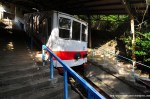
The Saikaibashi Corazon Hotel Monorail is one of those surprise locations you stumble upon every once in a while. *A year ago during Golden Week* I was on my way to the *Saikaibashi Public Aquarium* and went down some steps minding my own business when all of a sudden I saw something overgrown through the bushes. At first I thought it was the entrance of the aquarium, but getting closer it was pretty clear that this was some abandoned transportation device. A red cabin with very dirty greenish windows. So my second idea (which lasted for the rest of the trip) was that this monorail granted access to the aquarium and therefore was somehow connected to it.

Well, I was wrong, in more than one way. First of all the Saikaibashi Corazon Hotel Monorail technically isn’t really a monorail, at least not in the modern way – it’s more like a slope car (スロープカー/ surōpukā), kind of a sub-category of modern monorails. At least the Japanese term is a brand name of Kaho Manufacturing, so it might not be the proper word to use either, but I guess we’ll go with it from now on.

Since I didn’t know what a slope car was I better give an explanation in case you don’t either. A slope car is a small automated monorail that provides accessibility for handicapped or elderly people, usually transporting them between entrance gates / parking lots / buildings by avoiding stairs at steep slopes. In 1966 Yoneyama Industry invented a fright-only monorail system to be used in mikan orchards (mikan are very delicious seedless and easy-peeling tangerines). A system to transport construction workers and lumberjacks was developed later, but it wasn’t until the 1990s when the system became popular for the general public when Kaho Manufacturing entered the market with great success in Japan and Korea, installing 80 slope cars of their Slope Car brand alone.

I don’t know when the Saikaibashi Corazon Hotel Monorail opened or closed, but I guess it was after 1990. In 1996 it was still operating as I found a report in Japanese written by a guest of the hotel. He was using the slope car at the Corazon Hotel not to reach the Saikaibashi Aquarium, which was already abandoned at the time, but to get to the waterfront below the hotel. From there guests of the Corazon Hotel were able to board a boat once or twice a day to get to the nearby and then quite popular Huis Ten Bosch amusement park, a Netherlands themed park; Nagasaki and the Netherland have a close common history of more than 400 years, sadly the theme park never lived up to that history and is in danger of becoming an abandoned place for about 10 years now – half its existence. I guess at one point in time after 1996 the boat connected to Huis Ten Bosch was cancelled and with that there was no use for the slope car (capacity: 12 people) since the aquarium was already close a long time ago…

(If you don’t want to miss the latest article you can *follow Abandoned Kansai on Twitter* and *like this blog on Facebook* – and of course there is the *video channel on Youtube*…)

Read Full Post »

Every once in a while you come across words in English that are actually German. Some of them you might know, like kindergarten or rucksack, others are not that well-known, like schadenfreude (malicious joy). Given that Great Britain is the home of modern rail transportation I didn’t expect to find a German term that doesn’t have an equivalent in English, but here we are: Ausbesserungswerk (composed of Ausbesserung = repair / correction and Werk = plant / facory). I never found a spelling with a lower case A, so I guess unlike the previous examples Ausbesserungswerk never became officially an English term, but there is an English Wikipedia entry, so that’s good enough for me…
So, what’s an Ausbesserungswerk? Well, an Ausbesserungswerk is a repair and upgrade shop for railway vehicles and their components. While the so-called Bahnbetriebswerke (train yard / depot / engine terminal – you get the idea…) take care of maintenance, small repairs and cleaning, the Ausbesserungswerke are responsible for bigger repairs, general inspections and modernization. Originally there were 84 Ausbesserungswerke all over Germany, but today there are only 18 left.

One of the closed, abandoned and partly demolished one is / was in the lovely town of Schwetzingen, famous for its palace Schloss Schwetzingen.
On October 14th 1912 the citizen’s committee of Schwetzingen unanimously decided to build an Ausbesserungswerk northeast of the train station. Construction began in 1913 and was finished in 1917 to be opened in 1918. Perfect timing, because due to World War I there was a huge demand for the repair of railroad vehicles and from its opening on the Ausbesserungswerk was the biggest employer in the Schwetzingen area for decades to come, with about 1100 people in 1920.
During World War II the Ausbesserungswerk was fortified with bunkers, some of them are still in existence today. Armored observation towers against air raids were installed on the top of some buildings and in late 1943 a shooting range was built on the business premises – resulting in air raids by the Royal Air Force on March 19th 1945, damaging the buildings and killing 22 employees.
From the 1960s on the Ausbesserungswerk Schwetzingen was in decline. The German post-war economic miracle was in full bloom and a lot of employees switched to more lucrative jobs. At first they were replaced by guest workers, but when there was less and less work the amount of employees was continuously reduced from 1974 with the objective to close the Ausbesserungswerk; against the will of the staff council and the works management. But resistance was futile and on October 11th 1983 the Federal Minister of Transportation signed a document to close the Ausbesserungswerk Schwetzingen. In April of 1987 some employees were relocated to the Ausbesserungswerk in Karlsruhe (closed in 1997, mostly demolished by now) and on December 31st 1989 more than 70 years of railroad history ended in Schwetzingen…
In the following years some of the buildings were used as a half-way house for ethnic German immigrants and applicants for asylum, but most of them were just left to decay and rot – kind of insane, since a couple of buildings of the Ausbesserungswerk were put under monumental protection, which means that they can’t be torn down just like that. That came into effect when in Mai of 2011 all the other buildings were demolished, to make room for a logistics center of the manufacturer of sports equipment, Decathlon, scheduled to be opened in April of 2013. The protected buildings were handed over to the city of Schwetzingen for free, shifting the responsibility (and cost…) to the general public. The federal state of Baden-Württemberg granted 1.5 million Euros in 2010 to redevelop the protected area in the southern part of the Ausbesserungswerk and the city of Schwetzingen is deciding these days what to do with the money and the buildings – most likely a mixed use for both residential and commercial purposes. Those plans might have been affected by a case of arson committed by an 18 year old homeless guy on March 21st 2012, causing damages to the amount of 100.000 Euros, but I’m not sure how or if at all.

The Ausbesserungswerk Schwetzingen was the first urbex location in Germany I ever visited. My trip back home in 2011 was rather rainy and disappointing in general, so when there finally was a sunny day I took my chance and had a look. It was a weird feeling though, since everything felt a bit “more real”. In Japan I can always pretend to not being able to read signs, that I got lost, that I don’t understand a word. In Germany those excuses are a lot harder to make, especially since I am not a good bullshitter in the first place. (On the other hand some things are a lot easier – on later explorations I was able to ask people passing by about the history of places and even ask for permission to take photos, both rather impossible for me to do in Japan…)
Sadly there wasn’t much to see anymore. Most buildings were either in really bad condition or completely bolted up with metal plates. There was an abandoned TV, some instructions signs on walls and a rule book regarding laundry and other aspects of daily life living in the half-way house, but that’s pretty much it. A nice stroll, 1.5 to 2 hours, the most interesting part probably the small playground for children in the back of the half-way house – nothing spectacular, but far from being a disappointment…

(If you don’t want to miss the latest article you can *follow Abandoned Kansai on Twitter* and *like this blog on Facebook* – and of course there is the *video channel on Youtube*…)

Read Full Post »

When exploring abandoned places you are barely ever the first to visit, mainly because you have to find out about them somehow, which means that somebody had to write or tell you about them – so pretty much the best case scenario is that you haven’t seen too many photos and videos about a location before visiting it. That applied for most spots on my *haikyo trip to Hokkaido*, which is quite unusual, but Hokkaido isn’t exactly popular amongst foreign urban explorers (or Japanese haikyoists…) since it is rather off the beaten tracks. Those barely spoiled locations are especially exciting to explore, since there is only little known about them – how to get in, condition, size, dangerous parts, security…
Whether that’s a good thing or not lies in the eye of the beholder. I like my explorations with as little surprises as possible, to be honest with you, but at the same time I favor locations that haven’t been photographed to death; preferably places that are in the middle of nowhere with not a soul within a couple of kilometers. About 75% of the locations I visited in Hokkaido I knew little more about than their names and a handful of photos before exploring them myself – but the Mount Teine Ski Lift was special and stood out of even that group. Before walking up to the *Olympic Ruins Of Sapporo 1972* I had a look at the surroundings via GoogleMaps and saw a ski lift with two photos of abandoned constructions – but they weren’t named properly and I didn’t even know if they were just misplaced and in fact part of the Olympic Ruins. It turned out that they were a separate location, but although I know its name now researching it wasn’t exactly easy.

When I was walking up to the Mount Teine Ski Lift (which most likely was part of the still active Sapporo Teine Resort) I saw an old bus stop sign of the JR Hokkaido Bus line, although the staff at the JR Teine Station told me there were no busses running; maybe an old sign that was never removed… Not worthless though, as the sign had the name of the stop written on it: 千尺. The first kanji is common – sen, one thousand. But the second I couldn’t read, so I took a photo to find out later. Now I know that it means shaku, which is a traditional unit of measure in Asia, not in daily use anymore in Japan; about 303 mm or almost one foot. So the place was basically called “303 Meters”, although the slope was actually much longer; about 2 kilometers to be more specific. To get to the top you had to use two different lifts and it turned out that the mountain station of the second left was in proximity of the former start of the Olympic Bobsleigh track before it was dismantled, while the *Olympic Ruins Of Sapporo 1972* were the goal – it’s all connected…
If you google the term you’ll end up with links to the Gosenshaku Hotel, a rather high end accommodation in the Japanese Alps, about 1000 km away from the Senshaku ski lift. If you do some more googling in Japanese you might stumble across two year old photos on which the rest house is in way better shape. Now almost completely collapsed it was in decent condition just 24 months prior to my visit – and several (now unreadable) signs revealed more information; sadly the Japanese guys hosting those photos didn’t care to write anything about the place. It seems like the full name was “Teine Olympia Senshaku Highland”. Unlike the bobsleigh ruins, this ski lift didn’t show off the Olympic Rings, so it’s safe to say that it wasn’t part of the official venues; even more so since according to the Japanese Wikipedia the Olympia Highland was established in 1974 and opened in 1976, four years after the games were held. Instead it was a skiing slope for the general public – with lockers, rental gear, food and arcade machines. The chartered shuttle bus service was stopped in August of 2001 and 15 months later Kamori Kanko bought the place (they also own Noboribetsu Bear Park and Noboribetsu Marine Park Nixe near the *Tenkaen, Japan’s Lost China Theme Park*). And at that point I got lost a bit as I found contradictive information about combining two skiing areas, about places getting closed that still have active homepages, about areas that look the same, but have different names… Long story short: I still have no idea when Senshaku was closed!

All I know is that it was exciting walking up to the Senshaku area as I had little to no idea what to expect. While Sapporo itself was still basically snow free the 150 meters of additional elevation and not being in the city anymore made a difference of about 5 to 10 cm – just enough to be fun without being annoying. Of course a car was parked in front of the entrance upon my approach, but I decided to ignore the guy and just walked straight up the hill. I also ignored the mostly collapsed building to the left and had a quick look at the dilapidated ski lift to the right – being all by myself and already rather cold I refrained from climbing that death trap and made my way up the mountain to take some photos of the towers and to take some ultra-wide angle shots of the whole place. Up there I found a big cart with several ropes connected to it, probably used to transport goods up the mountain, though I didn’t find any information about it, even during the research I did for this article. While taking photos of the wagon I heard some wild noises that didn’t sound too friendly. I didn’t see any animals, but I wasn’t exactly eager to have any confrontation, so I grabbed my video camera and walked back down the hill. The video ended abruptly when I turned down the camera as soon as I saw a man standing between the lift and the rest house – preemptive obedience, Japan’s unofficial motto. It turned out that the guy didn’t mean no harm and just had a look himself, but it was good to stop anyway since him walking through the video several times or even talking to me wouldn’t have been good either. Obviously he wasn’t eager to talk to me… and left before I was done taking more photos of the ski lift.
The former rest house was in horrible condition and I only spent a couple of minutes exploring it – because it looked more dangerous than interesting, and because the sun was already setting behind Mount Teine and I still had to walk up the mountain to see the *Olympic Ruins of Sapporo 1972*

(If you don’t want to miss the latest article you can *follow Abandoned Kansai on Twitter* and *like this blog on Facebook* – and of course there is the *video channel on Youtube*…)

Read Full Post »

Abandoned Kansai in Hokkaido… Who would have thought that? Up till now I never made it further east than the center of Japan’s main island Honshu. I limited myself to the western half of Japan, because that was the reason I started this blog. Heck, initially I wanted to limit myself to the Kansai region; hence “Abandoned Kansai”, not “Abandoned Japan” or “Abandoned West Japan”. But then the “once in a while” hobby urban exploration turned into a regular thing and only weeks later I went to different regions, then to different islands – and in spring of 2012 I did a *haikyo trip to Okinawa* together with my urbex buddy *Michael Gakuran*. “What’s next?” was the big question, and the answer was found quickly – we already explored Japan’s most western prefecture, so we kind of had to explore Japan’s most eastern prefecture, Hokkaido!

Usually I plan my urbex trips on short notice. One time I brought my urbex equipment to work on Friday to see how I feel during the day, booked a hotel in the afternoon and left for a weekend trip right after work. Flexibility like that is impossible when partnering up for a long distance trip, so Michael and I booked plane tickets weeks ahead – and according to the weather forecast we ended up with a rainy weekend; a long weekend even, to which we added some days. Luckily the forecast was as reliable as always in Japan and so 4 out of my 5 days in Hokkaido were sunny and slightly snowy, only the last one came with 8° Celsius and rain.

Since I arrived almost a day earlier than Michael the original plan for me was to do some sightseeing in Sapporo. To my surprise the weather was sunny to cloudy, no rain at all, so instead of visiting indoor classics like the Sapporo Clock Tower, the Ishiya Chocolate Factory or the Sapporo Beer Museum I opted for a little hike to Mount Teine, once home to some of the sports events at the 1972 Winter Olympics in Sapporo. One day of good weather? I had to take advantage of that! Then it turned out that the next three days were pretty nice, too – which is a big advantage when doing urban exploration as you spend a lot of time outdoors…
On the last day Michael and I split – while he drove for hours to infiltrate a location he asked me to keep secret for now, I went on to do some really touristy stuff, like visiting the old harbor town of Otaru and taking a glass blowing lesson. My favorite touristic place though was the Sapporo night view from the freshly renovated observation platform on top of Mount Moiwa – stunningly beautiful! It was soooooo cold up there, but the view was absolutely amazing! I went there on the first day before visiting the Sapporo White Illumination and I strongly recommend to pay Mt. Moiwa a visit – I would love to shoot a time-lapse video from up there…
Overall the trip to Hokkaido was a great mix of urbex and tourist stuff. Five days I really enjoyed, probably more than any five consecutive days I spent in Osaka this year… So this is a list of the abandoned places I ended up visiting:
Advantest Research Institute
Bibai Bio Center
Canadian World Park
Hokkaido House Of Hidden Treasures
Horonai Coal Mine Substation
Mt. Teine Ski Lift
National Sanatorium Sapporo
Olympic Ruins Of Sapporo 1972
Sankei Hospital
Sapporo Art Village
Showa-Shinzan Tropical Plant Garden
Tenkaen – Japan’s Lost China Theme Park

(If you don’t want to miss the latest article you can *follow Abandoned Kansai on Twitter* and *like this blog on Facebook* – and of course there is the *video channel on Youtube*…)

Read Full Post »

Quite a while ago I wrote about my experiences exploring the *lower terminus of the Yashima Cable Car* – and after I was done I took the bus up the mountain. Usually I would have taken the hiking trail up there (or would have walked along the abandoned track like I did several times at the *Mount Atago Cable Car*), but since I lost quite some time in the morning thanks to a Shinkansen standstill (thanks, JR – the extra fee for the bullet train was really worth the money… grumble…) I took the easy way up. It was also a good way to check out the cable car’s competition, which made me wonder if the bus was already running when the cable car was still operating. Sure, the trip took about 10 minutes instead of 5, but it ended right next to Yashima Shrine (not a kilometer away) and the price was ridiculously low in comparison: 100 Yen each way!
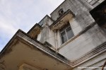
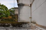
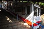
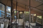
The upper terminus of the Yashima Cable Car (屋島山上駅, yashima sanjo eki, Yashima Mountaintop Station) was as locked up and untouched as the lower terminus – but the building itself was much more beautiful. Rather small, like most cable car stations, it totally reminded me of the *Maya Hotel* in Kobe. I think I’m a sucker for that art deco style of the 1920s and 30s. At the time of my visit the area was used by construction workers of the nearby Yashima Castle reconstruction site – there were parked cars everywhere and their container office almost blocked the access to the cable car track. Luckily none of the workers were in sight when I arrived, so I was able to sneak to the back and took some pictures: car #2 was already waiting for me as I expected, sadly slightly vandalized by some spray paint on the windows of the right side. Similar to the lower terminus the amount of decay was just perfect – the car, the handrails, the building itself. A perfect abandoned beauty, worthy the cover of a book or a magazine.

Read Full Post »

« Newer Posts - Older Posts »