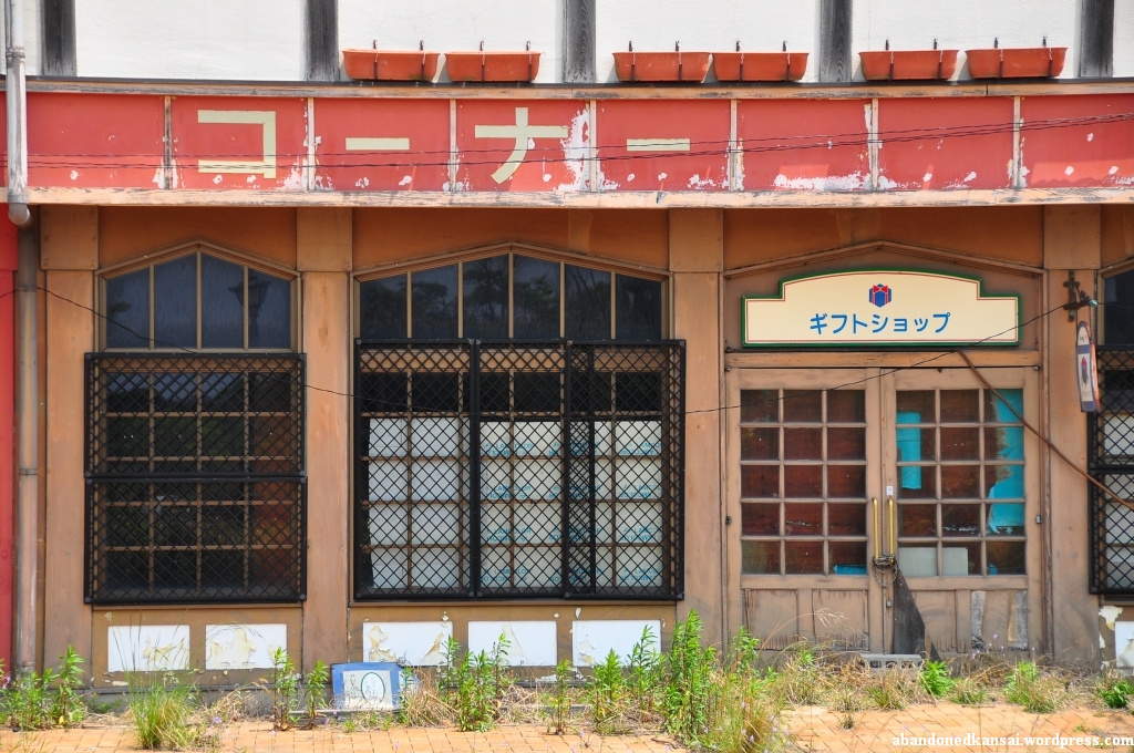
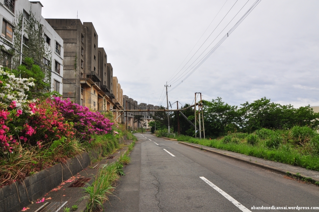
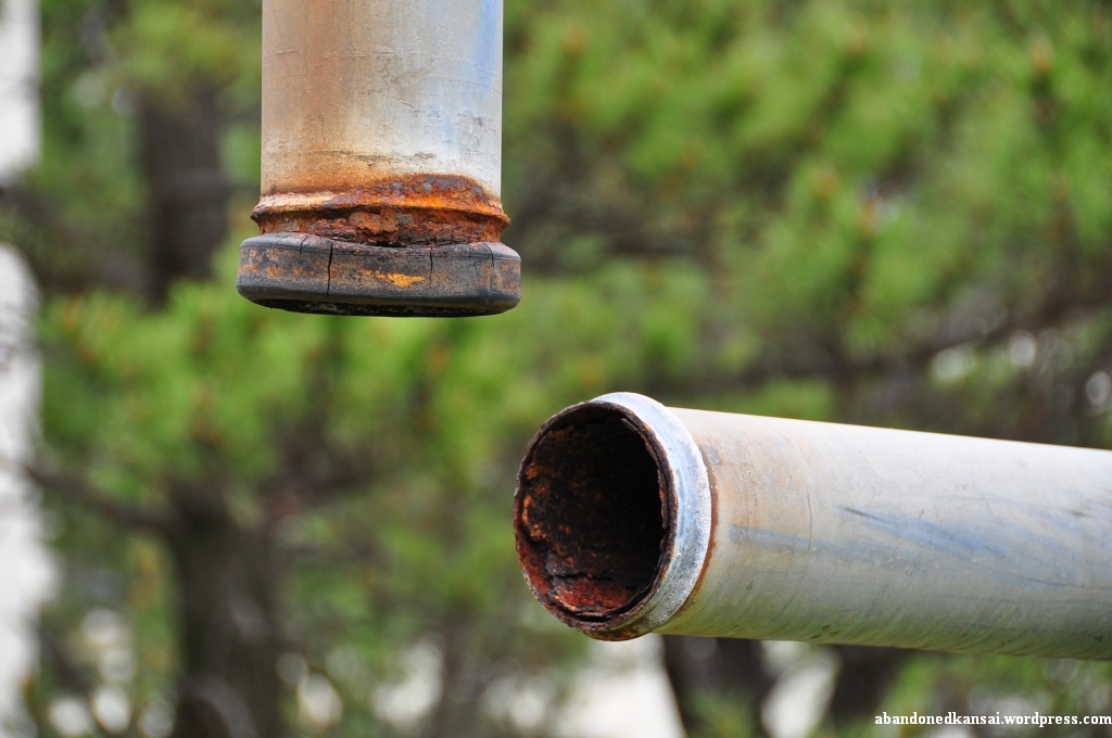
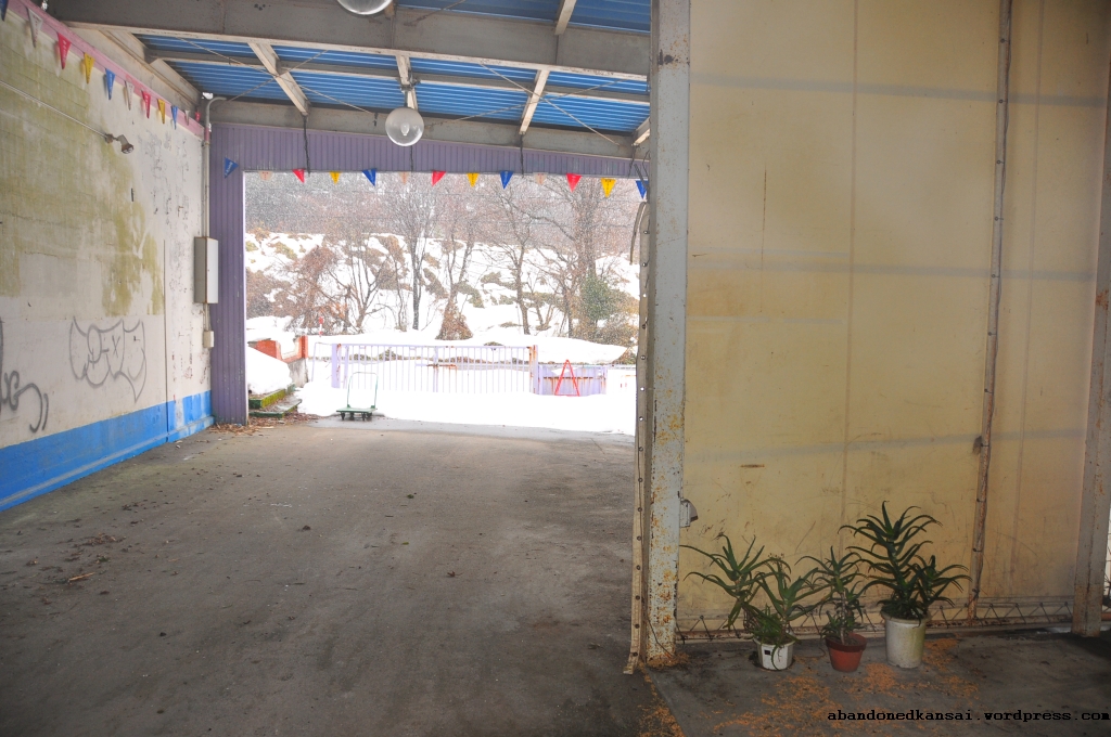
I can’t even remember how I found out about the Karadate Golf Center in Himeji. In late 2009 / early 2010 I did quite a bit of research about abandoned places in Japan and I guess one of the leads I had was that one. I just remember that I didn’t even found pictures, just a Japanese list of (operating) driving ranges – and that one of them had a footnote that it was closed / demolished. When I went to an abandoned shrine in Himeji in July of 2010 I went to the Karadate Golf Center, too, since it was only a few kilometers away from the shrine.
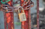
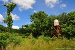
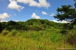
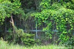
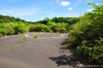
Located on top of a small mountain close to Mount Shosha (a filming location of “The Last Samurai” with Tom Cruise and Ken Watanabe) the Karadate Golf Center offered a stunning view on Himeji and the Seto Inland Sea, but due to its rather remote location (a couple of hundred meters away from the next houses at the end of a now too abandoned winding road) I guess it wasn’t a financial success – and the competition for driving ranges is tough in Japan! At the time I went there GoogleMaps still showed the driving range and a small building in satellite mode, but now these remains are only visible when switching to map mode. When I went there I found the golf center gone, with only a few signs left that it has ever been there: A fence, some bricks on the ground, a water tower, a lamp post… The driving range itself was almost completely overgrown, only two baskets sitting on the ground in the northern part. Unless you have a faible for old lamps the Karadate Golf Center is a demolished and hence uninteresting haikyo. But of course I had to see it for myself… And the view there was really nice!
Archive for the ‘Demolished’ Category
Karadate Golf Center
Posted in Asia, Demolished, Haikyo, Hyogo, Japan, Kansai, Sports, Urbex, Visited in 2010 on 2011/10/05| 2 Comments »


Biwako Tower & Igosu 108 (Amusement Park & Ferris Wheel)
Posted in Abandoned, Amusement Park, Asia, Demolished, Ferris Wheel, Haikyo, Japan, Kansai, Shiga, Urbex, Video, Visited in 2010 on 2011/09/23| 17 Comments »
Abandoned ferris wheels usually come with abandoned theme parks. But when I visited *Expoland* in Osaka the ferris wheel was just demolished. And so were the giant wheels in all the other *abandoned amusement parks* I visited – except for the *big wheel in Pripyat* – which was actually pretty small… So usually the ferris wheel is one of the first things to be demolished when an amusement park closes – to be re-built at another park or to be sold for scrap metal. Not in the case of Igosu 108…
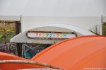
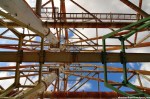
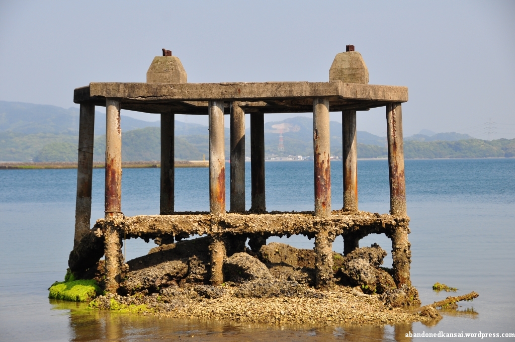
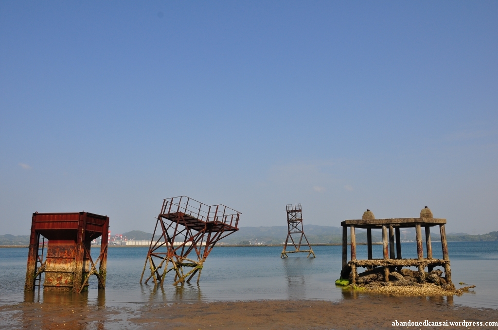
You might have seen photos of this abandoned ferris wheel at other blogs and you might ask yourself “Why is Florian calling the ferris wheel ‘Igosu 108’ – it says びわ湖タワー (Biwako Tower) in huge letters right in the middle of the thing and everybody calls it that way when writing about it?!”. Well, my Japanese might not be the best, but just because something is written somewhere doesn’t mean it’s the name of the place. And in this case it isn’t. The name of the ferris wheel is Igosu 108 – the name of the surrounding amusement park, now mostly gone, was Biwako Tower. To be more precise: The name of an observation tower, now gone, was Biwako Tower. This tower was 63.5 meters high and had a rotating observation platform that went up and down to give visitors a spectacular view across Lake Biwa, the largest freshwater lake in Japan. Biwako Tower was built in 1965 and extended to an amusement park in 1967. In addition to the observation platform there was a small ferris wheel, a rollercoaster, a pachinko parlor, water bumper car and several other small rides. But that’s not all! Biwako Tower also included an onsen (hot spring / spa) and a wedding hall – plus the usual array of restaurants, shops and stuff like that. Thanks to free parking and no entrance fee Biwako Tower was hugely successful and attracted up to 50.000 people a day!
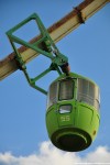
In 1992 the last attraction was built – now the last one standing: Igosu 108 (イーゴス108). I can’t say for sure, but I guess the name is a combination of sugoi (すごい, meaning “great”) backward and 108 – the height of the ferris wheel, at the time the largest ferris wheel in the world. It was soon considered a landmark of Shiga prefecture and Lake Biwa, but couldn’t stop the downfall of Biwako Tower. Speaking of which: Since the ferris wheel was higher than the name-giving attraction Biwako Tower was transformer into a bungee jumping platform.
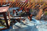
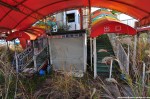
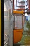
On August 31st of 2001 Biwako Tower finally closed its doors – just half a year after Universal Studios Japan opened in Osaka. Most of Biwako Tower was demolished in late 2003 / early 2004 with the exception of Igosu 108. Some small attractions survived partly (like a fortune teller booth, Fantasy Land and Bumper Boat), but the rest was transformed into big supermarkets and other stores, their parking lot replacing the pachinko parlor. Two sources claim that Igosu 108 still has an owner who announced in 2007 that the ferris wheel will re-open in 2008, but that never happened. According to them an operator puts Igosu 108 into motion once a month to make sure that everything is still working.
Having visited what’s left of Biwako Tower in December of 2010 (together with Damon and Andrew right after leaving the *Love Hotel Gion*) I kinda doubt that claim. While the outer part is easy to access Igosu 108 is protected by a typical Japanese orange site fence. The noisy kind that doesn’t have a door to let people in and out easily. I didn’t have a closer look at the controls of the ferris wheel, but the whole place looked quite rusty and run-down. To reactivate Igosu 108 you would need way more than just a bucket of paint and a “Reopened!” sign…
(If you don’t want to miss the latest postings you can *follow Abandoned Kansai on Twitter* and *like this blog on Facebook* – and of course there is the*video channel on Youtube*…)
Addendum 2013-11-28: Igosu 108 was dismantled in autumn of 2013…
-

- Igosu 108


Navelland
Posted in Abandoned, Amusement Park, Asia, Demolished, Fukuoka, Haikyo, Japan, Kyushu, Map, Restaurant, Urbex, Video, Visited in 2011 on 2011/08/19| 4 Comments »
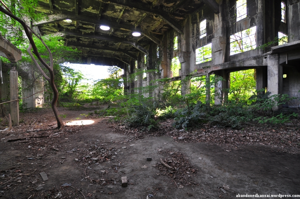
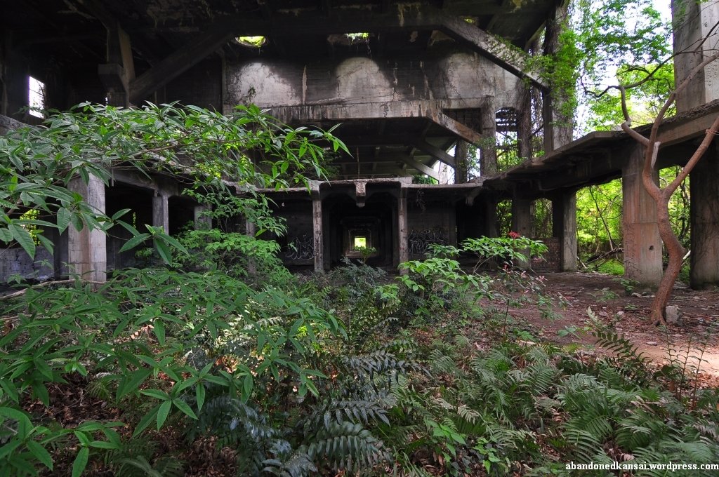
There’s nothing like abandoned theme parks. Everybody seems to love them, including yours truly. No matter if just recently closed (*Doggy Land*), closed a while ago (*Nara Dreamland*), mostly demolished (*Koga Family Land*), completely demolished (*Sekigahara Menard Land*), under deconstruction (*Expoland*) or left behind after a nuclear catastrophe (*Pripyat Amusement Park*) – each and every one of them has a unique, absolutely stunning atmosphere; even if they were just waterparks (*Tokushima Countryside Healthspa* / *Kyoto Waterland*). “New” abandoned amusement parks barely every show up – it’s more likely that well-known ones get demolished. Here’s an exception to the rule: Navelland. (ネイブルランド)
You would think that Navelland (or Navel Land), a science themed amusement park with an aquarium and a greenhouse that welcomes its guests with a huge half-“diving” whale in front of the entrance, most likely should have been called Navalland (or Naval Land) – but you would think wrong. The Japanese investors and creators chose the name on purpose, at least to some degree. Initially it was supposed to be called GeoBio World in the “BioCity” (or “Bio-City”) Omuta – but the name of the executing company was called Navel Land for three reasons, all related to its location in Omuta, Kyushu: GeoBio World was considered the “belly button project” (heso jigyo, 臍事業) of Omuta’s revitalization efforts with several other projects being based on it, Omuta’s history is strongly connected to coal (mined from the “belly” of the earth…) and Omuta is located in the center of Kyushu (or so the makers thought – to me it looks more like the “nipple of Kyushu”). At which stage of developement did GeoBio World become Navelland? I don’t know. But I guess a lot of things wrent wrong planning and executing the project, so the naming issue was just one of many, considering that Navelland was open to the public for less than two years…
Omuta’s economy was intertwined with coal for more than five centuries, for the longest time it was actually based on it. In 1467 a local farmer named Denzaemon found coal when making a bonfire in the hills of his home – like many Japanese cities Omuta is spread from the sea to the mountains. Mining on a larger scale didn’t begin until 1721 when Ono Harunobu (most likely not related to the producer of the series of “Street Fighter” games) was granted coal mining rights. When the age of industrialization finally reached Japan after the Meiji restauration the number of mines in the area was increased. In 1872 the Meiji nationalized the mines, most of them in the township of Miike (三池), nowadays part of Omuta. Towards the end of the 19th century the Japanese state privatized a lot of their model companies und sold them way under value. Mitsui, for centuries successful in finance and trade, got into heavy industries just a couple of decades prior when they aquired a mine as collateral for a loan they gave, bought the mine cheaply and turned it into the Mitsui Miike Coal Mine (三井三池炭鉱) in 1899.
The mine’s history is similar to most coal mines – a huge success in the early 20th century it became less and less profitable thanks to the fact that coal was replaced by oil as the most important natural resource in highly industrialized countries. So when the local politicians realized that the industry that provided the area with both jobs and wealth for centuries would be gone soon they looked for alternatives and came up with several ideas – one of them being Navelland, which ironically closed in 1998, only one year after the Mitsui Miike Coal Mine. (A rather interesting fact that shouldn’t be swept under the rug: The Mitsui Miike Coal Mine was also home of Fukuoka 17, a Japanese prisoner of war camp, mostly for Americans, Australians, British and Dutch – soldiers of the latter three nationalities survived the construction of the Burma Railway in Thailand; nowadays still famous thanks to a movie based on a book by the French author Pierre Boulle, The Bridge over the River Kwai. The camp was opened on August 7th 1943 and help up to 1735 prisoners. It was liberated on September 2nd 1945, almost a month after the atomic bombing of Hiroshima. The camp’s commandant, Asao Fukuhara, was later executed for war crimes.)
In 1988 it was more than obvious that coal wouldn’t be Omuta’s future. Mining it just wasn’t profitable enough anymore. At that time amusement parks were the current money makers, biotechnology the future ones. So why not combine both? Throw in some history and you’d get GeoBio World – split up into Geo Zone to remember Omuta’s coal history and Bio Zone to celebrate Omuta’s biotechnological future at the Ariake Sea. An amusement park with affiliated research labs and a mining museum. Turning Omuta from a dirty coal city into “BioCity”. In Kitakyushu, another former center of heavy industries only 1.5 hours away by car, a similar concept called “Spaceworld” was about to open, so the planners in Omuta spared neither trouble nor expense with about 82 million dollars to spend and about four years to plan and execute.
Navel Land (not the park, the company behind it) was finally established in September 1989 with the sole purpose of constructing and managing GeoBio World – to get the idea off the ground they even sponsored a large bio symposium in Omuta in November 1989. But four rejected concepts, one of them being presented by Futurist Light and Show who worked on Tokyo Disneyland, and more than two years later, Navel Land decided to come up with a concept by themselves, since none of the previous ones could convince the Japan Development Bank – the main backer of the project.
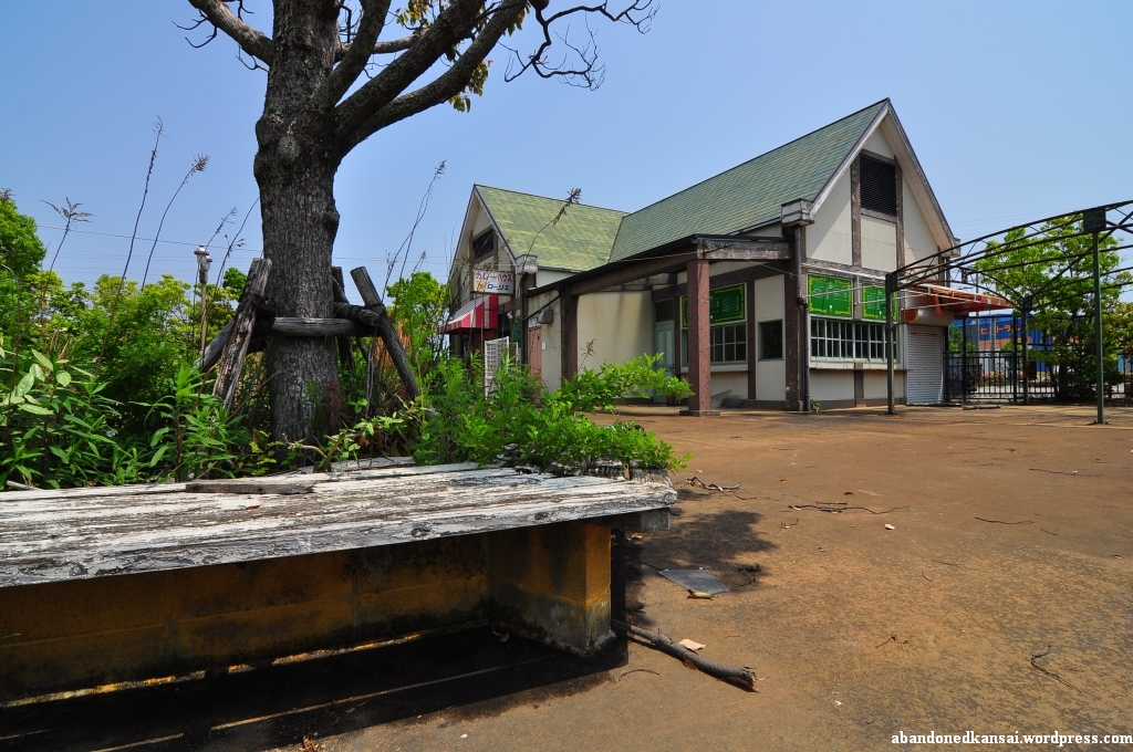
At this point information about GeoBio World and Navel Land becomes vague. While it’s a fact that the park finally opened under the name “Navelland” it seems like everybody agrees that it was closed down on December 25th 1998. What happened to GeoBio World and the biotechnology concept between the early 90s and 1998? I have no idea. All I know is that by the time Navelland closed its costs went way over budget (between 100 million and 200 million US-$ – or up to 160$ od debt for each Omuta resident) and that the visitor numbers never came close to the projected 600,000 per year. One of my sources said Navelland was opened in July of 1995, another one stated that it closed after less than two years – all three agreed it closed in late 1998. Maybe we will all find out more about Navelland soon since it is becoming more and more popular as a haikyo, a Japanese ruin, recently. Until then I’ll leave you with some photos and a quick video walking tour. The “House of Coal” exists as well as an aquarium and a greenhouse, so I guess the main concept was realized and not yet demolished. The amusement part of Navelland is mostly gone by now – both rollercoasters can only be seen on maps and the one thing that’s left of Kiddie Land is the entrance…
Addendum 2012-1-30: Navelland was demolished in late 2011 / early 2012. Now you can find its exact location on my *map of touristy and demolished ruins in Japan*.
(If you don’t want to miss the latest postings you can *follow Abandoned Kansai on Twitter* and *like this blog on Facebook* – and of course there is the *video channel on Youtube*…)


Sakito Mine
Posted in Abandoned, Asia, Demolished, Factory, Haikyo, Japan, Kyushu, Map, Mine, Nagasaki, Urbex, Visited in 2011 on 2011/08/11| 4 Comments »
Sometimes I wish urban exploration was as simple as googling “awesome abandoned location nearby”, hopping on the train for ten minutes, taking two dozen nice photos and then spending the rest of the day at the beach sipping icecold beverages. Sadly it’s not. It’s never that simple and sometimes things go completely wrong.
Like me visiting the Sakito Mine in northern Kyushu. I was a bit nervous about the place right from the beginning since it’s in the highly unreliable “Nippon No Haikyo” book (by now at least half of the places in the damn thing must be gone…) and GoogleMaps, my trustworthy friend to confirm locations with high resolution satellite images, delivered rather blurry results until a couple of weeks ago. I found some homepages about the place on the internet, but most of the photos were rather old, like 2003-ish. The Sakito Mine was actually the location I skipped on *my first trip to Kyushu* to give *Gunkanjima* another try, so it was kind of a given thing I had to include it to my itinerary; the mine being rather close to Sasebo didn’t hurt either…
After my long and exhausting trip to *Ikeshima* I was eager to finally see the remains of the Sakito Mine, but things went from bad to worse by the hour. When I started my trip on a nice Thursday morning the weather forecast promised four days of hot and scorching Japanese sun, but Friday was already overcast. When I woke up early again the next morning the situation didn’t change, but I wasn’t worried a lot. Ikeshima was way too exciting to be worried again so soon!
I got to the ferry terminal on time only to find out that the boat to the island the Sakito Mine was on would leave with a delay of ten minutes. Usually that doesn’t really matter, but of course it made me miss my bus to the mine, so I had the choice of either waiting 80 minutes for the next bus or walking the eight kilometers. I kind of remembered the bus route, so I decided to walk – still not worried about the overcast weather. Big mistake. About halfways down the road, not a single person (or shop) in sight, it started to drizzle. Not very strongly, but in combination with the high humidity and a rather cold breeze not exactly comfortable. After a while it stopped and when I was finally dry it started again. Not real rain (which would have made me look for shelter), but drizzle. So I continued to walk along the coast, following the road up and down – getting wet and drying.
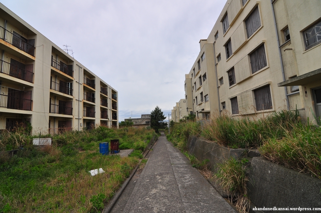
After about two hours I finally reached the area where I expected to find the leftovers of the Sakito Mine. I saw some of the remnants in the distance, overgrown and clearly blocked by (active) private property – so I looked for other remains, especially the apartment buildings I saw on Japanese photos and maps. When I found a chimney I remembered seeing on photos my spirits were finally lifted again. I saw more overgrown, out of reach concrete stuff (I wasn’t even able to identify it…), and then some apartment buildings appeared, reminding me of the ones I saw the day before on Ikeshima. I got closer and realized that they were once part of the mine, but that they have been fully renovated a couple of years ago – nevertheless they were almost completely abandoned, but still in good shape. Maybe one out of ten apartments still housed residents and the nearby playground wasn’t in good shape either – it wasn’t overgrown yet, but it didn’t look like a lot of children played there recently.
I knew that I was in the right area, and I also knew that most of the mine had been demolished right after it was shut down – but I was looking for some apartment buildings close to a huge park and restaurant. North of it actually, just down the road. When I reached the park the drizzle became rain and the light breeze became wind – it was raining almost horizontally. I fould shelter under some kind of resting stop, but I felt miserable: wet, tired, frustrated, unsure if there even were some remains left. The rain turned into drizzle again and I continued to follow the road. I found the fork to the north and of course it started to rain strongly again. This time I found shelter under a tree and after ten minutes I continued to follow the road down the mountain, only to find out that the blurry shadows on GoogleMaps were… blurry shadows – they surely weren’t the apartment buildings I was hoping for. Okay, wrong crossing… I followed the road to a different direction and to a street blocked by a massive metal blockade. That must have been it! I broke through the thick bushes next to it and followed the road for some dozen meters – only to find a flat area, big enough for some apartment blocks, but completely flattened; a wonderland for weeds. So I got back to the side road, saw another “Don’t trespass” sign and went down a rather steep road to a bay – again no signs of apartment buildings, although there should have been some of them visible according to the layout map I saw of the mine. I returned to the main road and followed it a bit more, not willing to give up. When I spotted the tip of another chimney I disappeared through the bushes again, this time to the south. I was able to take photos of some overgrown chimneys, but I couldn’t get closer as I didn’t trust the ground there – and the photos didn’t turn out well in front of the greyish sky. By now the weather was a draining mix of rain and… non-rain, leaving me contantly wet to some degree. Back to the main street I saw another possible location to the north, so I added some more scratches to my arms – again without getting the chance to take some photos.
At this point I gave up. I was tired, I was wet, I was dirty – and I’m sure I smelled pretty badly. At least the street I was walking along had some bus stops, so I didn’t have to walk all the way back to the harbor – but the next bus was coming in 30 minutes and the rain was getting worse again. I decided to go back to the shelter near the park down the road when a car passed me by, turned around and then again behind me. A few seconds later it stopped right next to me and an elderly couple asked me (in English!) where I wanted to go and if I needed a lift. Not that it happens very often, but usually I decline offers like that – not out of fear (it’s Japan…), but because I don’t wanna be a hassle for anybody. This time I gladly accepted. I was too tired and too disencouraged to worry about being a hassle. I just wanted to get out of the rain.
Being a foreigner in Japan you surprisingly often come across xenophobic people. Not at the typical tourist spots, but at shopping malls, off the beaten track roads and way too often in subway trains when they think you don’t understand Japanese at all. But the senior citizen couple I met in Kyushu were by far the nicest people I ever met in Japan, topping even the guy who helped Jordy and me at the *F# Elementary School* a couple of months earlier. They were from Beppu, but on vacation for Golden Week. Super nice people, and it was lovely to see them interact – they were exactly how you imagine kind older Japanese people to be; including the man talking (he did business internationally and therefore was used to speak English a bit) while his wife clearly understood more of what I said and translated for him what I said. They drove me all the way back to the harbor, a fact I’m still amazed about. I wasn’t trying to hitchhike and I must have looked miserably after walking in drizzle and rain without an umbrella for hours – but they turned around to offer me a ride, a male foreigner of all people. Not a lot of people would do that in Japan. Or anywhere else in the world. I doubt the two will ever read this article, but just in case: Thank you very much again, you lifted my spirits a lot and made my day a lot less miserable!
Back in Sasebo I was ready to go home one day earlier, but the staff at the little inn I stayed told me that the weather would be fine the next day. No more rain, so I stuck with my original plan. I took a shower and went to Base Street for a third time – and finally I got my “Special Size” burger, 15 cm in diameter, the best burger I ever had. Still as good as it was 14 months earlier and the perfect ending of a day full of ups and downs… (Well, lots of downs, but two insanely huge ups!)


Ikeshima – At Noon
Posted in Abandoned, Asia, Demolished, Factory, Haikyo, House, Japan, Kyushu, Map, Mine, Nagasaki, Urbex, Video, Visited in 2011 on 2011/07/21| 2 Comments »
After I left the apartment building and shot the first video I was looking for a new approach to Ikeshima. So I left the area with three-storey buildings and headed towards a bunch of row bungalows with little garden. Some of them were still inhabited and it seemed like the people living there took care of their former neighbors’ gardens. I continued to walk uphill and reached a small park with an observation platform – the highest point of the island. Although the stairs leading up were really rusty and maybe should have been off-limits I went up and had a look around. What a nice view!
A building with a headframe caught my eye, so I carefully went down again and walked toward the coop – which is sometimes mistaken for a hospital due to some “Safety first” signs. On my way I came across what turned out to be one of the most fascinating building complex I’ve ever seen, totally reminding me of my trip to *Chernobyl and Pripyat*. Its foundation was on the lower end of a slope, with bridges connecting the upper floors with the street I was walking along. A really fascinating construction, even more beautiful from its base as I found out later. But for now the headframe was more important, so I walked down some concrete steps with a severely damaged handrail to the backside of the coop. The rear entrance was actually open, but I refrained from entering. A sign displayed some kind of opening hours of the Mitsui Matsushima Resources Company (三井松島リソーシス株式会社), the subsidiary of Mitsui Matsushima responsible for taking care of the trainee program that ended in 2007. The front entrance had the same or a similar sign. So I took some photos from the outside of the building and walked up the street towards the apartment complex.
To get a better grasp of the whole complex I put down my tripod (including the camera) and my backpack on the side of the road and headed for the bus stop right in front of it. There was some kind of roundabout and the moment I wasn’t visible from the street a small pickup truck (actually a kei truck or Japanese mini truck) passed by and stopped next to my belongings. “Great… trouble!”, I thought and made myself visible. Two guys in their 50s or 60s got out of the truck and when I came closer they addressed me in a mix of Japanese and English – and I answered the same way.
What I was doing here?
Just taking some photos…
Interested in history?
Yep, a lot!
From America?
No, Germany.
At this point their faces lit up a bit and we switched from 75% Japanese to 75% English. Then they asked me if I wanted to see their offices. Wait, what? Yeah, they were working at the coop building with the headframe, they told me. So I picked up my belongings and jumped on the truck bed. Knowing that there wouldn’t be any oncoming traffic the driver sped up quite a bit and hurried down the mountain, but somehow I managed to take some slightly blurry photos without falling off the truck.
The front door of the building was also unlocked and the guys guided me to the second floor. There were several offices and the entrance to the mine shaft. Lighting was horrible and the guided tour was so quick that most pictures turned out to be blurry. I snatched some shots of the room where the mobile radios as well as other equipment were stored (and charged), then we went through some more offices and by the time I realized what I was doing I was outside again and said goodbye to my guide – I barely spent ten minutes inside the coop, but I was able to take some rare photos. What a great opportunity!
Since the guys gave me a one way ride I walked up the street again and back to the apartment complex. This time I put down my belongings where they weren’t visible from the street and started to take pictures and videos. The weather seemed to brighten up a bit and just looking at the amazing apartment complex put a smile on my face. Such a great building, such a nice atmosphere… I felt at ease and my worries about living up to the uniqueness of Ikeshima were gone. Now that I’m writing these lines I’m again not sure if the pictures and videos can really put you there, but looking at the material for the first time in a couple weeks makes me daydream a bit. As far as I could see all entrances were boarded up or even bricked up, there was quite a bit of barbed wire and the previously mentioned bridges looked very dilapidated from below – but I didn’t even have the urge to enter the complex. It was just nice being there. With the apartment complex, more apartment buildings further down the slope, and an overgrown children’s playground on an additional level between the two housing sections. A couple of minutes before I continued my exploration of Ikeshima the van parked in front of the bus stop continued its tour after quite a long break (the driver must have taken a rest in the little hut next to it) and I felt good. Really good.
Half of my time on Ikeshima was over and I was curious *what the afternoon would bring* – it didn’t disappoint…
(Since the inhabitants of Ikeshima consider their island a tourist attraction I added it to the *Map Of Demolished Places And Tourist Spots* and created *a new map just for Ikeshima*. If you don’t want to miss the latest postings you can *follow Abandoned Kansai on Twitter* and *like this blog on Facebook* – and of course there is the *video channel on Youtube*…)


Ikeshima – In The Morning
Posted in Abandoned, Asia, Demolished, Factory, Haikyo, House, Japan, Kyushu, Map, Mine, Nagasaki, Power Station, Transportation, Urbex, Video, Visited in 2011 on 2011/07/13| 5 Comments »
„絆 池しま 大スキ“ – „Kizuna Ikeshima daisuki“ – „I / We like Ikeshima a lot“
That’s what’s written with huge, colorful characters in the sand of the breakwater at the Ikeshima harbor. A last pledge of allegiance from about 300 remaining inhabitants of an island once the home to several thousand people – miners and their families, shop owners, restaurateurs, …
When I arrived on Ikeshima I can’t say I agreed with the bold statement at the harbor. The weather changed from sunny to overcast with a serious risk of rain and the humidity rose to levels you usually experience during the long, excruciating Japanese summers. Though the previous day was pretty long, exploring the *Imari Kawaminami Shipyard* and the *Mukaiyama Mine*, I had to get up again before 6 a.m. to make it to the ferry on time and my landlubber slugabed stomach wasn’t a big fan of the early morning breakfast, although the ferry ride itself was really enjoyable.
In addition to that I felt a pressure right from the beginning I hadn’t felt in years. Back in my days as a journalist in Germany (10+ years ago) I was writing about all kinds of topics. Most of the stuff was trivial and routine, but once in a while I dealt with a project close to my heart – and in those cases of course I wanted to rise to the occasion and write an article that did justice to the topic.
So while I tried to calm down my slightly upset stomach I was worried if I would be able to take pictures that represent Ikeshima properly, if I could come up with interesting stories to write about – if I was able to experience this island that is on its way to become an urbex legend; some people already call it Gunkanjima’s little brother (although Ikeshima is way bigger…). And since Ikeshima is in way better shape and way easier to access than *Gunkanjima* it is actually on its way to become more popular amongst urban explorers – a trend that seems to be appreciated and supported by the remaining inhabitants of the island, at least to some degree.
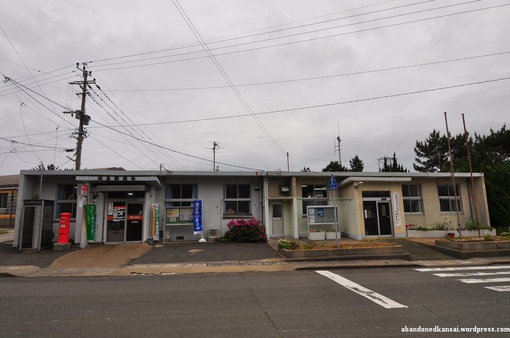
The first thing I saw getting off the ferry were two maps of the Ikeshima right at the pier – one being an aerial shot of the island from 1982, highlighting 9 points of interest; the other being a typically Japanese manga tourist map with a hiking guide, pointing out restrooms, bus stops, areas off-limit and buildings you shouldn’t miss. Sadly (for for the locals) Ikeshima wasn’t a tourist attraction (yet), at least not during Golden Week 2011: I was not only the sole foreigner on board, I was also the only person carrying photography equipment. The other half a dozen passengers were elderly Japanese guys looking for a relaxing day of fishing.
I took a few quick photos at the harbor to calm my stomach, get used to the humidity and make sure that the settings of my camera were how they should be – and somehow I got the feeling that the few locals I met weren’t really happy about it. As a rather big, tall non-Asian foreigner in Japan I’m used to being stared at, but maybe I was overly sensitive because of the uncomfortable situation I felt I was in, so I didn’t like Ikeshima a lot at that point…
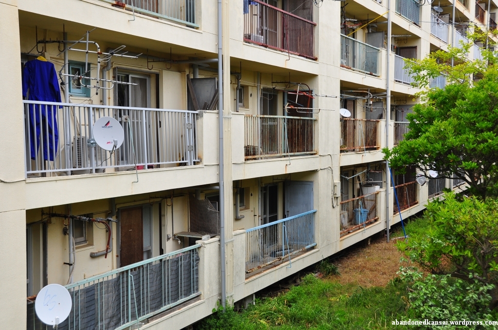
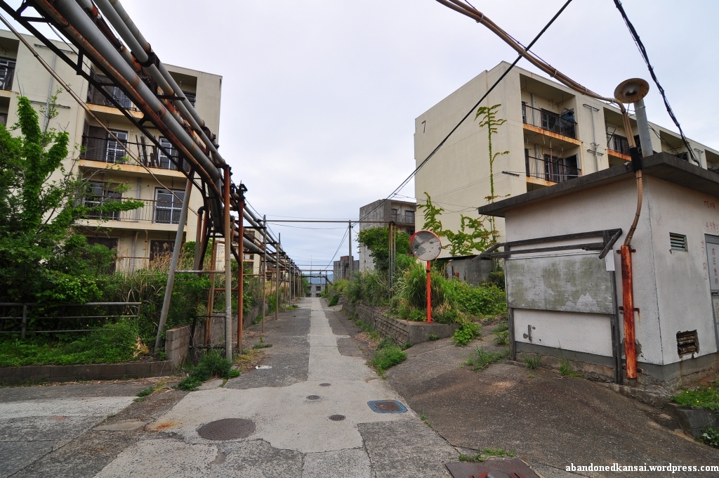
I passed by four of five people trying to get one of the omnipresent cats from an electricity pole and left the harbor area to follow the street uphill. Down to the right was a little settlement, several dozen houses, once the homes of the non-mining population on Ikeshima. I saw some big apartment buildings on the top of the hill, so I decided to follow the street and maybe have a look down there later.
Reaching the top I passed by the post office which, to my surprise, actually had one or two customers while I was looking around that area. Although nowadays most people seemed to live down by the harbor the uphill apartment section was surprisingly busy. Within the first hour I spent there I saw maybe two dozen pedestrians and at least half a dozen cars, including the local shuttle bus which seemed to pass by me every 5 minutes – and in the background a recycling company caused quite some noise.
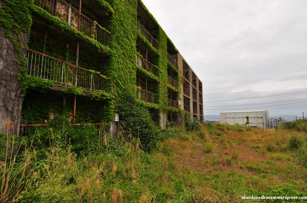
At that point I felt like a kid in a candy store – extremely excited, looking at dozens of opportunities, each one of them usually worth a day-trip on its own, and no idea where to start. But this was Ikeshima, Little Gunkanjima, so I had to take some spectacular shots! Just how? Especially since all buildings seemed to be boarded up, the doors bolted or welded. And the industrial areas were all off-limits, “No Trespassing!” signs everywhere in Japanese (kanji) and Bahasa Indonesia (Latin alphabet and katakana). Still under irrational pressure I felt like I had to make a move – and when I saw an open balcony door I jumped the railing and got inside. Finally what I was looking for? Not at all! I felt more uncomfortable than ever. I’m into urban exploration for the unique esthetics, for the quiet time in the middle of nowhere, for interesting angles and the amazing atmosphere really spectacular places provide. I’m not doing it for the thrill of being in buildings I’m not supposed to be. Quite the opposite in fact, I really dislike that aspect. So I took a few quick shots while hearing cars and voices everywhere outside – I could have gotten to the staircase and maybe to other apartments from there, but instead I decided to leave the building. Seconds later another car passed by, followed by two senior citizens, greeting me with a smile. Maybe it was about time to change my approach. So I put down my tripod and my backpack at one of the crossroads, grabbed my video camera and started to tape a walking tour of the housing area, wondering what the people I met were still doing on Ikeshima.
It was not until World War II that coal was discovered under Ikeshima. At that time about 300 people lived on the island while the huge corporate conglomerate (keiretsu, 系列) Mitsui Matsushima (三井松島) started to buy large parts. The development of the coal deposits started in 1952 and in 1959 mining finally began – the last colliery to open in Japan. In 1970 about 8,000 people lived on the island (although one source throws out a number as high as 20,000…), but like in all Western industrialized countries coal became less and less important; oil was the new coal. In summer of 1999, long after most Japanese coal mines were closed for good, a technology transfer program was proposed and as if it was a sign that the days of the Ikeshima Coal Mine (池島炭鉱) were numbered a fire broke out in the mine in February of 2000. On November 28th of 2001 the last shift left the Ikeshima Coal Mine, about 3000 people living on the island at that time – making Ikeshima the second to last Japanese coal mine to be closed. On April 18th of 2002 the technology transfer program started, training students from Indonesia about mining – hence the multi-language warning signs all over the island. The trainee program ran out by the end of March 2007, a year after 77 miners won a lawsuit against Mitsui Matsushima; suing them for negligence, related to coal worker’s pneumoconiosis. Around that time the number of people living on Ikeshima dropped to about 300 – as it was before coal was discovered. (The name Ikeshima means “pond island”, because until the 1950s a large pond was the main feature of the island – it was turned into the harbor by Mitsui Matsushima… Please *click here* to be taken to a Japanese homepage with before and after shots next to each other.)
Did the two old ladies know any of those 77 miners? Were they maybe even sons or husbands? And why were they still living on Ikeshima? I never found out. But I talked to several other people on the island later that day – so don’t miss *part 2* and *part 3* of my Ikeshima exploration…
(Since the inhabitants of Ikeshima consider their island a tourist attraction I added it to the *Map Of Demolished Places And Tourist Spots* and created *a new map just for Ikeshima*. If you don’t want to miss the latest postings you can *follow Abandoned Kansai on Twitter* and *like this blog on Facebook* – and of course there is the *video channel on Youtube*…)


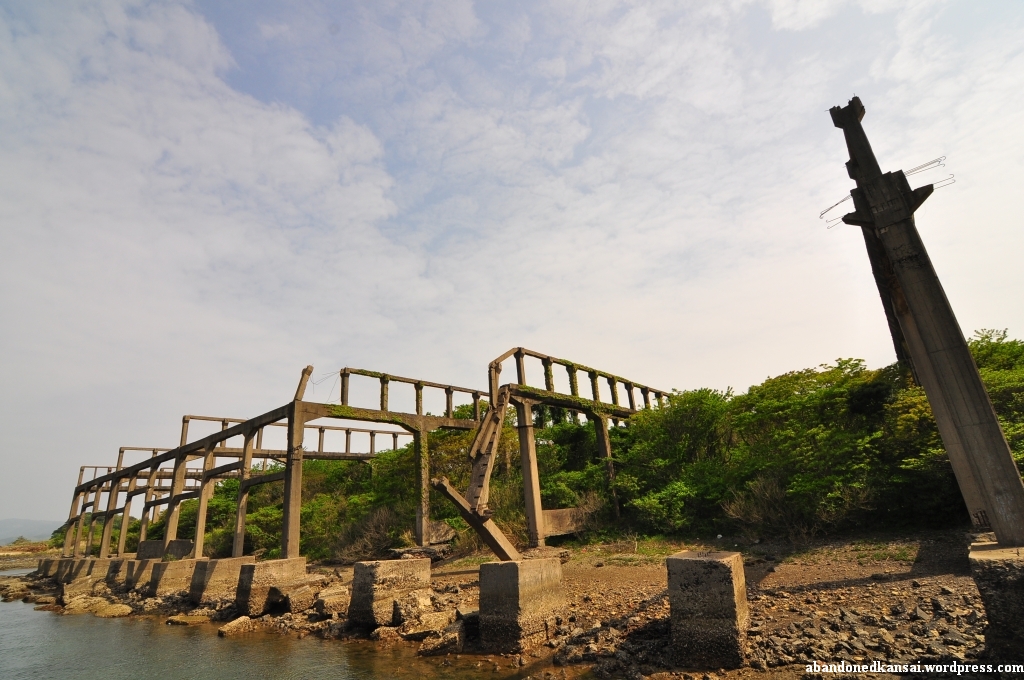
Mukaiyama Mine (向山炭鉱)
Posted in Abandoned, Asia, Demolished, Haikyo, Japan, Kyushu, Mine, Nagasaki, Transportation, Urbex, Video, Visited in 2011 on 2011/06/30| 2 Comments »
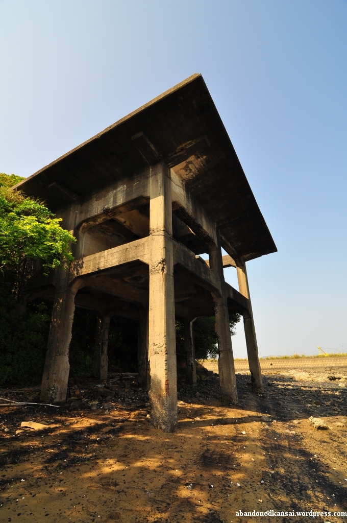
Just a couple of hundred meters down the road from the *Imari Kawaminami Shipyard* is another haikyo – visible from both the street and the train tracks the place is nevertheless often overlooked. After we finished shooting the seaside part of the shipyard Yasu was heading back to the main building while Ben and I headed to the remains I saw a couple of times on Japanese blogs without even exactly knowing what to expect – the pictures I saw were labeled “向山炭鉱“ (Mukaiyama Tankou, tankou being the Japanese word for mine), but a mine so close to the sea? Could that be?
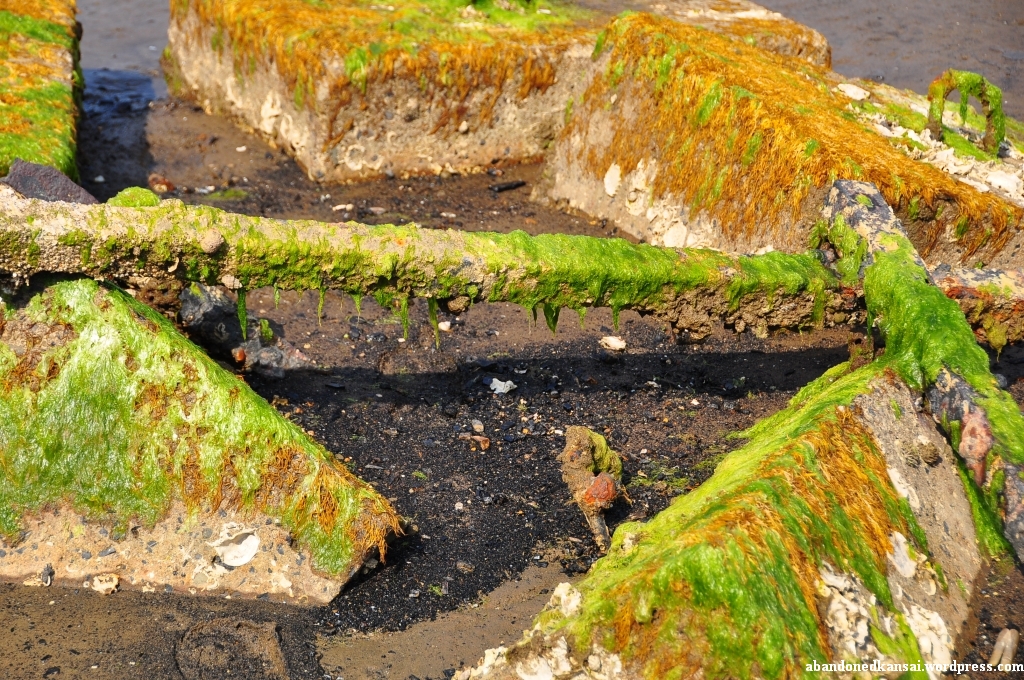
When Ben and I arrived on the other waterfront we saw three elderly Japanese people skimming through the part of the beach that was now accessible thanks to the low tide. Since Ben’s Japanese was way better than mine he talked to them and found out that they were looking for Asari (also known as Manila clam or Venerupis philippinarum), a popular ingredient in miso soup. Like the fisherman from the dam the clam searchers were quite chatty and told us a bit about the abandoned place we were visiting. As I assumed the concrete and rusty steel remains weren’t part of a mine, but part of the sea terminal of the mine – the mine itself was somewhere in the nearby mountains and demolished centuries ago. Speaking of mountains: I didn’t realize it until Ben told me what he heard from our new Japanese friends, but the surrounding hills near the beach weren’t natural. They were also remains of the sea terminal, in this case the parts of the deliveries from the mine that didn’t get onto the ships as there weren’t coal, but worthless rocks not even good enough to be used for construction. Like everywhere else in the world that stuff was piled to create spoil-tips (or botayama, ボタ山, in Japanese).
There is actually not a lot of general information I found about the Mukaiyama Mine. Coal extraction at the place started during the Meiji era under different names and different owners. Until 1909 23 miners mined about 750 tons of coal, in 1910 15 miners brought 298 tons to daylight. 1911 brought a new owner with headquarters in Matsuura and new deposits were found. In 1912 the mine was renamed once more to now known “Mukaiyama Mine” and 100 miners were employed to mine about 800 tons of coal a year. At the same time 15 houses were constructed for the miners – if you want to see pictures from that era please have a *look here*, but please be aware that the site is in Japanese; nevertheless I didn’t want to steal their photos to put them up here… In 1937 the mine was taken over by Kawaminami Industries Ltd. who increased production again in 1939 – probably to support their *soon to be demolished shipyard*. In 1946 the Mukaiyama Colliery Labor Union was formed, raising the daily wage from 35 to 50 Yen and prohibiting underground work of women and minors. (Minors, not miners!)
In 1951, when the *Kawaminami Shipyard* was struggling, a railroad connection to the sea was built. Although new coal deposits were developed in 1957 and 1960 the Mukaiyama Mine was shut down in 1963 – and with it the sea terminal. Okay, so much for the history lesson…
As I mentioned several times before: I was extremely lucky that the tide was low during my visit. On most pictures I saw on the internet the beach was covered with water, the remains of the sea terminal barely sticking out of the sea. Not during my visit. Thanks to that the remnants were almost completely visible, exposing their more decayed parts with vibrant colors.
(*Like Abandoned Kansai on Facebook* if you don’t want to miss the latest articles and exclusive content – and subscribe to the *video channel on Youtube* to receive a message right after a new video is online…)


Imari Kawaminami Shipyard (伊万里川南造船所) – R.I.P.?
Posted in Abandoned, Asia, Demolished, Factory, Haikyo, Japan, Kyushu, Map, Military, Nagasaki, Shipyard, Urbex, Video, Visited in 2011 on 2011/06/27| 4 Comments »
Darn, me and my timing again… In my previous posting I referred to Gakuranman’s article about the Imari Kawaminami Shipyard – he mentioned a discussion in 2010 about demolishing the place; and I expressed how happy I was it didn’t happen between his visit and mine. Well, it seems like things are moving forward. The Japanese newspaper “Yomiuri” reported on June 24th (almost a week after I published my exploration experience) that the Yamashiro City Zoning Committee decided on June 9th that the Imari Kawaminami Shipyard is a safety hazard and not worth to be preserved as a historical landmark – they will demolish the place, only saving some of the pillars with the safety warnings (as seen on the photos below). And it took them only 50 years to realize that…
I guess the real reason for demolishing the place is the land reclamation project going on behind the seaside part of the shipyard which the dam mentioned in the previous posting is part of. Getting rid of the ruin will create a huge piece of land if both properties are combined – with access to both sea and the main road of the area.
I was quite shocked when I heard about the news today – it’s always a sad thing when abandoned buildings disappear, especially famous and unique ones like this. A place that grew on me a lot after I explored it, especially since there seemed to be a connection to the Katashima Suicide Training School.
Japan is quite weird when it comes to timing. Sometimes things drag forever and maybe the shipyard won’t be destroyed after all, although the committee made the decision to demolish the place. But sometimes things move extremely fast, so maybe the shipyard is already gone by the time I write these lines. Urbex is becoming more and more popular in Kyushu recently – if I hear any news I’ll make sure to keep you updated.
(To make this posting more colorful I chose six previously unpublished photos and uploaded them together with a video I forgot last time…)
Addendum 2012-1-30: The Imari Kawaminami Shipyard was demolished in late 2011 / early 2012. Now you can find its exact location on my *map of touristy and demolished ruins in Japan*.


Back From The Island(s) – Again…
Posted in Abandoned, Amusement Park, Demolished, Factory, Haikyo, House, Japan, Kyushu, Mine, Nagasaki, Shipyard, Transportation, Urbex, Visited in 2011 on 2011/06/02| 4 Comments »
About 15 months ago I went on my first multi-day urban exploration trip: 3 days to Kyushu with my buddy Enric. A trip with lots of up and downs, visiting some amazing locations – Gunkanjima, the Katashima Suicide Training School and the winding tower of the Shime Coal Mine, now known to some people as the Anti-Zombie Fortress. But March was kinda cold, last year as well as this year. So when Golden Week came up (late April / early May) and my company forced me to take two of my paid vacation days to install a new AC I took the lemon and made lemonade – it was time to go back to Kyushu!
Since Enric left Japan and returned to Spain a couple of months ago, I went on my own this time. Remembering the best burger I’ve ever had I set up my base in Sasebo after a long day of exploring an abandoned shipyard and the abandoned leftovers of the dock of a mine close to it. The next day I explored one of the most amazing places I’ve ever been to: an almost abandoned island, once the home of several thousand people – and as exciting as that day was as disappointing was the next one when I walked through drizzle for hours without an umbrella to look for remains of a mine and its workers’ housing-estate; but they were gone forever – as research after my return confirmed… Luckily the weather turned around on my last day, so I was able to visit an abandoned amusement park on my way back home. Thank heavens for sunscreen, because without it the harsh Kyushu sun would have burned me crisp within half an hour…
Exploring all day I spent my three evenings in Sasebo at Base Street to enjoy some burgers. While the regular sized ones are good I’ll definitely recommend the so-called “Special Size” – this 15 centimeters in diameter monster is a classic Sasebo style burger that will fill you up with pure deliciousness; if you ever wanna spend 1100 Yen (yep, that’s 9.50 Euros or 13.60 Dollars!) on a single burger without even considering regretting it then this is the place to go! I just hope I’ll find more abandoned places close to Sasebo so I can have a good reason to go back there once more…
(Oh, and greetings to the tourist office in the Sasebo! It sells a variety of souvenirs, but not the awesome huge plush hamburgers that fill half of their display window. To get one of those you have to ride a bus for about half an hour to get to a small store at a shopping mall in the middle of nowhere. And since I had to wait 45 minutes for the next bus they lost a customer who would have happily paid 200 Yen more to avoid the hassle of a 2.5 hour long round trip to get a cute present for his even cuter niece. A no-win situation… and pretty much the worst sales strategy ever!)


Sekigahara Menard Land – A Comparison
Posted in Abandoned, Amusement Park, Asia, Chūbu, Demolished, Gifu, Haikyo, Japan, Urbex, Visited in 2010 on 2010/06/27| Leave a Comment »
(Next up will be a much more exciting entry about the barely ever mentioned Taga Mine in Shiga followed by Expoland Revisited – just so you know what’s coming in the near future…)


Abandoned Kansai on Facebook
-
Join 5,100 other subscribers
Pages
Archives
Categories
Recent Comments
Ja Ni on Hahn Air Base (Flughafen … Gred Cz on Sakura Car Shop Sue on Sakura Car Shop Gred Cz on Mie Minshuku Matauia vainetutai M… on Nara Dreamland – Frequen… Emily on Mie Minshuku Gred Cz on Kitakitsune Farm (Non-Urbex) Seyeon Park on North Korea Revisited: Ep… Florian / Abandoned… on Green Plaza Akakura Florian / Abandoned… on Green Plaza Akakura
